
| Memorials | : | 593 |
| Location | : | Loup City, Sherman County, USA |
| Coordinate | : | 41.3022003, -98.9847031 |
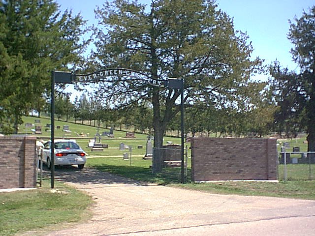
| Description | : | Saint Josaphats Cemetery is located north of Loup City on the east side of 474th Avenue. It is north of the Evergreen Cemetery, which is on the west side. The two are often considered to be parts of a single cemetery. |
frequently asked questions (FAQ):
-
Where is Saint Josaphats Cemetery?
Saint Josaphats Cemetery is located at Loup City, Sherman County ,Nebraska ,USA.
-
Saint Josaphats Cemetery cemetery's updated grave count on graveviews.com?
555 memorials
-
Where are the coordinates of the Saint Josaphats Cemetery?
Latitude: 41.3022003
Longitude: -98.9847031
Nearby Cemetories:
1. Evergreen Cemetery
Loup City, Sherman County, USA
Coordinate: 41.2997017, -98.9852982
2. Sunny Slope Cemetery
Loup City, Sherman County, USA
Coordinate: 41.2906000, -99.0267000
3. Cleoria Cemetery
Loup City, Sherman County, USA
Coordinate: 41.2779000, -99.0893500
4. Balsora Cemetery
Sherman County, USA
Coordinate: 41.3782997, -99.0975037
5. Austin Cemetery
Rockville, Sherman County, USA
Coordinate: 41.1880989, -98.8981018
6. Verdurette Cemetery
Sherman County, USA
Coordinate: 41.1697006, -98.9757996
7. Davis Creek Cemetery
Valley County, USA
Coordinate: 41.4219017, -98.9052963
8. Saint Francis Cemetery
Ashton, Sherman County, USA
Coordinate: 41.2438000, -98.7994000
9. Lone Elm Cemetery
Loup City, Sherman County, USA
Coordinate: 41.2921982, -99.1864014
10. Immanuel Lutheran Cemetery
Ashton, Sherman County, USA
Coordinate: 41.2140000, -98.8142000
11. Arcadia Cemetery
Arcadia, Valley County, USA
Coordinate: 41.4237000, -99.1167000
12. Gray Cemetery
Sherman County, USA
Coordinate: 41.2099991, -99.1567001
13. Pleasant Hill Friends Cemetery
Valley County, USA
Coordinate: 41.4230800, -98.8377700
14. Dunkard Cemetery
Arcadia, Valley County, USA
Coordinate: 41.4522000, -99.0769000
15. Union Cemetery
Ashton, Sherman County, USA
Coordinate: 41.2214012, -98.7855988
16. Litchfield Cemetery
Litchfield, Sherman County, USA
Coordinate: 41.1543999, -99.1283035
17. Mount Carmel Cemetery
Howard County, USA
Coordinate: 41.2797012, -98.7328033
18. Salem Evangelical Church Cemetery
Ord, Valley County, USA
Coordinate: 41.4902992, -98.9244003
19. Lewis Burial Plat
Litchfield, Sherman County, USA
Coordinate: 41.1383000, -99.1484000
20. Lee Park Cemetery
Custer County, USA
Coordinate: 41.4025002, -99.2307968
21. Trinity Lutheran Church Cemetery
Hazard, Sherman County, USA
Coordinate: 41.0913000, -99.0052000
22. Lee Park Catholic Cemetery
Westerville, Custer County, USA
Coordinate: 41.4091988, -99.2311020
23. Dannevirke Cemetery
Dannevirke, Howard County, USA
Coordinate: 41.3227997, -98.6986008
24. Saint Marys Cemetery
Rockville, Sherman County, USA
Coordinate: 41.1202000, -98.8255000