
| Memorials | : | 0 |
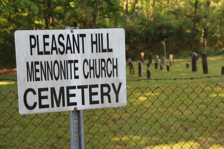
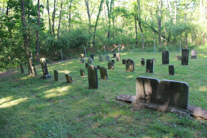
| Location | : | Chambersburg, Franklin County, USA |
| Coordinate | : | 39.9946070, -77.6931580 |
| Description | : | This cemetery is on land acquired around the middle of the 20th century by the U.S. Government for use as an ammunition depot. Today the land is called Letterkenny Army Depot and The Depot is headquartered in Chambersburg, PA. Burials stopped at the time the land was acquired by our government. Letterkenny Army Depot is responsible for upkeep of this cemetery and seven others on their land. Once a year, in May, The Depot provides a bus driven tour of all the cemeteries. This is the only time people are allowed to visit. Check local newspapers for announcements of the... Read More |
frequently asked questions (FAQ):
-
Where is Pleasant Hill Mennonite Church Cemetery?
Pleasant Hill Mennonite Church Cemetery is located at Chambersburg, Franklin County ,Pennsylvania ,USA.
-
Pleasant Hill Mennonite Church Cemetery cemetery's updated grave count on graveviews.com?
0 memorials
-
Where are the coordinates of the Pleasant Hill Mennonite Church Cemetery?
Latitude: 39.9946070
Longitude: -77.6931580
Nearby Cemetories:
1. Rocky Spring Churchyard
Chambersburg, Franklin County, USA
Coordinate: 39.9886290, -77.6756130
2. Emanuel's Liberal United Brethren Church Cemetery
Chambersburg, Franklin County, USA
Coordinate: 39.9825000, -77.7144000
3. Upper Strasburg Mennonite Church Cemetery
Chambersburg, Franklin County, USA
Coordinate: 40.0203300, -77.6967000
4. Salem United Brethren Church Cemetery
Chambersburg, Franklin County, USA
Coordinate: 39.9851000, -77.6555000
5. Snider Cemetery
Chambersburg, Franklin County, USA
Coordinate: 39.9928810, -77.7500360
6. Brechbill Cemetery
Chambersburg, Franklin County, USA
Coordinate: 39.9745978, -77.7473585
7. Brinzer-Brainer Cemetery
Chambersburg, Franklin County, USA
Coordinate: 39.9636870, -77.6483340
8. Air Hill Cemetery
Chambersburg, Franklin County, USA
Coordinate: 40.0169500, -77.6355000
9. Norland Cemetery
Chambersburg, Franklin County, USA
Coordinate: 39.9667400, -77.6372500
10. Old Order York Brethren Cemetery
Chambersburg, Franklin County, USA
Coordinate: 40.0378630, -77.6556560
11. Shirk's Mennonite Cemetery
Chambersburg, Franklin County, USA
Coordinate: 39.9720190, -77.6319010
12. Culbertson Mennonite Church Cemetery
Chambersburg, Franklin County, USA
Coordinate: 39.9994300, -77.6247400
13. Chambersburg Mennonite Cemetery
Chambersburg, Franklin County, USA
Coordinate: 39.9567000, -77.6453000
14. Parklawns Memorial Gardens
Chambersburg, Franklin County, USA
Coordinate: 39.9741516, -77.6243362
15. Park Avenue United Methodist Church Columbarium
Chambersburg, Franklin County, USA
Coordinate: 39.9491570, -77.6486410
16. Cedar Grove Cemetery
Chambersburg, Franklin County, USA
Coordinate: 39.9417000, -77.6644000
17. Corpus Christi Cemetery
Chambersburg, Franklin County, USA
Coordinate: 39.9380860, -77.6748680
18. Criders Cemetery
Chambersburg, Franklin County, USA
Coordinate: 39.9589729, -77.7540283
19. Falling Spring Presbyterian Church Cemetery
Chambersburg, Franklin County, USA
Coordinate: 39.9410670, -77.6615500
20. Lebanon Cemetery
Chambersburg, Franklin County, USA
Coordinate: 39.9348900, -77.6813600
21. Green Village United Methodist Cemetery
Green Village, Franklin County, USA
Coordinate: 39.9922910, -77.6106940
22. Crider Family Farm Cemetery
Chambersburg, Franklin County, USA
Coordinate: 39.9459000, -77.7463000
23. First Evangelical Lutheran Church Cemetery
Chambersburg, Franklin County, USA
Coordinate: 39.9349823, -77.6633301
24. Trinity Episcopal Church Columbarium
Chambersburg, Franklin County, USA
Coordinate: 39.9362440, -77.6590820