
| Memorials | : | 0 |
| Location | : | Chambersburg, Franklin County, USA |
| Coordinate | : | 40.0203300, -77.6967000 |
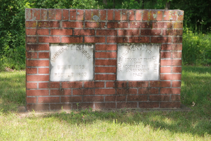
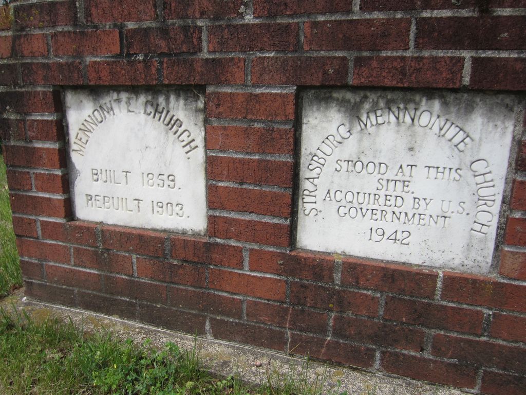
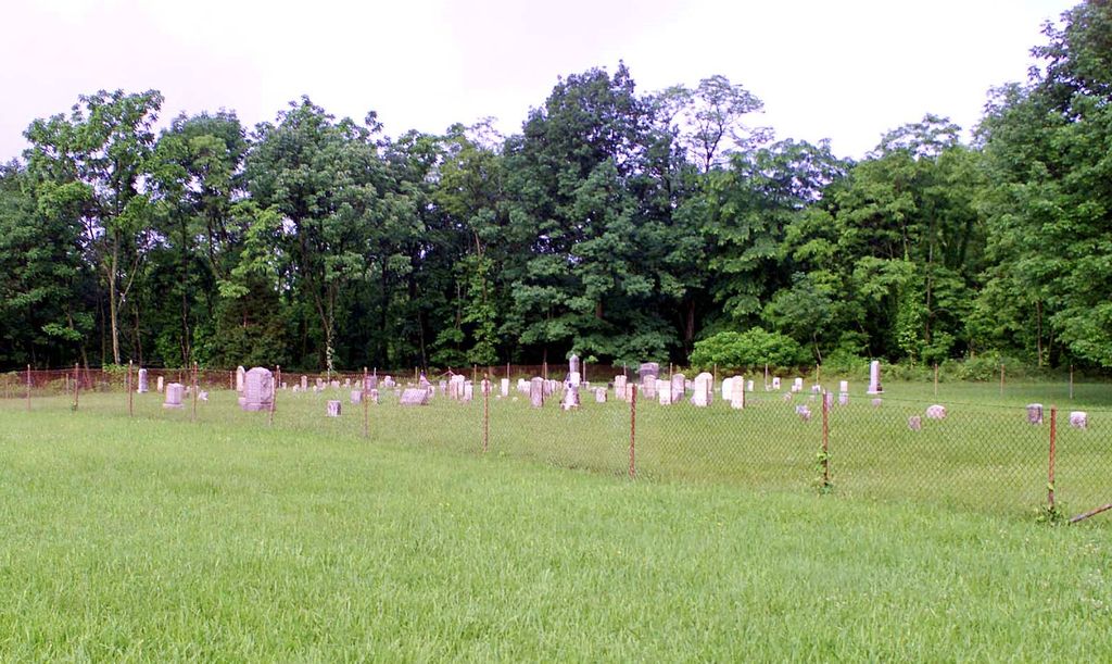
| Description | : | This cemetery is on land acquired by the U.S. Government for use as an ammunition depot. Today it's called Letterkenny Army Depot and is headquartered in Chambersburg, Pennsylvania. Burials stopped at the time the land was acquired. Letterkenny Army Depot is responsible for upkeep of this cemetery and seven others on The Depot. Most of the information on this site regarding gravestone inscriptions was provided by The Letterkenny Army Dept. Once a year, usually before Memorial Day Weekend, The Depot provides a bus driven tour of all the cemeteries. Check local newspapers for dates and times. |
frequently asked questions (FAQ):
-
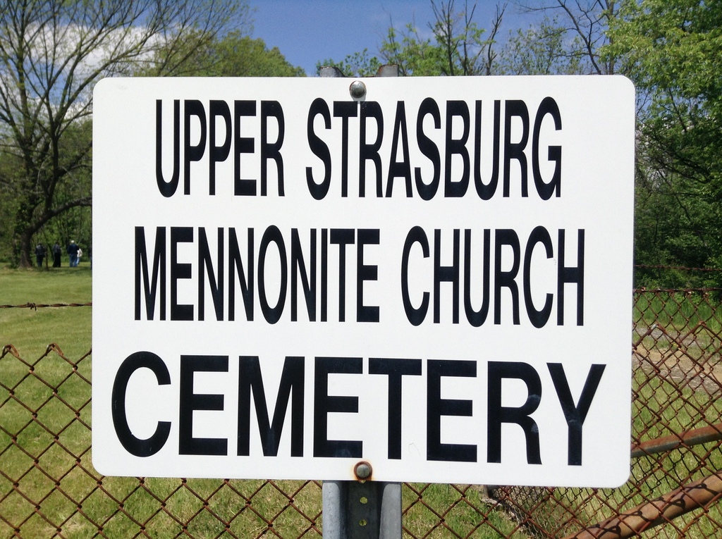
Where is Upper Strasburg Mennonite Church Cemetery?
Upper Strasburg Mennonite Church Cemetery is located at Chambersburg, Franklin County ,Pennsylvania ,USA.
-
Upper Strasburg Mennonite Church Cemetery cemetery's updated grave count on graveviews.com?
0 memorials
-
Where are the coordinates of the Upper Strasburg Mennonite Church Cemetery?
Latitude: 40.0203300
Longitude: -77.6967000

Nearby Cemetories:
1. Pleasant Hill Mennonite Church Cemetery
Chambersburg, Franklin County, USA
Coordinate: 39.9946070, -77.6931580
2. Rocky Spring Churchyard
Chambersburg, Franklin County, USA
Coordinate: 39.9886290, -77.6756130
3. Old Order York Brethren Cemetery
Chambersburg, Franklin County, USA
Coordinate: 40.0378630, -77.6556560
4. Emanuel Lutheran Church Cemetery
Upper Strasburg, Franklin County, USA
Coordinate: 40.0587000, -77.7049000
5. Emanuel's Liberal United Brethren Church Cemetery
Chambersburg, Franklin County, USA
Coordinate: 39.9825000, -77.7144000
6. Upper Strasburg Methodist Church Cemetery
Upper Strasburg, Franklin County, USA
Coordinate: 40.0596000, -77.7105000
7. New Hope Mennonite Cemetery
Upper Strasburg, Franklin County, USA
Coordinate: 40.0628950, -77.7099840
8. Air Hill Cemetery
Chambersburg, Franklin County, USA
Coordinate: 40.0169500, -77.6355000
9. Salem United Brethren Church Cemetery
Chambersburg, Franklin County, USA
Coordinate: 39.9851000, -77.6555000
10. Snider Cemetery
Chambersburg, Franklin County, USA
Coordinate: 39.9928810, -77.7500360
11. Pleasant Hall Cemetery
Pleasant Hall, Franklin County, USA
Coordinate: 40.0579600, -77.6527300
12. Gipe Grove Cemetery Old
Nyesville, Franklin County, USA
Coordinate: 40.0316700, -77.6227800
13. Culbertson Mennonite Church Cemetery
Chambersburg, Franklin County, USA
Coordinate: 39.9994300, -77.6247400
14. Brechbill Cemetery
Chambersburg, Franklin County, USA
Coordinate: 39.9745978, -77.7473585
15. Myers Cemetery
Orrstown, Franklin County, USA
Coordinate: 40.0485992, -77.6239014
16. Brinzer-Brainer Cemetery
Chambersburg, Franklin County, USA
Coordinate: 39.9636870, -77.6483340
17. Shirk's Mennonite Cemetery
Chambersburg, Franklin County, USA
Coordinate: 39.9720190, -77.6319010
18. Norland Cemetery
Chambersburg, Franklin County, USA
Coordinate: 39.9667400, -77.6372500
19. Green Village United Methodist Cemetery
Green Village, Franklin County, USA
Coordinate: 39.9922910, -77.6106940
20. Parklawns Memorial Gardens
Chambersburg, Franklin County, USA
Coordinate: 39.9741516, -77.6243362
21. Greenvillage Lutheran Cemetery
Chambersburg, Franklin County, USA
Coordinate: 39.9946000, -77.6074000
22. Chambersburg Mennonite Cemetery
Chambersburg, Franklin County, USA
Coordinate: 39.9567000, -77.6453000
23. Orrstown United Brethren Cemetery
Orrstown, Franklin County, USA
Coordinate: 40.0578000, -77.6114000
24. Criders Cemetery
Chambersburg, Franklin County, USA
Coordinate: 39.9589729, -77.7540283