
| Memorials | : | 0 |
| Location | : | Chambersburg, Franklin County, USA |
| Coordinate | : | 39.9928810, -77.7500360 |
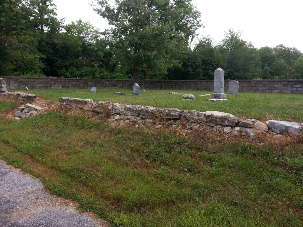
| Description | : | This cemetery is located off the Letterkenny Army Depot just South of Gate 14 on Burkett Road Franklin County, Pa. ____ about 1500 feet from Boundary Road. It is a small stone-walled cemetery. The headstones were arranged in rows extending from the North to the South, along the length of the plot. At one time there were 35 tombstones in the cemetery, but in September 1990, vandals destroyed over a dozen or more. They used a backhoe and pulled the stones from the ground. Most stones were broken and scattered thru the area. Some stones were found in a nearby... Read More |
frequently asked questions (FAQ):
-
Where is Snider Cemetery?
Snider Cemetery is located at Burkett Road Chambersburg, Franklin County ,Pennsylvania , 17202USA.
-
Snider Cemetery cemetery's updated grave count on graveviews.com?
0 memorials
-
Where are the coordinates of the Snider Cemetery?
Latitude: 39.9928810
Longitude: -77.7500360
Nearby Cemetories:
1. Brechbill Cemetery
Chambersburg, Franklin County, USA
Coordinate: 39.9745978, -77.7473585
2. Emanuel's Liberal United Brethren Church Cemetery
Chambersburg, Franklin County, USA
Coordinate: 39.9825000, -77.7144000
3. Criders Cemetery
Chambersburg, Franklin County, USA
Coordinate: 39.9589729, -77.7540283
4. Mount Olivet Cemetery
Chambersburg, Franklin County, USA
Coordinate: 39.9771000, -77.7921000
5. Pleasant Hill Mennonite Church Cemetery
Chambersburg, Franklin County, USA
Coordinate: 39.9946070, -77.6931580
6. Crider Family Farm Cemetery
Chambersburg, Franklin County, USA
Coordinate: 39.9459000, -77.7463000
7. Upper Strasburg Mennonite Church Cemetery
Chambersburg, Franklin County, USA
Coordinate: 40.0203300, -77.6967000
8. Edenville Methodist Church Cemetery
Edenville, Franklin County, USA
Coordinate: 39.9577000, -77.8031000
9. Rocky Spring Churchyard
Chambersburg, Franklin County, USA
Coordinate: 39.9886290, -77.6756130
10. Horse Valley Cemetery
Franklin County, USA
Coordinate: 40.0386009, -77.8058014
11. Coble Family Cemetery
Saint Thomas, Franklin County, USA
Coordinate: 39.9279020, -77.7562660
12. Keefers Cemetery
Upper Strasburg, Franklin County, USA
Coordinate: 40.0406550, -77.8079090
13. Forrester Family Cemetery
Freestone, Franklin County, USA
Coordinate: 40.0172290, -77.8317830
14. Salem United Brethren Church Cemetery
Chambersburg, Franklin County, USA
Coordinate: 39.9851000, -77.6555000
15. Upper Strasburg Methodist Church Cemetery
Upper Strasburg, Franklin County, USA
Coordinate: 40.0596000, -77.7105000
16. Emanuel Lutheran Church Cemetery
Upper Strasburg, Franklin County, USA
Coordinate: 40.0587000, -77.7049000
17. New Hope Mennonite Cemetery
Upper Strasburg, Franklin County, USA
Coordinate: 40.0628950, -77.7099840
18. Zion United Brethren Cemetery
Upper Strasburg, Franklin County, USA
Coordinate: 39.9909670, -77.8514330
19. Archibald Graveyard
Saint Thomas, Franklin County, USA
Coordinate: 39.9183690, -77.7788400
20. Zion United Brethren Cemetery
Saint Thomas, Franklin County, USA
Coordinate: 39.9909893, -77.8516591
21. Lebanon Cemetery
Chambersburg, Franklin County, USA
Coordinate: 39.9348900, -77.6813600
22. Pleasant View Mennonite Cemetery
Chambersburg, Franklin County, USA
Coordinate: 39.9247000, -77.6974000
23. Corpus Christi Cemetery
Chambersburg, Franklin County, USA
Coordinate: 39.9380860, -77.6748680
24. Saint Thomas Lutheran Cemetery
Saint Thomas, Franklin County, USA
Coordinate: 39.9192807, -77.7928746