
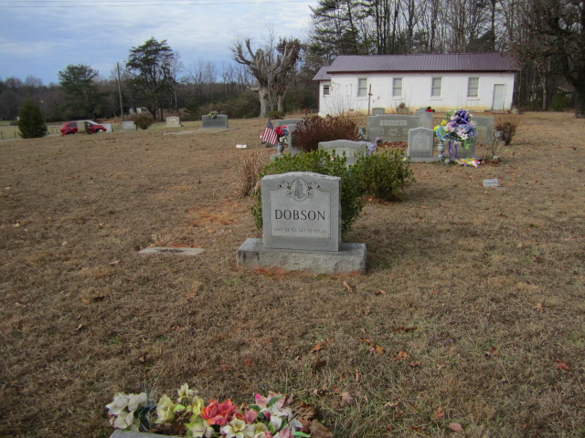
| Memorials | : | 0 |
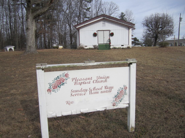
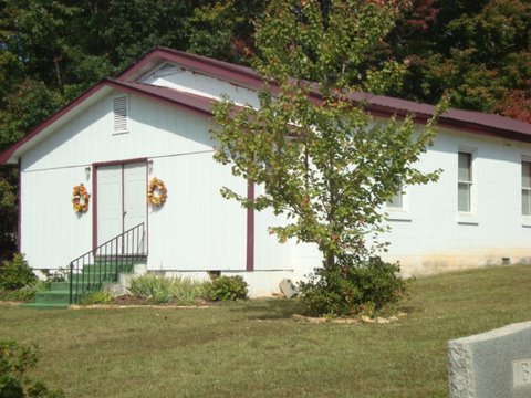
| Location | : | Salemfork, Surry County, USA |
| Coordinate | : | 36.4208060, -80.8063610 |
| Description | : | From the intersection of Reely Cook Road and Crossroads Church Road, travel approximately 0.07 miles on Reely Cook Road; the church and cemetery will be on the right. The church and cemetery are located next to Crossroads Missionary Baptist Church. |
frequently asked questions (FAQ):
-
Where is Pleasant Union Baptist Church Cemetery?
Pleasant Union Baptist Church Cemetery is located at 132 Reely Cook Road Salemfork, Surry County ,North Carolina , 27017USA.
-
Pleasant Union Baptist Church Cemetery cemetery's updated grave count on graveviews.com?
0 memorials
-
Where are the coordinates of the Pleasant Union Baptist Church Cemetery?
Latitude: 36.4208060
Longitude: -80.8063610
Nearby Cemetories:
1. Crossroads Missionary Baptist Church Cemetery
Salemfork, Surry County, USA
Coordinate: 36.4212780, -80.8057500
2. Riggans Family Cemetery
Salemfork, Surry County, USA
Coordinate: 36.4314420, -80.7896220
3. Jesse Venable Family Cemetery
Surry County, USA
Coordinate: 36.4050000, -80.7925000
4. Cox Family Cemetery
Dobson, Surry County, USA
Coordinate: 36.4391700, -80.7983300
5. Mitchell Family Cemetery
Dobson, Surry County, USA
Coordinate: 36.4335920, -80.7815160
6. Dayspring Baptist Chapel Cemetery
Salemfork, Surry County, USA
Coordinate: 36.3996270, -80.7895910
7. Speer Family Cemetery
Mount Airy, Surry County, USA
Coordinate: 36.4443333, -80.7945000
8. Nixon Family Cemetery
Surry County, USA
Coordinate: 36.4445830, -80.7949720
9. Central View Missionary Baptist Cemetery
Dobson, Surry County, USA
Coordinate: 36.4272232, -80.7711639
10. Salem Fork Christian Church Cemetery
Salemfork, Surry County, USA
Coordinate: 36.3950386, -80.7884827
11. Lineberry Family Cemetery
Dobson, Surry County, USA
Coordinate: 36.3961300, -80.8276300
12. Beamer Family Cemetery
Surry County, USA
Coordinate: 36.4397530, -80.7754330
13. Llewellyn Cemetery
Dobson, Surry County, USA
Coordinate: 36.4425690, -80.7781150
14. New Life Baptist Cemetery
Mount Airy, Surry County, USA
Coordinate: 36.4524994, -80.8030548
15. Edwards-Franklin House Grounds
Mount Airy, Surry County, USA
Coordinate: 36.4541664, -80.8181915
16. Rocky Ford Baptist Church Cemetery
Mountain Park, Surry County, USA
Coordinate: 36.4160576, -80.8523865
17. Drewery Hodges Cemetery
Dobson, Surry County, USA
Coordinate: 36.4438900, -80.7653900
18. Amazing Grace Baptist Church Cemetery
Ladonia, Surry County, USA
Coordinate: 36.4588700, -80.8254250
19. New Bethel Baptist Church Cemetery
Ladonia, Surry County, USA
Coordinate: 36.4505610, -80.8420590
20. Payne Family Cemetery
Dobson, Surry County, USA
Coordinate: 36.4130700, -80.7539600
21. Isaacks Family Cemetery
Mount Airy, Surry County, USA
Coordinate: 36.4621670, -80.8236670
22. Sarah Isaacs Cemetery
Franklin, Surry County, USA
Coordinate: 36.4636110, -80.8205830
23. Salem Fork Baptist Church Cemetery
Salemfork, Surry County, USA
Coordinate: 36.3835440, -80.7758290
24. Flat Top Primitive Baptist Church Cemetery
Beulah, Surry County, USA
Coordinate: 36.4570000, -80.7730000