
| Memorials | : | 67 |
| Location | : | Ladonia, Surry County, USA |
| Coordinate | : | 36.4505610, -80.8420590 |
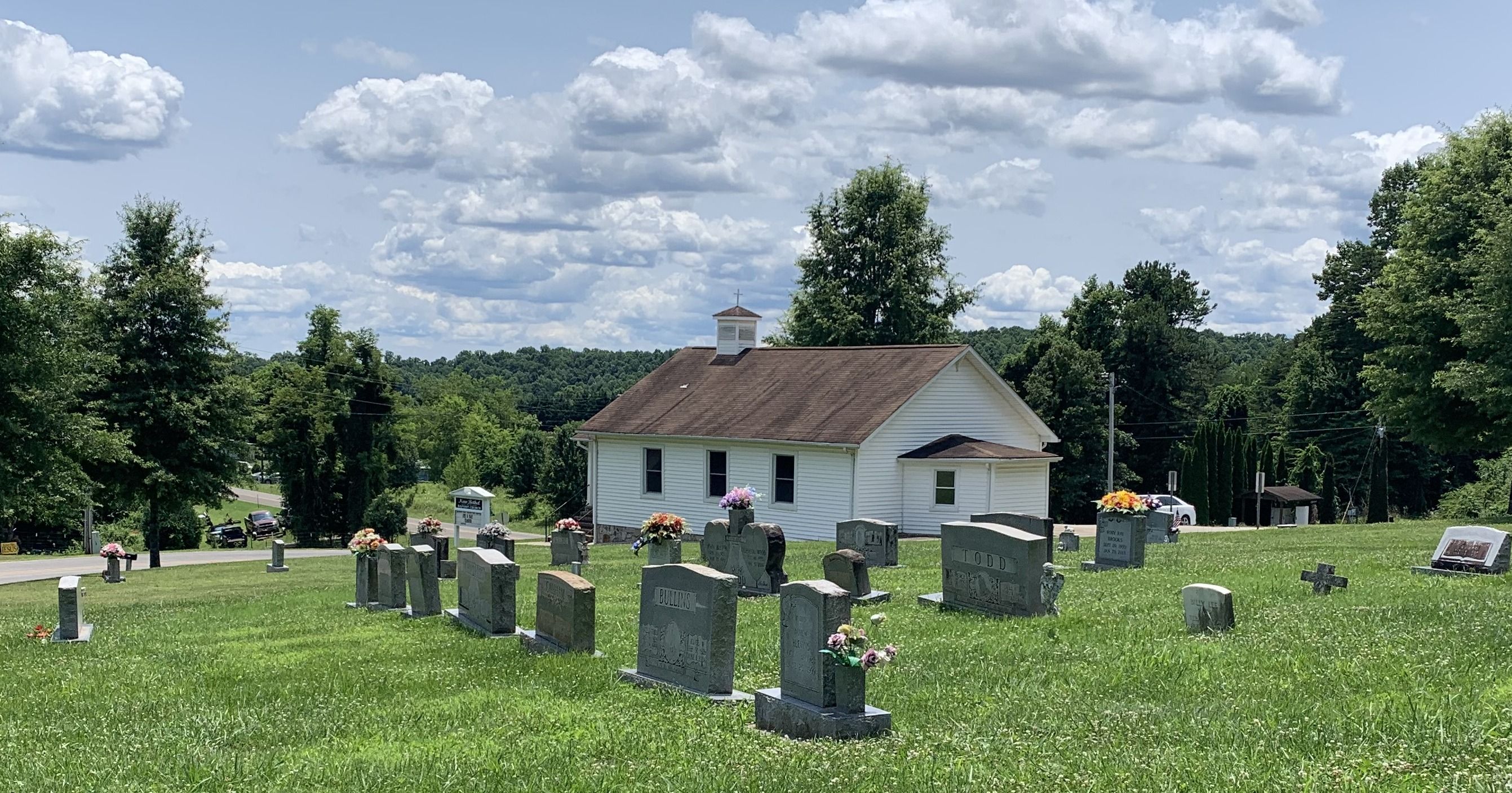
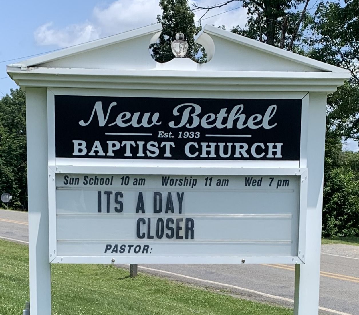
| Description | : | Please note There are two different New Bethel Baptist located in Surry County, NC. The other New Bethel is located at: Pipers Gap Rd SR 1624, Mt. Airy, NC This one is located at: 4918 Haystack Road, Mountain Park, NC The church and cemetery are located at the intersection of Haystack Road and Red Hill Creek Road. |
frequently asked questions (FAQ):
-
Where is New Bethel Baptist Church Cemetery?
New Bethel Baptist Church Cemetery is located at 116 Heavens Pathway Ladonia, Surry County ,North Carolina , 27017USA.
-
New Bethel Baptist Church Cemetery cemetery's updated grave count on graveviews.com?
67 memorials
-
Where are the coordinates of the New Bethel Baptist Church Cemetery?
Latitude: 36.4505610
Longitude: -80.8420590
Nearby Cemetories:
1. Amazing Grace Baptist Church Cemetery
Ladonia, Surry County, USA
Coordinate: 36.4588700, -80.8254250
2. Isaacks Family Cemetery
Mount Airy, Surry County, USA
Coordinate: 36.4621670, -80.8236670
3. Edwards-Franklin House Grounds
Mount Airy, Surry County, USA
Coordinate: 36.4541664, -80.8181915
4. Sarah Isaacs Cemetery
Franklin, Surry County, USA
Coordinate: 36.4636110, -80.8205830
5. Ladonia Baptist Church Cemetery
Ladonia, Surry County, USA
Coordinate: 36.4780280, -80.8386670
6. New Life Baptist Cemetery
Mount Airy, Surry County, USA
Coordinate: 36.4524994, -80.8030548
7. Carpenter - Snow Family Cemetery
Dobson, Surry County, USA
Coordinate: 36.4523330, -80.8820280
8. Rocky Ford Baptist Church Cemetery
Mountain Park, Surry County, USA
Coordinate: 36.4160576, -80.8523865
9. Cox Family Cemetery
Dobson, Surry County, USA
Coordinate: 36.4391700, -80.7983300
10. Nixon Family Cemetery
Surry County, USA
Coordinate: 36.4445830, -80.7949720
11. Speer Family Cemetery
Mount Airy, Surry County, USA
Coordinate: 36.4443333, -80.7945000
12. Pleasant Union Baptist Church Cemetery
Salemfork, Surry County, USA
Coordinate: 36.4208060, -80.8063610
13. Crossroads Missionary Baptist Church Cemetery
Salemfork, Surry County, USA
Coordinate: 36.4212780, -80.8057500
14. Riggans Family Cemetery
Salemfork, Surry County, USA
Coordinate: 36.4314420, -80.7896220
15. Mitchell Family Cemetery
Dobson, Surry County, USA
Coordinate: 36.4335920, -80.7815160
16. Llewellyn Cemetery
Dobson, Surry County, USA
Coordinate: 36.4425690, -80.7781150
17. Mount Vernon Baptist Church Cemetery
Beulah, Surry County, USA
Coordinate: 36.5003624, -80.8213882
18. Beamer Family Cemetery
Surry County, USA
Coordinate: 36.4397530, -80.7754330
19. Country Baptist Church Cemetery
Beulah, Surry County, USA
Coordinate: 36.4662230, -80.7760980
20. Lineberry Family Cemetery
Dobson, Surry County, USA
Coordinate: 36.3961300, -80.8276300
21. Flat Top Primitive Baptist Church Cemetery
Beulah, Surry County, USA
Coordinate: 36.4570000, -80.7730000
22. Samuel Isaacks Cemetery
Thurmond, Surry County, USA
Coordinate: 36.3978610, -80.8729170
23. Payne Cemetery
Lowgap, Surry County, USA
Coordinate: 36.4947220, -80.7928060
24. Union Hill Baptist Church Cemetery
Union Hill, Surry County, USA
Coordinate: 36.4012500, -80.8848610