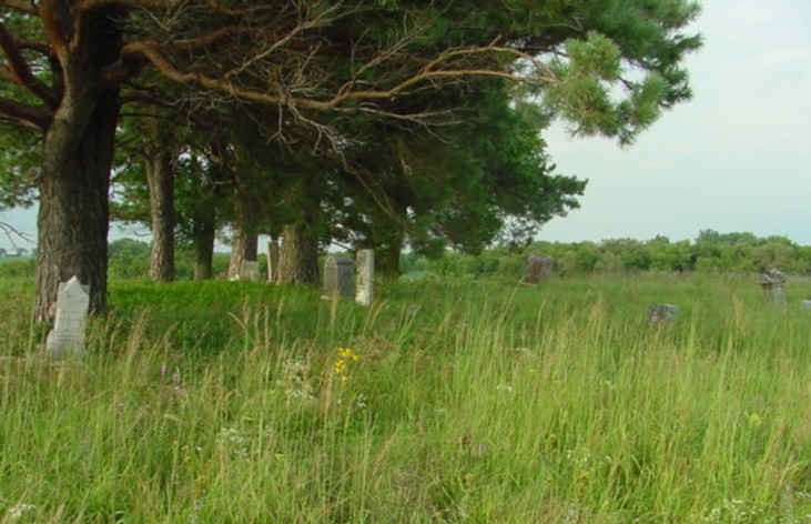
| Memorials | : | 0 |
| Location | : | Racine, Mower County, USA |
| Coordinate | : | 43.8116989, -92.6074982 |
| Description | : | In June, 1870, five acres of land, situated in the southeast quarter of section 15, the property of L.S. Bates, was purchased by the town, at $10 per acre, for a burial ground. It is now known as the Pleasant Valley Cemetery. From: The History of Mower County 1911. |
frequently asked questions (FAQ):
-
Where is Pleasant Valley Cemetery?
Pleasant Valley Cemetery is located at Racine, Mower County ,Minnesota ,USA.
-
Pleasant Valley Cemetery cemetery's updated grave count on graveviews.com?
0 memorials
-
Where are the coordinates of the Pleasant Valley Cemetery?
Latitude: 43.8116989
Longitude: -92.6074982
Nearby Cemetories:
1. Immanuel Cemetery
Racine, Mower County, USA
Coordinate: 43.8107986, -92.6089020
2. Saint Johns Evangelical Cemetery
Racine, Mower County, USA
Coordinate: 43.8053017, -92.5586014
3. High Forest Cemetery
High Forest, Olmsted County, USA
Coordinate: 43.8472214, -92.5413895
4. Norwegian Methodist Church Cemetery
Grand Meadow, Mower County, USA
Coordinate: 43.7397385, -92.5555878
5. Zion Lutheran Church Cemetery
Sargeant, Mower County, USA
Coordinate: 43.7891693, -92.7161102
6. Sever Temanson Cemetery
Grand Meadow, Mower County, USA
Coordinate: 43.7475014, -92.5377808
7. Bear Creek Lutheran Church Cemetery
Mower County, USA
Coordinate: 43.7391701, -92.5555573
8. Saint Finbarrs Cemetery
Grand Meadow, Mower County, USA
Coordinate: 43.7252998, -92.5886002
9. Racine Salem Cemetery
Racine, Mower County, USA
Coordinate: 43.7611008, -92.5061035
10. Woodlawn Cemetery
Stewartville, Olmsted County, USA
Coordinate: 43.8561707, -92.4966507
11. Evanger Lutheran Church Cemetery
Sargeant, Mower County, USA
Coordinate: 43.8416710, -92.7300034
12. Pilot Grove Cemetery
Racine, Mower County, USA
Coordinate: 43.7926903, -92.4798660
13. Saint Bernard Catholic Cemetery
Stewartville, Olmsted County, USA
Coordinate: 43.8624992, -92.4942017
14. Grand Meadow Cemetery
Grand Meadow, Mower County, USA
Coordinate: 43.7092018, -92.5796967
15. Dexter Cemetery
Dexter, Mower County, USA
Coordinate: 43.7313995, -92.7050018
16. Zion Cemetery
Rock Dell, Olmsted County, USA
Coordinate: 43.9297218, -92.6377792
17. Hamilton Cemetery
Hamilton, Fillmore County, USA
Coordinate: 43.7671432, -92.4489136
18. East Saint Olaf Lutheran Church Cemetery
Rock Dell, Olmsted County, USA
Coordinate: 43.9327812, -92.6383286
19. Saint Johns Lutheran Cemetery
Sargeant, Mower County, USA
Coordinate: 43.7751083, -92.7908936
20. West Saint Olaf Cemetery
Vernon, Dodge County, USA
Coordinate: 43.9266701, -92.7177811
21. Oakridge Farm Cemetery
Rochester, Olmsted County, USA
Coordinate: 43.9479480, -92.5435090
22. Frankford Cemetery
Mower County, USA
Coordinate: 43.7139015, -92.4580994
23. Jerusalem Evangelical Cemetery
Pleasant Grove, Olmsted County, USA
Coordinate: 43.8917389, -92.4381256
24. South Zumbro Lutheran Church Cemetery
Salem Corners, Olmsted County, USA
Coordinate: 43.9517670, -92.6777878

