
| Memorials | : | 0 |
| Location | : | Salem Corners, Olmsted County, USA |
| Coordinate | : | 43.9517670, -92.6777878 |
| Description | : | Street Address Co. Rd. 17 & 120th Ave. SW Driving Directions Co. Rd. 3 north of Rock Dell 2 miles, left on Co. Rd. 17 (50th St. SW). Right on 120th Ave. SW--cemetery east of road. On the county line with Dodge County. |
frequently asked questions (FAQ):
-
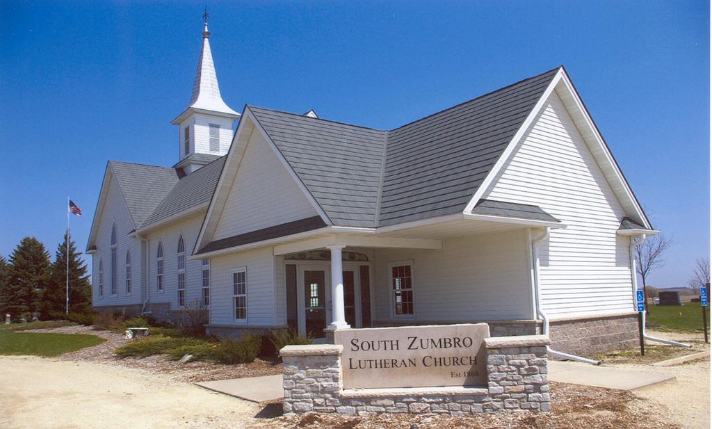
Where is South Zumbro Lutheran Church Cemetery?
South Zumbro Lutheran Church Cemetery is located at Salem Corners, Olmsted County ,Minnesota ,USA.
-
South Zumbro Lutheran Church Cemetery cemetery's updated grave count on graveviews.com?
0 memorials
-
Where are the coordinates of the South Zumbro Lutheran Church Cemetery?
Latitude: 43.9517670
Longitude: -92.6777878
Nearby Cemetories:
1. East Saint Olaf Lutheran Church Cemetery
Rock Dell, Olmsted County, USA
Coordinate: 43.9327812, -92.6383286
2. Zion Cemetery
Rock Dell, Olmsted County, USA
Coordinate: 43.9297218, -92.6377792
3. West Saint Olaf Cemetery
Vernon, Dodge County, USA
Coordinate: 43.9266701, -92.7177811
4. Riverside Cemetery
Salem Corners, Olmsted County, USA
Coordinate: 43.9785995, -92.6074982
5. Byron Cemetery
Byron, Olmsted County, USA
Coordinate: 44.0359459, -92.6424713
6. Maple Grove Cemetery
Kasson, Dodge County, USA
Coordinate: 44.0214005, -92.7553024
7. Oakridge Farm Cemetery
Rochester, Olmsted County, USA
Coordinate: 43.9479480, -92.5435090
8. Evanger Lutheran Church Cemetery
Sargeant, Mower County, USA
Coordinate: 43.8416710, -92.7300034
9. Mayowood Cemetery
Rochester, Olmsted County, USA
Coordinate: 43.9909500, -92.5218800
10. Evergreen Cemetery
Mantorville, Dodge County, USA
Coordinate: 44.0619011, -92.7418976
11. Saint Margaret Cemetery
Mantorville, Dodge County, USA
Coordinate: 44.0616989, -92.7435989
12. Mount Hope Cemetery
Rochester, Olmsted County, USA
Coordinate: 44.0703011, -92.5783005
13. High Forest Cemetery
High Forest, Olmsted County, USA
Coordinate: 43.8472214, -92.5413895
14. Fairview Cemetery
Hayfield, Dodge County, USA
Coordinate: 43.8849983, -92.8585968
15. Pleasant Valley Cemetery
Racine, Mower County, USA
Coordinate: 43.8116989, -92.6074982
16. Immanuel Cemetery
Racine, Mower County, USA
Coordinate: 43.8107986, -92.6089020
17. First Unitarian Universalist Memorial Garden
Rochester, Olmsted County, USA
Coordinate: 44.0140700, -92.4876100
18. Congregational Church Columbarium
Rochester, Olmsted County, USA
Coordinate: 44.0122900, -92.4857200
19. Wildwood Cemetery
Wasioja, Dodge County, USA
Coordinate: 44.0713997, -92.8142014
20. Riverside Cemetery
Dodge Center, Dodge County, USA
Coordinate: 44.0393982, -92.8597031
21. Saint Bernard Catholic Cemetery
Stewartville, Olmsted County, USA
Coordinate: 43.8624992, -92.4942017
22. Othello Cemetery
Genoa, Olmsted County, USA
Coordinate: 44.1116982, -92.6641998
23. Woodlawn Cemetery
Stewartville, Olmsted County, USA
Coordinate: 43.8561707, -92.4966507
24. Saint Lukes Episcopal Church Columbarium
Rochester, Olmsted County, USA
Coordinate: 44.0453240, -92.4928450