
| Memorials | : | 4 |
| Location | : | Stringtown, Cole County, USA |
| Coordinate | : | 38.5192986, -92.3526993 |
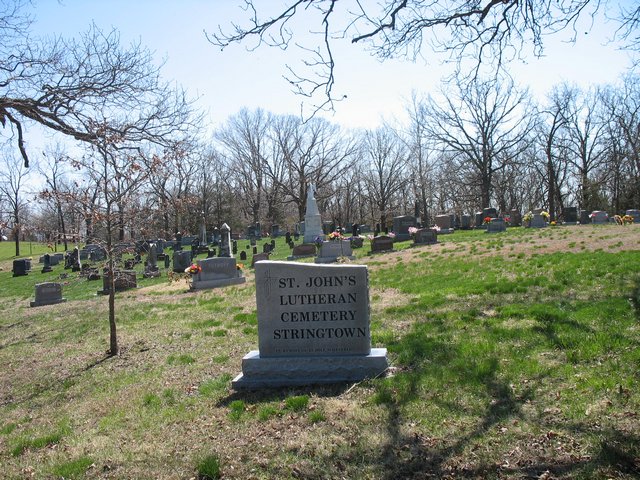
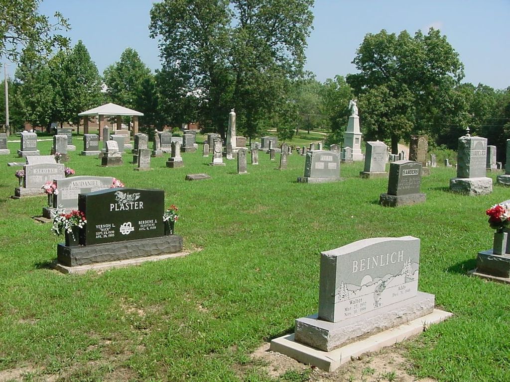
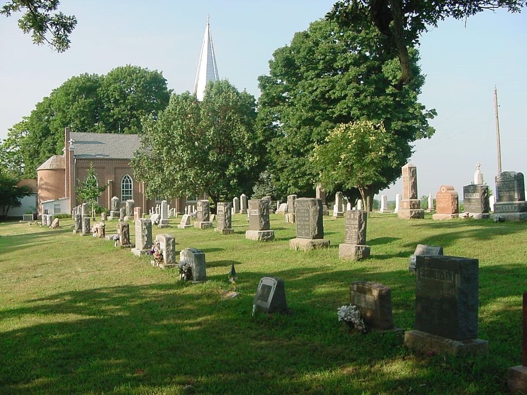
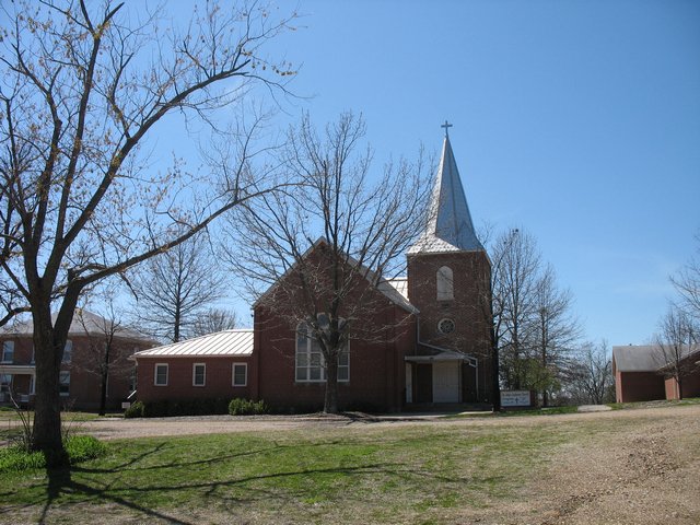
| Description | : | Saint John Lutheran Church Lutheran Church Missouri Synod 4420 Stringtown Rd Lohman, MO 65053-9550 Stringtown is on the SW Quarter of Section 21 Township 44 Range 13 and was established circa 1882 Lohman is the new name given to Stringtown (circa 1884). It is 12 miles SW of the county/state capital (Jefferson City). |
frequently asked questions (FAQ):
-
Where is Saint Johns Lutheran Church Cemetery?
Saint Johns Lutheran Church Cemetery is located at 4420 Stringtown Rd Stringtown, Cole County ,Missouri , 65053USA.
-
Saint Johns Lutheran Church Cemetery cemetery's updated grave count on graveviews.com?
3 memorials
-
Where are the coordinates of the Saint Johns Lutheran Church Cemetery?
Latitude: 38.5192986
Longitude: -92.3526993
Nearby Cemetories:
1. Saint Pauls Lutheran Cemetery
Lohman, Cole County, USA
Coordinate: 38.5388985, -92.3597031
2. Colvin Strong Cemetery
Millbrook, Cole County, USA
Coordinate: 38.5025600, -92.3690400
3. Old Catholic Cemetery
Jefferson City, Cole County, USA
Coordinate: 38.5358009, -92.3321991
4. Saint Joseph Cemetery
Stringtown, Cole County, USA
Coordinate: 38.5361110, -92.3320720
5. Gordon Cemetery
Lohman, Cole County, USA
Coordinate: 38.5370900, -92.3158100
6. Pleasant Hill Cemetery
Brazito, Cole County, USA
Coordinate: 38.4810300, -92.3224000
7. Plummer Burying Ground
Jefferson City, Cole County, USA
Coordinate: 38.5633800, -92.3247900
8. Blank Cemetery
Russellville, Cole County, USA
Coordinate: 38.5203018, -92.4180984
9. Stone Cemetery
Cole County, USA
Coordinate: 38.5718994, -92.3358002
10. Johnston Cemetery
Brazito, Cole County, USA
Coordinate: 38.4928017, -92.2910995
11. Clibourn Cemetery
Russellville, Cole County, USA
Coordinate: 38.4760500, -92.3973500
12. Wilkerson Cemetery
Cole County, USA
Coordinate: 38.5722008, -92.3308029
13. Trinity Lutheran Cemetery
Russellville, Cole County, USA
Coordinate: 38.5028000, -92.4317017
14. Buckner Russell Cemetery
Cole County, USA
Coordinate: 38.5136900, -92.4359390
15. Russellville Cemetery
Russellville, Cole County, USA
Coordinate: 38.5196991, -92.4366989
16. Barnhardt Cemetery
Lohman, Cole County, USA
Coordinate: 38.5537900, -92.4267100
17. Emil Seidel Farm Cemetery
Scruggs, Cole County, USA
Coordinate: 38.5601845, -92.2841797
18. Eberhardt Cemetery
Cole County, USA
Coordinate: 38.5257988, -92.2668991
19. Evangelical Lutheran Cemetery One Acre
Russellville, Cole County, USA
Coordinate: 38.5175667, -92.4415817
20. Saint Michael Cemetery
Russellville, Cole County, USA
Coordinate: 38.5109300, -92.4429100
21. Campbell Cemetery
Cole County, USA
Coordinate: 38.4810982, -92.4297028
22. Peace Lutheran Cemetery
Brazito, Cole County, USA
Coordinate: 38.4676600, -92.2889300
23. Hedler Cemetery
Jefferson City, Cole County, USA
Coordinate: 38.4814000, -92.2705700
24. Roark Cemetery
Russellville, Cole County, USA
Coordinate: 38.4696999, -92.4255981