| Memorials | : | 231 |
| Location | : | Ware Neck, Gloucester County, USA |
| Coordinate | : | 37.4023590, -76.4399470 |
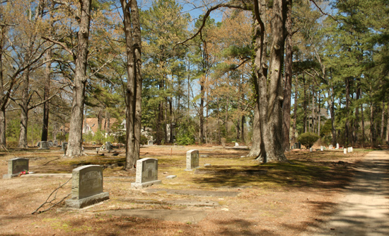
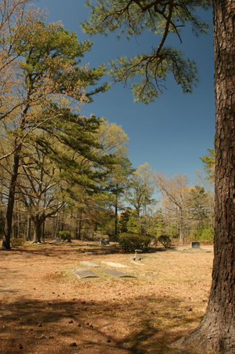
| Description | : | Located beneath stately pines, the oldest marked grave dates to 1908. Once known as the Union Zion Baptist Church cemetery, Pole Bridge Cemetery is located off Ditchley Road (Route 625) and Gill Lane. |
frequently asked questions (FAQ):
-
Where is Pole Bridge Cemetery?
Pole Bridge Cemetery is located at Ware Neck, Gloucester County ,Virginia ,USA.
-
Pole Bridge Cemetery cemetery's updated grave count on graveviews.com?
231 memorials
-
Where are the coordinates of the Pole Bridge Cemetery?
Latitude: 37.4023590
Longitude: -76.4399470
Nearby Cemetories:
1. Davis Cemetery
Gloucester County, USA
Coordinate: 37.4009490, -76.4248900
2. Singleton United Methodist Church Cemetery
Schley, Gloucester County, USA
Coordinate: 37.3909380, -76.4508860
3. Beulah Baptist Church Cemetery
Schley, Gloucester County, USA
Coordinate: 37.3837980, -76.4425980
4. Jarvis Cemetery
Schley, Gloucester County, USA
Coordinate: 37.3820700, -76.4468000
5. Chandler Cemetery
Gloucester County, USA
Coordinate: 37.3829460, -76.4282580
6. Auburn Cemetery
Mathews, Mathews County, USA
Coordinate: 37.4231620, -76.4311980
7. Peter W. Smith Family Cemetery
Gloucester County, USA
Coordinate: 37.3852759, -76.4637594
8. Gayle-Hudgins Cemetery
Mathews County, USA
Coordinate: 37.4313801, -76.4413433
9. Yeatman Plantation Cemetery
Foster, Mathews County, USA
Coordinate: 37.4360966, -76.4426093
10. Sibley Family Cemetery
Bohannon, Mathews County, USA
Coordinate: 37.3974400, -76.3928100
11. Oakland Creek Burials
Cardinal, Mathews County, USA
Coordinate: 37.4266395, -76.3948929
12. Sinclair Cemetery
Gloucester County, USA
Coordinate: 37.3558006, -76.4555969
13. Emmaus Baptist Church Cemetery
Mathews County, USA
Coordinate: 37.4437486, -76.4052237
14. Oak Grove Cemetery
Selden, Gloucester County, USA
Coordinate: 37.3563995, -76.4666977
15. Zion Poplars Baptist Church Cemetery
Gloucester, Gloucester County, USA
Coordinate: 37.3994320, -76.5085530
16. Mount Zion United Methodist Church Cemetery
Gloucester, Gloucester County, USA
Coordinate: 37.4506600, -76.4724080
17. Severn Presbyterian Church Cemetery
Naxera, Gloucester County, USA
Coordinate: 37.3469960, -76.4523550
18. Shiloh Cemetery
Gloucester, Gloucester County, USA
Coordinate: 37.3996010, -76.5123030
19. Ware Episcopal Church Cemetery
Gloucester, Gloucester County, USA
Coordinate: 37.4227470, -76.5078880
20. Poplar Woods Cemetery
Cardinal, Mathews County, USA
Coordinate: 37.4205584, -76.3710153
21. Cook Cemetery
Cardinal, Mathews County, USA
Coordinate: 37.4265629, -76.3738042
22. Saint Pauls Cemetery
Roanes, Gloucester County, USA
Coordinate: 37.3678017, -76.5000000
23. Providence Cemetery
Cardinal, Mathews County, USA
Coordinate: 37.4167560, -76.3675830
24. Foster Burials
Mathews County, USA
Coordinate: 37.4247320, -76.3708234


