| Memorials | : | 5 |
| Location | : | Patrick, Chesterfield County, USA |
| Coordinate | : | 34.5778480, -80.0467570 |
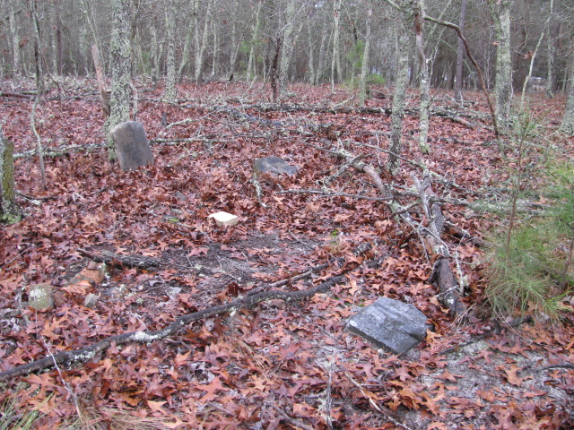
| Description | : | From Patrick, S.C. take Highway 102 North. Go across the railroad tracks. Turn the first street to the right. Turn the next street to the left. This street dead ends on private property. The cemetery is on this property. You will have to get permission from the home on the left. This cemetery has been vandalized in the past. Only two marked stones are left and they are broken. |
frequently asked questions (FAQ):
-
Where is Polson Cemetery?
Polson Cemetery is located at Patrick, Chesterfield County ,South Carolina ,USA.
-
Polson Cemetery cemetery's updated grave count on graveviews.com?
5 memorials
-
Where are the coordinates of the Polson Cemetery?
Latitude: 34.5778480
Longitude: -80.0467570
Nearby Cemetories:
1. Morning Star Baptist Church Cemetery
Patrick, Chesterfield County, USA
Coordinate: 34.5772100, -80.0437200
2. Patrick Cemetery
Patrick, Chesterfield County, USA
Coordinate: 34.5746994, -80.0567017
3. Mount Olive Church Cemetery
Patrick, Chesterfield County, USA
Coordinate: 34.5808400, -80.0330600
4. Ainsley Polson Cemetery
Patrick, Chesterfield County, USA
Coordinate: 34.5858600, -80.0204810
5. Griggs Cemetery
Patrick, Chesterfield County, USA
Coordinate: 34.5602630, -80.0050000
6. Huggins-McLain Cemetery
Patrick, Chesterfield County, USA
Coordinate: 34.5917015, -80.0924988
7. Brown Springs Baptist Church Cemetery
Patrick, Chesterfield County, USA
Coordinate: 34.5373690, -80.0374550
8. Pierce Cemetery
Patrick, Chesterfield County, USA
Coordinate: 34.6184529, -80.0608026
9. Saint Marys Presbyterian Church Cemetery Old
Patrick, Chesterfield County, USA
Coordinate: 34.5989460, -80.0001400
10. Bear Creek Cemetery
Patrick, Chesterfield County, USA
Coordinate: 34.6122300, -80.0918340
11. Fannie Cemetery
Chesterfield County, USA
Coordinate: 34.6352997, -80.0541992
12. Campbell Cemetery
Patrick, Chesterfield County, USA
Coordinate: 34.5346410, -80.0946370
13. Ganey Cemetery
Patrick, Chesterfield County, USA
Coordinate: 34.5346410, -80.0946370
14. Cross Branch Cemetery
Chesterfield County, USA
Coordinate: 34.6324997, -80.0836029
15. Piney Grove Cemetery
Cheraw, Chesterfield County, USA
Coordinate: 34.5825000, -79.9705600
16. Saint John Freewill Baptist Church Cemetery
Chesterfield County, USA
Coordinate: 34.6128000, -80.1111000
17. Bethesda United Methodist Church Cemetery
Chesterfield, Chesterfield County, USA
Coordinate: 34.6422005, -80.0468979
18. Wilkes Chapel United Methodist Church Cemetery
Patrick, Chesterfield County, USA
Coordinate: 34.5296200, -80.1030400
19. Bethlehem Church Cemetery
Middendorf, Chesterfield County, USA
Coordinate: 34.5605030, -80.1267820
20. Mount Mary Baptist Church Cemetery
Chesterfield, Chesterfield County, USA
Coordinate: 34.6463050, -80.0383590
21. Campbell Cemetery
Chesterfield County, USA
Coordinate: 34.5115010, -80.0696270
22. Piney Grove Baptist Church Cemetery
Patrick, Chesterfield County, USA
Coordinate: 34.6144500, -79.9728500
23. Cedar Creek Baptist Church Cemetery
Chesterfield County, USA
Coordinate: 34.5063360, -80.0593630
24. Green Family Cemetery
Chesterfield, Chesterfield County, USA
Coordinate: 34.6514260, -80.0319670

