
| Memorials | : | 0 |
| Location | : | Chesterfield, Chesterfield County, USA |
| Coordinate | : | 34.6422005, -80.0468979 |
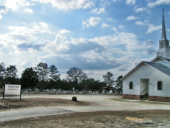
| Description | : | Directions: From Chesterfield take Hwy. 9 East. From the Intersection of Main Street and Hwy. 9 go approximately .5 of a mile to Teals Mill Road on the right. Bear to the right onto Teals Mill Road. Go approximately 3 miles to Evans Mill Road. Bear to the right onto Evans Mill Road. Go approximately 4 miles to Intersection of Hunts Mill Road. Take a left at Intersection onto Hunts Mill Road. Cemetery is on the immediate left. |
frequently asked questions (FAQ):
-
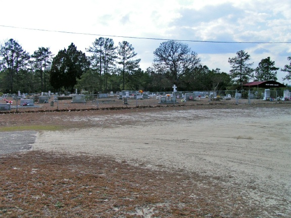
Where is Bethesda United Methodist Church Cemetery?
Bethesda United Methodist Church Cemetery is located at Chesterfield, Chesterfield County ,South Carolina ,USA.
-
Bethesda United Methodist Church Cemetery cemetery's updated grave count on graveviews.com?
0 memorials
-
Where are the coordinates of the Bethesda United Methodist Church Cemetery?
Latitude: 34.6422005
Longitude: -80.0468979
Nearby Cemetories:
1. Mount Mary Baptist Church Cemetery
Chesterfield, Chesterfield County, USA
Coordinate: 34.6463050, -80.0383590
2. Fannie Cemetery
Chesterfield County, USA
Coordinate: 34.6352997, -80.0541992
3. Green Family Cemetery
Chesterfield, Chesterfield County, USA
Coordinate: 34.6514260, -80.0319670
4. Peniel Cemetery
Chesterfield, Chesterfield County, USA
Coordinate: 34.6644170, -80.0460000
5. Pine View Baptist Church Cemetery
Chesterfield, Chesterfield County, USA
Coordinate: 34.6662350, -80.0428890
6. Pierce Cemetery
Patrick, Chesterfield County, USA
Coordinate: 34.6184529, -80.0608026
7. Saint James AME Zion Church Cemetery
Chesterfield County, USA
Coordinate: 34.6648470, -80.0721920
8. Cross Branch Cemetery
Chesterfield County, USA
Coordinate: 34.6324997, -80.0836029
9. Curry Family Cemetery
Chesterfield, Chesterfield County, USA
Coordinate: 34.6478430, -80.0053170
10. Lower Macedonia Memorial Garden
Chesterfield, Chesterfield County, USA
Coordinate: 34.6688470, -80.0077090
11. Cranford Cemetery
Chesterfield, Chesterfield County, USA
Coordinate: 34.6837260, -80.0300450
12. Drucilla AME Zion Church Cemetery
Chesterfield, Chesterfield County, USA
Coordinate: 34.6865100, -80.0374170
13. Church in the Lord Jesus Christ of the Apostles Ce
Chesterfield, Chesterfield County, USA
Coordinate: 34.6876730, -80.0490400
14. Mount Olivet United Methodist Church Cemetery
Hunts Mill, Chesterfield County, USA
Coordinate: 34.6623192, -79.9972763
15. Bear Creek Cemetery
Patrick, Chesterfield County, USA
Coordinate: 34.6122300, -80.0918340
16. First Southern Methodist Church Cemetery
Cheraw, Chesterfield County, USA
Coordinate: 34.6692090, -79.9958000
17. Kite Cemetery
Chesterfield, Chesterfield County, USA
Coordinate: 34.6855330, -80.0917620
18. Bay Springs Baptist Church Cemetery
Bay Springs, Chesterfield County, USA
Coordinate: 34.6372860, -80.1167890
19. Saint Marys Presbyterian Church Cemetery Old
Patrick, Chesterfield County, USA
Coordinate: 34.5989460, -80.0001400
20. Shiloh United Methodist Church Cemetery
Chesterfield, Chesterfield County, USA
Coordinate: 34.6819000, -80.0994034
21. Ainsley Polson Cemetery
Patrick, Chesterfield County, USA
Coordinate: 34.5858600, -80.0204810
22. Saint John Freewill Baptist Church Cemetery
Chesterfield County, USA
Coordinate: 34.6128000, -80.1111000
23. Evans Family Cemetery
Chesterfield, Chesterfield County, USA
Coordinate: 34.7031340, -80.0369290
24. Mount Olive Church Cemetery
Patrick, Chesterfield County, USA
Coordinate: 34.5808400, -80.0330600