
| Memorials | : | 3 |
| Location | : | Powers, Coos County, USA |
| Coordinate | : | 42.8944016, -124.0777969 |
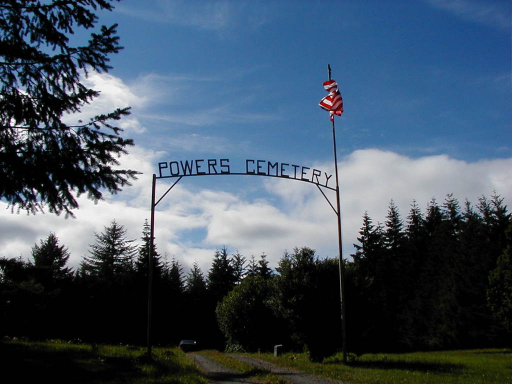
| Description | : | Located in Powers, the cemetery is on the left of the highway on a hill across the railroad tracks. This cemetery was started by the Masonic Lodge, later turned over to a church organization and is now owned by the town of Powers. |
frequently asked questions (FAQ):
-
Where is Powers Cemetery?
Powers Cemetery is located at Powers, Coos County ,Oregon ,USA.
-
Powers Cemetery cemetery's updated grave count on graveviews.com?
3 memorials
-
Where are the coordinates of the Powers Cemetery?
Latitude: 42.8944016
Longitude: -124.0777969
Nearby Cemetories:
1. Hayes Cemetery
Powers, Coos County, USA
Coordinate: 42.8708000, -124.0528030
2. Morris Family Cemetery
Powers, Coos County, USA
Coordinate: 42.8689003, -124.0516968
3. Wise Cemetery
Coos County, USA
Coordinate: 42.9247017, -124.1164017
4. Warner Grave
Coos County, USA
Coordinate: 42.9333000, -124.1166992
5. Jefferson Cemetery
Powers, Coos County, USA
Coordinate: 42.8365370, -124.0399280
6. Waterman Cemetery
Coos County, USA
Coordinate: 42.9317017, -124.0021973
7. Neal Cemetery
Gaylord, Coos County, USA
Coordinate: 42.9761009, -124.1138992
8. Myrtle Creek Cemetery
Bridge, Coos County, USA
Coordinate: 42.9696999, -124.0139008
9. Haines Cemetery
Curry County, USA
Coordinate: 42.8418999, -124.1875000
10. Gibbs Cemetery
Eckley, Curry County, USA
Coordinate: 42.8387200, -124.1845400
11. Haines Cemetery
Eckley, Curry County, USA
Coordinate: 42.8417700, -124.1887100
12. Dement Cemetery
Coos County, USA
Coordinate: 42.9832993, -124.1667023
13. Miller Cemetery
Myrtle Point, Coos County, USA
Coordinate: 43.0104600, -124.1321500
14. Hermann Family Cemetery
Broadbent, Coos County, USA
Coordinate: 43.0046997, -124.1567001
15. Breuer Cemetery
Coos County, USA
Coordinate: 43.0194016, -124.0792007
16. Brack Cemetery
Bridge, Coos County, USA
Coordinate: 43.0280991, -124.0877991
17. Warner Cemetery
Coos County, USA
Coordinate: 43.0250015, -124.1280975
18. Whittington Cemetery
Myrtle Point, Coos County, USA
Coordinate: 43.0222783, -124.1486533
19. Enchanted Prairie Cemetery
Coos County, USA
Coordinate: 43.0189018, -123.9713974
20. Hoffman Cemetery
Myrtle Point, Coos County, USA
Coordinate: 43.0402300, -124.1152400
21. Garrett Cemetery
Coos County, USA
Coordinate: 43.0405998, -124.1144028
22. Catching Creek Cemetery
Coos County, USA
Coordinate: 43.0080986, -124.2130966
23. Huckleberry Knoll Cemetery
Curry County, USA
Coordinate: 42.7785988, -124.2356033
24. Myrtle Point Cemetery
Myrtle Point, Coos County, USA
Coordinate: 43.0639000, -124.1196976