
| Memorials | : | 0 |
| Location | : | Louth, East Lindsey District, England |
| Coordinate | : | 53.3679743, 0.0029732 |
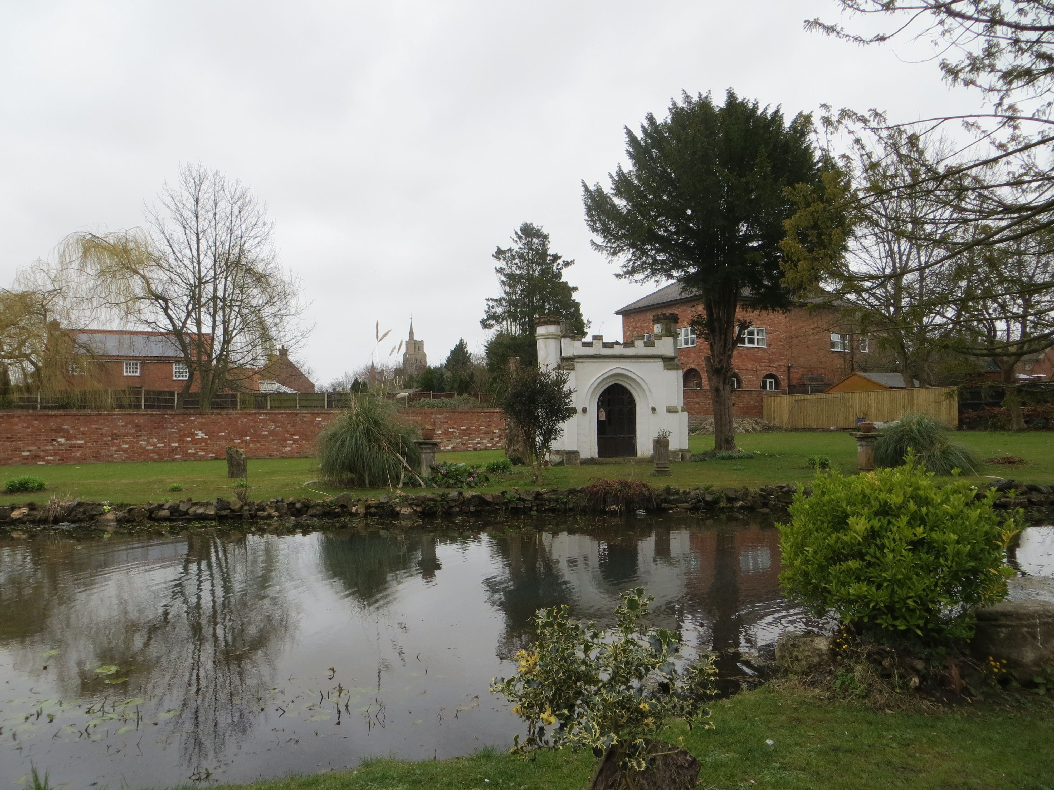
| Description | : | There is only one burial here, that of Thomas Espin FSA. He obtained special permission to be buried in the grounds of his home, Priory Cottage. A special mausoleum was built to house his grave. Thomas died in 1822, the building and grave are still there. |
frequently asked questions (FAQ):
-
Where is Priory Cottage, Eastgate?
Priory Cottage, Eastgate is located at Eastgate Louth, East Lindsey District ,Lincolnshire ,England.
-
Priory Cottage, Eastgate cemetery's updated grave count on graveviews.com?
0 memorials
-
Where are the coordinates of the Priory Cottage, Eastgate?
Latitude: 53.3679743
Longitude: 0.0029732
Nearby Cemetories:
1. Holy Trinity Church Cemetery
Louth, East Lindsey District, England
Coordinate: 53.3691600, 0.0071900
2. St. James Churchyard
Louth, East Lindsey District, England
Coordinate: 53.3666730, -0.0080358
3. Louth Abbey
Louth, East Lindsey District, England
Coordinate: 53.3666840, -0.0080750
4. Saint Mary's Old Cemetery
Louth, East Lindsey District, England
Coordinate: 53.3679040, -0.0100780
5. Louth Cemetery
Louth, East Lindsey District, England
Coordinate: 53.3604820, -0.0038070
6. St. Margaret Churchyard
Keddington, East Lindsey District, England
Coordinate: 53.3777150, 0.0203370
7. St Edith's Churchyard
Little Grimsby, East Lindsey District, England
Coordinate: 53.4020500, -0.0062550
8. St. Helen's Churchyard
Little Cawthorpe, East Lindsey District, England
Coordinate: 53.3332700, 0.0363400
9. St Helen's Churchyard
Little Cawthorpe, East Lindsey District, England
Coordinate: 53.3332300, 0.0363000
10. St. Mary Churchyard
Fotherby, East Lindsey District, England
Coordinate: 53.4057520, -0.0204600
11. All Saints Churchyard
Legbourne, East Lindsey District, England
Coordinate: 53.3390478, -0.0525820
12. St Adelwold Churchyard
Alvingham, East Lindsey District, England
Coordinate: 53.4009600, 0.0560600
13. St Edith Churchyard
Grimoldby, East Lindsey District, England
Coordinate: 53.3700890, 0.0919330
14. All Saints Churchyard
Haugham, East Lindsey District, England
Coordinate: 53.3127100, 0.0033400
15. St. Mary’s Churchyard
Covenham St Mary, East Lindsey District, England
Coordinate: 53.4292484, 0.0147001
16. St Bartholomew Churchyard
Covenham St Bartholomew, East Lindsey District, England
Coordinate: 53.4307280, 0.0140490
17. St John the Baptist Churchyard
Great Carlton, East Lindsey District, England
Coordinate: 53.3481180, 0.1138540
18. St. Michael's Churchyard
Burwell, East Lindsey District, England
Coordinate: 53.2968800, 0.0325800
19. St Faith Church
Kelstern, East Lindsey District, England
Coordinate: 53.3911200, -0.1196310
20. St Marys Churchyard
Ludborough, East Lindsey District, England
Coordinate: 53.4405106, -0.0510651
21. St Georges Churchyard
Gayton le Marsh, East Lindsey District, England
Coordinate: 53.3349200, 0.1386000
22. St. Peter's Churchyard
Gayton le Wold, East Lindsey District, England
Coordinate: 53.3562320, -0.1431270
23. St. Lawrence's Churchyard
Fulstow, East Lindsey District, England
Coordinate: 53.4599000, -0.0070000
24. St. Peter's Churchyard
Conisholme, East Lindsey District, England
Coordinate: 53.4365000, 0.1100100