
| Memorials | : | 0 |
| Location | : | Louth, East Lindsey District, England |
| Coordinate | : | 53.3666730, -0.0080358 |
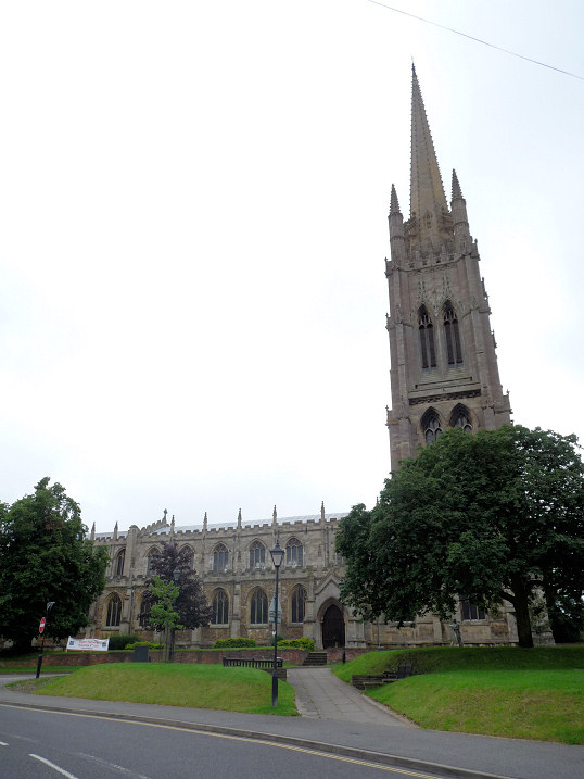
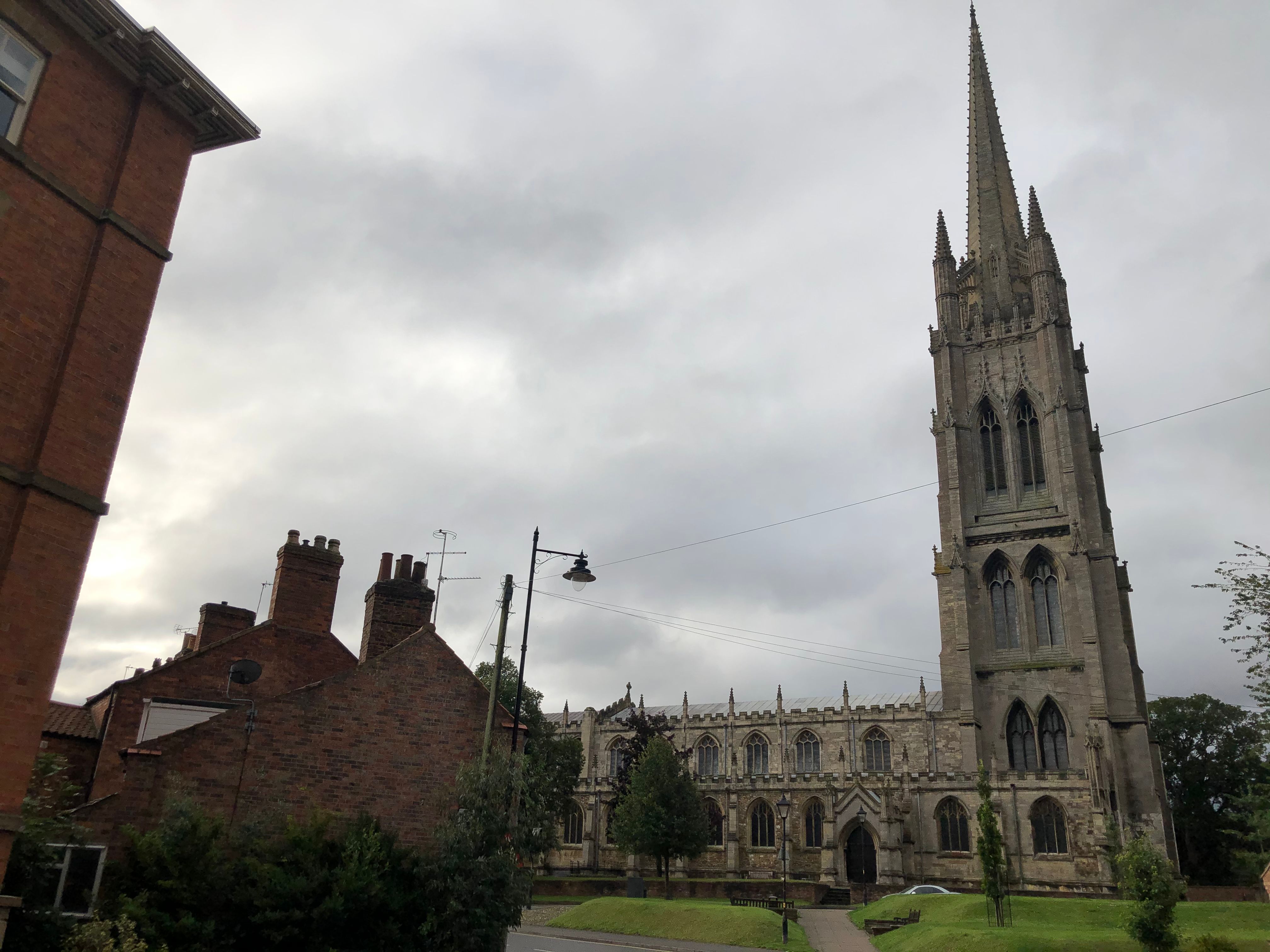
| Description | : | The mainly 15th century Anglican parish church of St James in Louth, replacing 11th and 13th century structures, is widely recognised as one of our finest late medieval churches. The spire is the tallest medieval parish church spire in England, completed in 1515. In October 1536, national discontent resulting from Henry VIII’s taxation and ecclesiastical changes culminated in people mustering in St James’ church to start the Lincolnshire Rising, the first serious rebellion threatening the Crown, followed by the Pilgrimage of Grace. Neither succeeded and the church was stripped of its riches including the rood screen. The church... Read More |
frequently asked questions (FAQ):
-
Where is St. James Churchyard?
St. James Churchyard is located at Louth, East Lindsey District ,Lincolnshire ,England.
-
St. James Churchyard cemetery's updated grave count on graveviews.com?
0 memorials
-
Where are the coordinates of the St. James Churchyard?
Latitude: 53.3666730
Longitude: -0.0080358
Nearby Cemetories:
1. Louth Abbey
Louth, East Lindsey District, England
Coordinate: 53.3666840, -0.0080750
2. Saint Mary's Old Cemetery
Louth, East Lindsey District, England
Coordinate: 53.3679040, -0.0100780
3. Louth Cemetery
Louth, East Lindsey District, England
Coordinate: 53.3604820, -0.0038070
4. Priory Cottage, Eastgate
Louth, East Lindsey District, England
Coordinate: 53.3679743, 0.0029732
5. Holy Trinity Church Cemetery
Louth, East Lindsey District, England
Coordinate: 53.3691600, 0.0071900
6. St. Margaret Churchyard
Keddington, East Lindsey District, England
Coordinate: 53.3777150, 0.0203370
7. St Edith's Churchyard
Little Grimsby, East Lindsey District, England
Coordinate: 53.4020500, -0.0062550
8. All Saints Churchyard
Legbourne, East Lindsey District, England
Coordinate: 53.3390478, -0.0525820
9. St. Mary Churchyard
Fotherby, East Lindsey District, England
Coordinate: 53.4057520, -0.0204600
10. St. Helen's Churchyard
Little Cawthorpe, East Lindsey District, England
Coordinate: 53.3332700, 0.0363400
11. St Helen's Churchyard
Little Cawthorpe, East Lindsey District, England
Coordinate: 53.3332300, 0.0363000
12. St Adelwold Churchyard
Alvingham, East Lindsey District, England
Coordinate: 53.4009600, 0.0560600
13. All Saints Churchyard
Haugham, East Lindsey District, England
Coordinate: 53.3127100, 0.0033400
14. St Edith Churchyard
Grimoldby, East Lindsey District, England
Coordinate: 53.3700890, 0.0919330
15. St. Mary’s Churchyard
Covenham St Mary, East Lindsey District, England
Coordinate: 53.4292484, 0.0147001
16. St Bartholomew Churchyard
Covenham St Bartholomew, East Lindsey District, England
Coordinate: 53.4307280, 0.0140490
17. St Faith Church
Kelstern, East Lindsey District, England
Coordinate: 53.3911200, -0.1196310
18. St. Michael's Churchyard
Burwell, East Lindsey District, England
Coordinate: 53.2968800, 0.0325800
19. St John the Baptist Churchyard
Great Carlton, East Lindsey District, England
Coordinate: 53.3481180, 0.1138540
20. St Marys Churchyard
Ludborough, East Lindsey District, England
Coordinate: 53.4405106, -0.0510651
21. St. Peter's Churchyard
Gayton le Wold, East Lindsey District, England
Coordinate: 53.3562320, -0.1431270
22. St. Helen's Churchyard
Biscathorpe, East Lindsey District, England
Coordinate: 53.3464850, -0.1538460
23. St. Helen's Churchyard
Louth, East Lindsey District, England
Coordinate: 53.3464700, -0.1539300
24. Station Road Cemetery
Donington on Bain, East Lindsey District, England
Coordinate: 53.3270700, -0.1429600