
| Memorials | : | 8 |
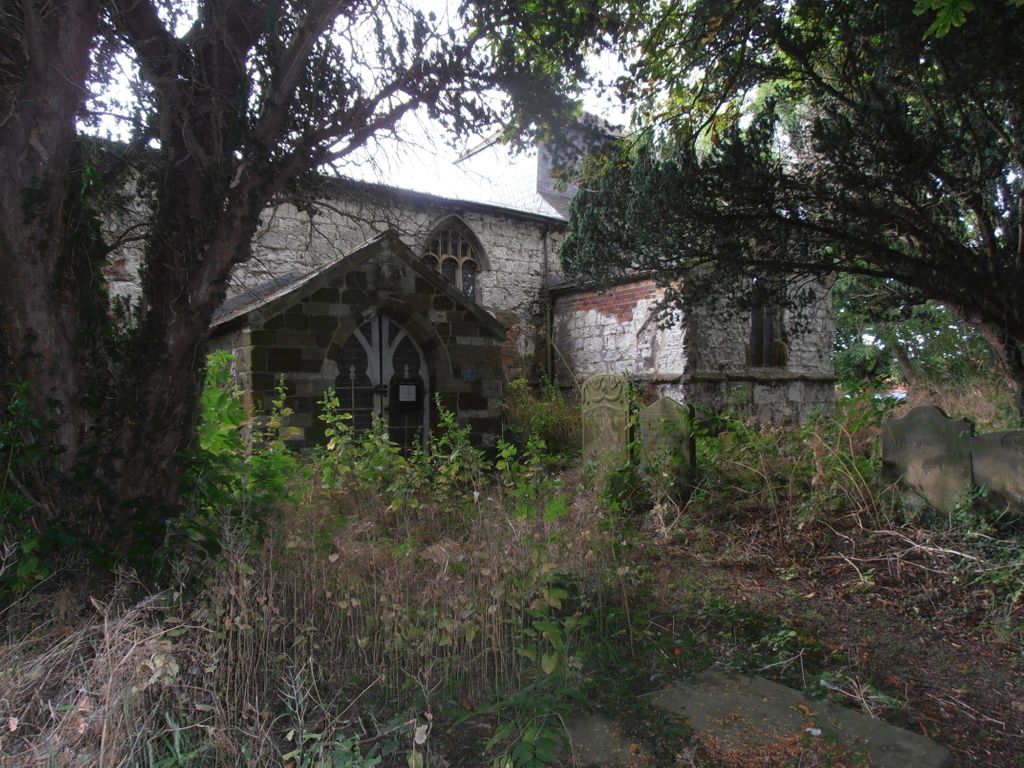
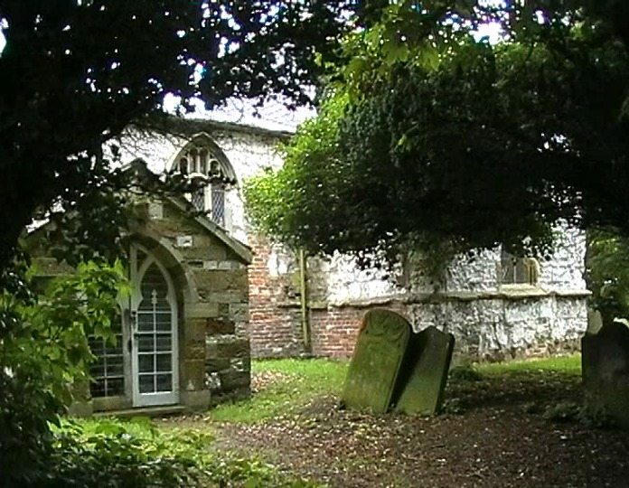
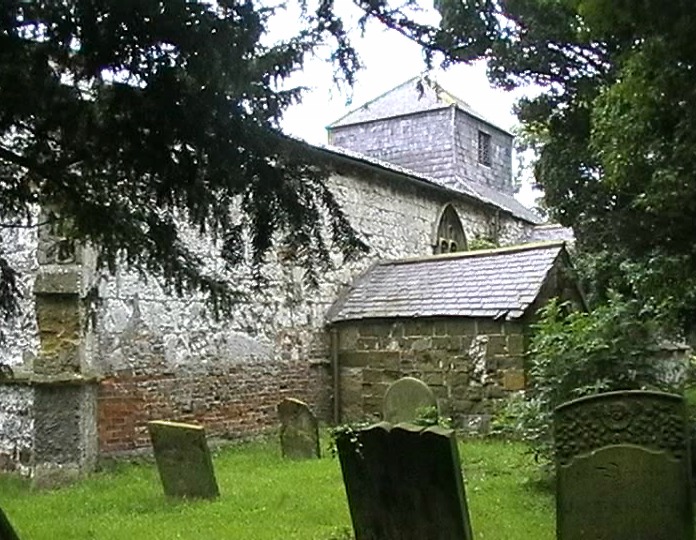
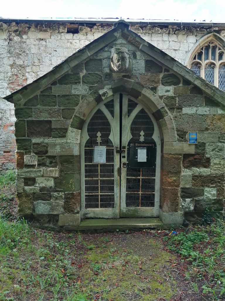
| Location | : | Covenham St Bartholomew, East Lindsey District, England |
| Coordinate | : | 53.4307280, 0.0140490 |
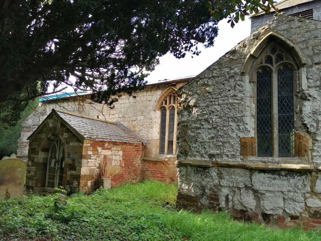
| Description | : | The Church has been closed for religious ceremony since the 1980s and the building is currently (2015) subject to Grade II listed status. |
frequently asked questions (FAQ):
-
Where is St Bartholomew Churchyard?
St Bartholomew Churchyard is located at Birketts Lane Covenham St Bartholomew, East Lindsey District ,Lincolnshire , LN11 0FFEngland.
-
St Bartholomew Churchyard cemetery's updated grave count on graveviews.com?
8 memorials
-
Where are the coordinates of the St Bartholomew Churchyard?
Latitude: 53.4307280
Longitude: 0.0140490


Nearby Cemetories:
1. St. Mary’s Churchyard
Covenham St Mary, East Lindsey District, England
Coordinate: 53.4292484, 0.0147001
2. St Edith's Churchyard
Little Grimsby, East Lindsey District, England
Coordinate: 53.4020500, -0.0062550
3. St. Lawrence's Churchyard
Fulstow, East Lindsey District, England
Coordinate: 53.4599000, -0.0070000
4. St. Mary Churchyard
Fotherby, East Lindsey District, England
Coordinate: 53.4057520, -0.0204600
5. St Adelwold Churchyard
Alvingham, East Lindsey District, England
Coordinate: 53.4009600, 0.0560600
6. St Marys Churchyard
Ludborough, East Lindsey District, England
Coordinate: 53.4405106, -0.0510651
7. St. Clement's Churchyard
Grainthorpe, East Lindsey District, England
Coordinate: 53.4477210, 0.0881160
8. St. Margaret Churchyard
Keddington, East Lindsey District, England
Coordinate: 53.3777150, 0.0203370
9. St. Peter's Churchyard
Conisholme, East Lindsey District, England
Coordinate: 53.4365000, 0.1100100
10. Holy Trinity Church Cemetery
Louth, East Lindsey District, England
Coordinate: 53.3691600, 0.0071900
11. Priory Cottage, Eastgate
Louth, East Lindsey District, England
Coordinate: 53.3679743, 0.0029732
12. Saint Mary's Old Cemetery
Louth, East Lindsey District, England
Coordinate: 53.3679040, -0.0100780
13. Louth Abbey
Louth, East Lindsey District, England
Coordinate: 53.3666840, -0.0080750
14. St. James Churchyard
Louth, East Lindsey District, England
Coordinate: 53.3666730, -0.0080358
15. St Nicholas Church
Grainsby, East Lindsey District, England
Coordinate: 53.4765150, -0.0755630
16. Louth Cemetery
Louth, East Lindsey District, England
Coordinate: 53.3604820, -0.0038070
17. St Edith Churchyard
Grimoldby, East Lindsey District, England
Coordinate: 53.3700890, 0.0919330
18. St Peters Churchyard
Holton le Clay, East Lindsey District, England
Coordinate: 53.5060368, -0.0616628
19. Holton le Clay Cemetery
Holton le Clay, East Lindsey District, England
Coordinate: 53.5074170, -0.0592630
20. St Faith Church
Kelstern, East Lindsey District, England
Coordinate: 53.3911200, -0.1196310
21. St Peter's Churchyard
Ashby cum Fenby, North East Lincolnshire Unitary Authority, England
Coordinate: 53.4903100, -0.1105200
22. St. Helen's Churchyard
Little Cawthorpe, East Lindsey District, England
Coordinate: 53.3332700, 0.0363400
23. St Helen's Churchyard
Little Cawthorpe, East Lindsey District, England
Coordinate: 53.3332300, 0.0363000
24. St Peters Churchyard
Humberston, North East Lincolnshire Unitary Authority, England
Coordinate: 53.5278300, -0.0238300