| Memorials | : | 0 |
| Location | : | Henderson County, USA |
| Coordinate | : | 35.6970330, -88.4366830 |
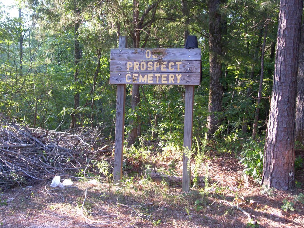
| Description | : | Prospect is an abandoned cemetery in the woods east of Black Bottom Creek. To reach it drive North on 104 and turn right on Black Bottom Road. Drive across Beech Lake, and up the hill. Look for a pulloff which may be hard to spot because in 2004 tree debris was piled there. Park and follow the path, once an old road, through the woods to the cemetery. |
frequently asked questions (FAQ):
-
Where is Prospect Cemetery?
Prospect Cemetery is located at off of Black Bottom Road Henderson County ,Tennessee ,USA.
-
Prospect Cemetery cemetery's updated grave count on graveviews.com?
0 memorials
-
Where are the coordinates of the Prospect Cemetery?
Latitude: 35.6970330
Longitude: -88.4366830
Nearby Cemetories:
1. McCage Cemetery
Lexington, Henderson County, USA
Coordinate: 35.6951000, -88.4520000
2. Ridge Grove Church Cemetery
Lexington, Henderson County, USA
Coordinate: 35.7041250, -88.4551490
3. New Antioch Primitive Baptist Church Cemetery
Lexington, Henderson County, USA
Coordinate: 35.6786003, -88.4308014
4. Center Ridge Cemetery
Lexington, Henderson County, USA
Coordinate: 35.7166450, -88.4591400
5. Mount Carmel Cemetery
Lexington, Henderson County, USA
Coordinate: 35.7231750, -88.4558820
6. Henderson County Memory Gardens
Lexington, Henderson County, USA
Coordinate: 35.6616500, -88.4285200
7. Old Beech River Cemetery
Timberlake, Henderson County, USA
Coordinate: 35.6920470, -88.3913740
8. Beech River Cemetery
Lexington, Henderson County, USA
Coordinate: 35.6906030, -88.3905160
9. Sand Ridge Church Cemetery
Lexington, Henderson County, USA
Coordinate: 35.6800760, -88.4800950
10. Fairview Cemetery
Lexington, Henderson County, USA
Coordinate: 35.6972800, -88.3881010
11. Caffey Cemetery
Bargerton, Henderson County, USA
Coordinate: 35.7036018, -88.4860992
12. Kizer Cemetery
Lexington, Henderson County, USA
Coordinate: 35.7195610, -88.3915660
13. Timberlake Grove Cemetery
Lexington, Henderson County, USA
Coordinate: 35.7214970, -88.3904810
14. Rhodes Cemetery
Henderson County, USA
Coordinate: 35.7331009, -88.4032974
15. Pine Grove Church Cemetery
Wildersville, Henderson County, USA
Coordinate: 35.7262300, -88.3930680
16. Boswell Cemetery
Henderson County, USA
Coordinate: 35.7402992, -88.4178009
17. White Family Cemetery
Bargerton, Henderson County, USA
Coordinate: 35.7448600, -88.4570100
18. Cooper's Grove Church Cemetery
Lexington, Henderson County, USA
Coordinate: 35.6459320, -88.4398000
19. Hall Cemetery
Lexington, Henderson County, USA
Coordinate: 35.7330850, -88.4841940
20. Halbrook Cemetery
Lexington, Henderson County, USA
Coordinate: 35.6928090, -88.3692740
21. Bargerton Church of Christ Cemetery
Henderson County, USA
Coordinate: 35.7314000, -88.4917570
22. Lewis Cemetery
Wildersville, Henderson County, USA
Coordinate: 35.7527250, -88.4059170
23. Natchez Trace Baptist Cemetery
Lexington, Henderson County, USA
Coordinate: 35.7011780, -88.3612380
24. Lexington Cemetery
Lexington, Henderson County, USA
Coordinate: 35.6511290, -88.3860080


