
| Memorials | : | 1 |
| Location | : | Center Township, O'Brien County, USA |
| Coordinate | : | 43.1282500, -95.5257500 |
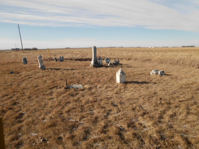
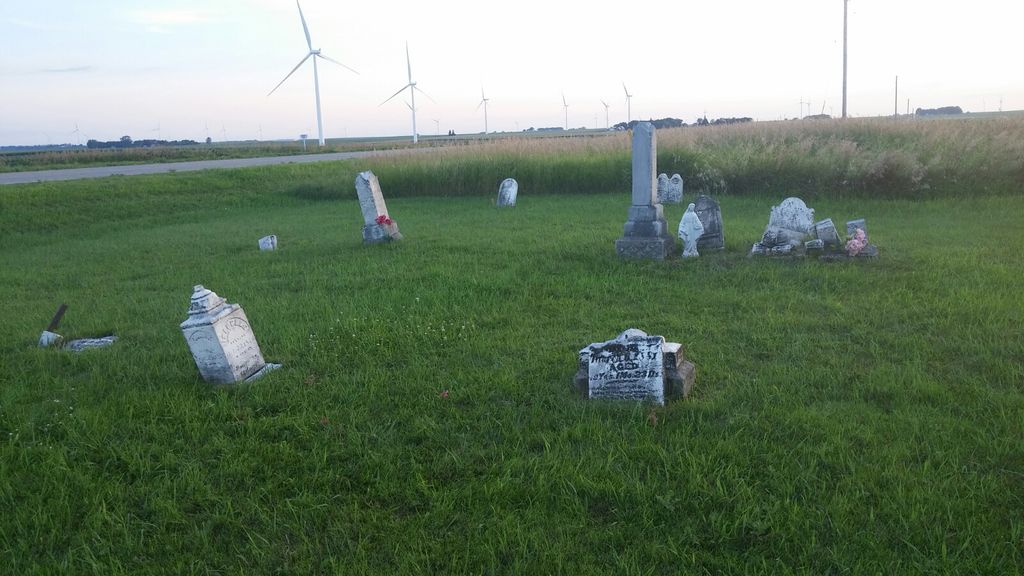
| Description | : | Randolph Cemetery is located in the ditch on the northwest corner of the intersection of Tyler Avenue and 360th Street (B24) in O'Brien County, Iowa. There is no sign that marks the cemetery. Its boundaries include Tyler Ave (gravel road) on the east, B24 (blacktop surfaced road) on the south, and crop fields on the north and west edges. The cemetery is maintained as requested by family of benefactor William Fitz Randolph. The 1930's WPA Graves Project identified fifteen graves at this location. A sixteenth remains unidentified, marked by an illegible stone similar to others in... Read More |
frequently asked questions (FAQ):
-
Where is Randolph Cemetery?
Randolph Cemetery is located at 3599 Tyler Avenue Center Township, O'Brien County ,Iowa ,USA.
-
Randolph Cemetery cemetery's updated grave count on graveviews.com?
1 memorials
-
Where are the coordinates of the Randolph Cemetery?
Latitude: 43.1282500
Longitude: -95.5257500
Nearby Cemetories:
1. Center Township Cemetery
O'Brien County, USA
Coordinate: 43.1150000, -95.5355000
2. Steuck Cemetery
Center Township, O'Brien County, USA
Coordinate: 43.1208500, -95.5440000
3. Pleasant View Cemetery
Hartley, O'Brien County, USA
Coordinate: 43.1719017, -95.4756012
4. Covey Church Cemetery
Hartley, O'Brien County, USA
Coordinate: 43.0682000, -95.4875000
5. Doyle Cemetery
Highland Township, O'Brien County, USA
Coordinate: 43.0619011, -95.5243988
6. Saint Anthonys Catholic Calvary Cemetery
Primghar, O'Brien County, USA
Coordinate: 43.0981930, -95.6373780
7. Pleasant Hill Cemetery
Primghar, O'Brien County, USA
Coordinate: 43.0980988, -95.6374969
8. Saint Cecilia Cemetery
Sanborn, O'Brien County, USA
Coordinate: 43.1711006, -95.6524963
9. TriMello Cemetery
Royal, Clay County, USA
Coordinate: 43.0682983, -95.3728027
10. Roseland Cemetery
Sanborn, O'Brien County, USA
Coordinate: 43.1852989, -95.6813965
11. Lone Tree Cemetery
Everly, Clay County, USA
Coordinate: 43.1411018, -95.3347015
12. Friends Cemetery
Mapleside, O'Brien County, USA
Coordinate: 43.0022000, -95.6225000
13. Calvary Cemetery
Sutherland, O'Brien County, USA
Coordinate: 42.9686012, -95.4858017
14. Waterman Cemetery
Sutherland, O'Brien County, USA
Coordinate: 42.9664001, -95.4847031
15. Clay Center Cemetery
Royal, Clay County, USA
Coordinate: 43.0410995, -95.3272018
16. Baker Township Cemetery
Melvin, Osceola County, USA
Coordinate: 43.3142200, -95.5635700
17. Harrison Cemetery
May City, Osceola County, USA
Coordinate: 43.3130989, -95.4477997
18. Willow Creek Cemetery
Royal, Clay County, USA
Coordinate: 43.0214005, -95.2885971
19. Prairie View Cemetery
Paullina, O'Brien County, USA
Coordinate: 42.9688988, -95.7022018
20. First Reformed Cemetery
Clay County, USA
Coordinate: 43.2399500, -95.2889000
21. West Prairie View Cemetery
Paullina, O'Brien County, USA
Coordinate: 42.9688988, -95.7039032
22. Mennonite Cemetery
Osceola County, USA
Coordinate: 43.3278008, -95.4531021
23. Hannibal H Waterman Cemetery
O'Brien County, USA
Coordinate: 42.9375530, -95.4170760
24. Liberty Cemetery
Calumet, O'Brien County, USA
Coordinate: 42.9241982, -95.5932999