
| Memorials | : | 172 |
| Location | : | Rangoon, East Yangon District, Myanmar |
| Coordinate | : | 16.8113000, 96.1331300 |
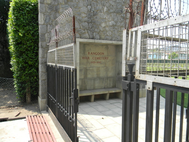
| Description | : | Rangoon War Cemetery was first used as a burial ground immediately following the recapture of Rangoon in May 1945. Later, the Army Graves Service moved in graves from several burial sites in and around Rangoon, including those of the men who died in Rangoon Jail as prisoners of war. The cemetery is situated between Myienegone and Manthawaddy roundabout (close to the circle) and at the back of Burma Translation Society (Sarbaybeikmann). The entrance to the cemetery is in a lane facing east along PYI road (formerly Prome Road) some 8 kilometres from the port, 12 kilometres from the airport and 5... Read More |
frequently asked questions (FAQ):
-
Where is Rangoon War Cemetery?
Rangoon War Cemetery is located at Rangoon, East Yangon District ,Yangon Region ,Myanmar.
-
Rangoon War Cemetery cemetery's updated grave count on graveviews.com?
172 memorials
-
Where are the coordinates of the Rangoon War Cemetery?
Latitude: 16.8113000
Longitude: 96.1331300

Nearby Cemetories:
1. Rangoon University Student Union
Rangoon, East Yangon District, Myanmar
Coordinate: 16.8300530, 96.1347060
2. Kandawmin Garden Mausolea
West Yangon District, Myanmar
Coordinate: 16.7927000, 96.1511000
3. Holy Trinity Anglican Cathedral, Yangon
West Yangon District, Myanmar
Coordinate: 16.7799538, 96.1539837
4. Yangon Jewish Cemetery
Rangoon, East Yangon District, Myanmar
Coordinate: 16.7850500, 96.1654000
5. Protestant Burial Ground
Rangoon, East Yangon District, Myanmar
Coordinate: 16.7800100, 96.1679910
6. Taukkyan War Cemetery
Htauk Kyant, Kale District, Myanmar
Coordinate: 17.0356846, 96.1317749
7. Rangoon Memorial
Rangoon, East Yangon District, Myanmar
Coordinate: 17.0357094, 96.1321487
8. Taukkyan Memorial
Htauk Kyant, Kale District, Myanmar
Coordinate: 17.0358300, 96.1314100
9. St. Patrick's Catholic Church
Mawlamyine, Mawlamyine District, Myanmar
Coordinate: 16.4849900, 97.6242000
10. Thanbyuzayat War Cemetery
Thanbyuzayat, Mawlamyine District, Myanmar
Coordinate: 15.9734100, 97.7188400
11. Taungoo Cemetery
Toungoo, Toungoo District, Myanmar
Coordinate: 18.9402780, 96.4113890
12. Kwaygyi Cemetery
Ottara District, Myanmar
Coordinate: 19.9073026, 96.1682684
13. Wat Umong
Thailand
Coordinate: 18.7990680, 98.9516830
14. Panteon de San Agustin
San Agustin, Jamay Municipality, Mexico
Coordinate: 18.4642431, 100.9854444
15. All Saints Church Maymyo
Pyin Oo Lwin, Pyin Oo Lwin District, Myanmar
Coordinate: 22.0226894, 96.4623257
16. Maymyo Cemetery
Pyin Oo Lwin, Pyin Oo Lwin District, Myanmar
Coordinate: 22.0416000, 96.4712000
17. Mong Ping Parish Square
Taunggyi, Taunggyi District, Myanmar
Coordinate: 21.3477710, 99.0332790
18. Ross Island Cemetery
India
Coordinate: 11.6754300, 92.7618500
19. Port Blair Christian Cemetery
India
Coordinate: 11.6682997, 92.7449417
20. Chittagong War Cemetery
Chittagong, Chattogram District, Bangladesh
Coordinate: 22.3572300, 91.8282200