
| Memorials | : | 369 |
| Location | : | Thanbyuzayat, Mawlamyine District, Myanmar |
| Coordinate | : | 15.9734100, 97.7188400 |
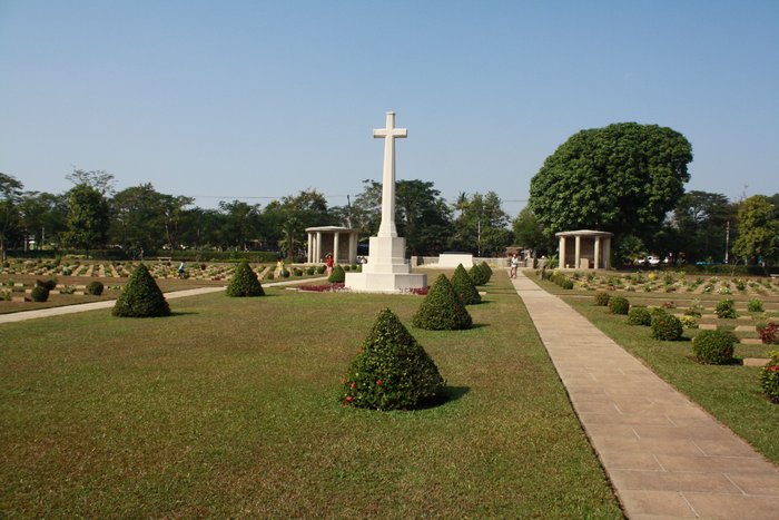
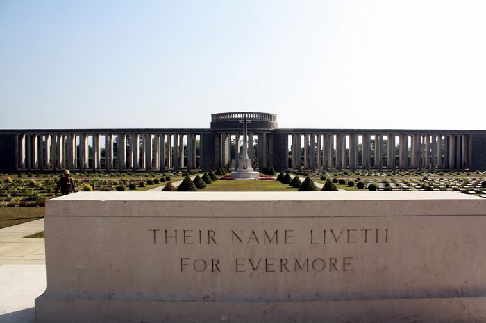
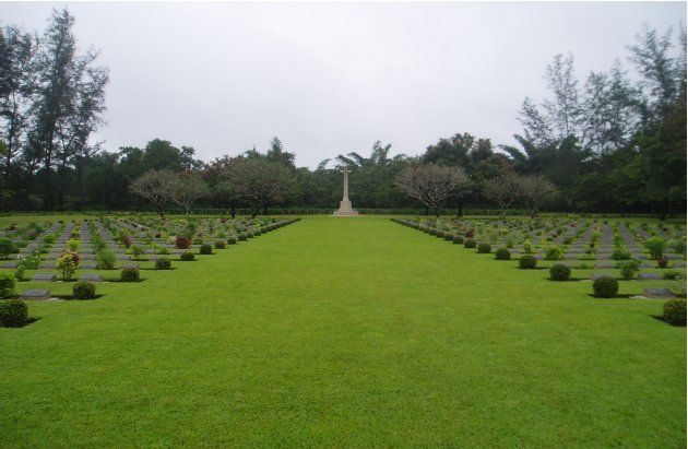
| Description | : | The village of Thanbyuzayat is 65 kilometres south of the port of Moulmein, and the war cemetery lies at the foot of the hills which separate the Union of Myanmar from Thailand. The notorious Burma-Siam railway, built by Commonwealth, Dutch and American prisoners of war, was a Japanese project driven by the need for improved communications to support the large Japanese army in Burma. During its construction, approximately 13,000 prisoners of war died and were buried along the railway. An estimated 80,000 to 100,000 civilians also died in the course of the project, chiefly forced labour brought from Malaya and the... Read More |
frequently asked questions (FAQ):
-
Where is Thanbyuzayat War Cemetery?
Thanbyuzayat War Cemetery is located at Thanbyuzayat, Mawlamyine District ,Mon State ,Myanmar.
-
Thanbyuzayat War Cemetery cemetery's updated grave count on graveviews.com?
360 memorials
-
Where are the coordinates of the Thanbyuzayat War Cemetery?
Latitude: 15.9734100
Longitude: 97.7188400

Nearby Cemetories:
1. St. Patrick's Catholic Church
Mawlamyine, Mawlamyine District, Myanmar
Coordinate: 16.4849900, 97.6242000
2. Protestant Burial Ground
Rangoon, East Yangon District, Myanmar
Coordinate: 16.7800100, 96.1679910
3. Yangon Jewish Cemetery
Rangoon, East Yangon District, Myanmar
Coordinate: 16.7850500, 96.1654000
4. Holy Trinity Anglican Cathedral, Yangon
West Yangon District, Myanmar
Coordinate: 16.7799538, 96.1539837
5. Kandawmin Garden Mausolea
West Yangon District, Myanmar
Coordinate: 16.7927000, 96.1511000
6. Rangoon War Cemetery
Rangoon, East Yangon District, Myanmar
Coordinate: 16.8113000, 96.1331300
7. Rangoon University Student Union
Rangoon, East Yangon District, Myanmar
Coordinate: 16.8300530, 96.1347060
8. Rangoon Memorial
Rangoon, East Yangon District, Myanmar
Coordinate: 17.0357094, 96.1321487
9. Taukkyan War Cemetery
Htauk Kyant, Kale District, Myanmar
Coordinate: 17.0356846, 96.1317749
10. Taukkyan Memorial
Htauk Kyant, Kale District, Myanmar
Coordinate: 17.0358300, 96.1314100
11. Wat Umong
Thailand
Coordinate: 18.7990680, 98.9516830
12. Taungoo Cemetery
Toungoo, Toungoo District, Myanmar
Coordinate: 18.9402780, 96.4113890
13. Panteon de San Agustin
San Agustin, Jamay Municipality, Mexico
Coordinate: 18.4642431, 100.9854444
14. Kwaygyi Cemetery
Ottara District, Myanmar
Coordinate: 19.9073026, 96.1682684
15. Mong Ping Parish Square
Taunggyi, Taunggyi District, Myanmar
Coordinate: 21.3477710, 99.0332790
16. All Saints Church Maymyo
Pyin Oo Lwin, Pyin Oo Lwin District, Myanmar
Coordinate: 22.0226894, 96.4623257
17. Maymyo Cemetery
Pyin Oo Lwin, Pyin Oo Lwin District, Myanmar
Coordinate: 22.0416000, 96.4712000
18. Ross Island Cemetery
India
Coordinate: 11.6754300, 92.7618500
19. Port Blair Christian Cemetery
India
Coordinate: 11.6682997, 92.7449417
20. Wat Khunaram
Thailand
Coordinate: 9.4500000, 100.0005000
21. Panteon Municipal
Tapalpa Municipality, Mexico
Coordinate: 19.9422642, 103.7611260
22. Panteon Municipal Union del Cuatro
Tlajomulco de Zuñiga Municipality, Mexico
Coordinate: 20.5212889, 103.3909979
23. Panteon Municipal
Tlajomulco de Zuñiga Municipality, Mexico
Coordinate: 20.4757480, 103.4433670
24. Panteon San Clemente
Tlajomulco de Zuñiga Municipality, Mexico
Coordinate: 20.5278549, 103.4253333