
| Memorials | : | 0 |
| Location | : | Thailand |
| Coordinate | : | 18.7990680, 98.9516830 |
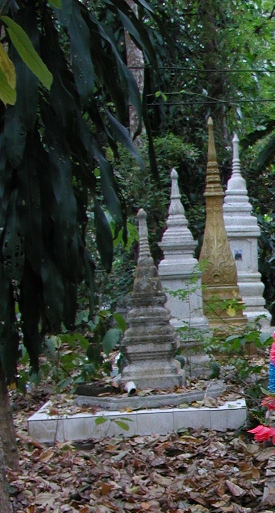
| Description | : | "Wat Umong (complete name: Wat Umong Suan Puthatham) is a 700 year old Buddhist temple in Chiang Mai, Thailand. It is located against the mountains of Doi Suthep and is south of Chiang Mai University. Wat Umong is unique in that the resident monks live in a very natural setting, and occasionally feed the deer that live in the area. The entire Wat Umong complex consists of 37.5 rai (15 acres) of wooded grounds. You can feed the fish, turtles, and ducks in a large pond. "Talking trees" have words of wisdom in Thai and English. The wat is famous for its... Read More |
frequently asked questions (FAQ):
-
Where is Wat Umong?
Wat Umong is located at Suthep, Mueang Chiang Mai, Chiang Mai 50200, Thailand Chiang Mai , 50200Thailand.
-
Wat Umong cemetery's updated grave count on graveviews.com?
0 memorials
-
Where are the coordinates of the Wat Umong?
Latitude: 18.7990680
Longitude: 98.9516830
Nearby Cemetories:
1. Panteon de San Agustin
San Agustin, Jamay Municipality, Mexico
Coordinate: 18.4642431, 100.9854444
2. Taungoo Cemetery
Toungoo, Toungoo District, Myanmar
Coordinate: 18.9402780, 96.4113890
3. Mong Ping Parish Square
Taunggyi, Taunggyi District, Myanmar
Coordinate: 21.3477710, 99.0332790
4. St. Patrick's Catholic Church
Mawlamyine, Mawlamyine District, Myanmar
Coordinate: 16.4849900, 97.6242000
5. Kwaygyi Cemetery
Ottara District, Myanmar
Coordinate: 19.9073026, 96.1682684
6. Thanbyuzayat War Cemetery
Thanbyuzayat, Mawlamyine District, Myanmar
Coordinate: 15.9734100, 97.7188400
7. Rangoon Memorial
Rangoon, East Yangon District, Myanmar
Coordinate: 17.0357094, 96.1321487
8. Taukkyan War Cemetery
Htauk Kyant, Kale District, Myanmar
Coordinate: 17.0356846, 96.1317749
9. Taukkyan Memorial
Htauk Kyant, Kale District, Myanmar
Coordinate: 17.0358300, 96.1314100
10. Rangoon University Student Union
Rangoon, East Yangon District, Myanmar
Coordinate: 16.8300530, 96.1347060
11. Yangon Jewish Cemetery
Rangoon, East Yangon District, Myanmar
Coordinate: 16.7850500, 96.1654000
12. Protestant Burial Ground
Rangoon, East Yangon District, Myanmar
Coordinate: 16.7800100, 96.1679910
13. Kandawmin Garden Mausolea
West Yangon District, Myanmar
Coordinate: 16.7927000, 96.1511000
14. Rangoon War Cemetery
Rangoon, East Yangon District, Myanmar
Coordinate: 16.8113000, 96.1331300
15. Holy Trinity Anglican Cathedral, Yangon
West Yangon District, Myanmar
Coordinate: 16.7799538, 96.1539837
16. All Saints Church Maymyo
Pyin Oo Lwin, Pyin Oo Lwin District, Myanmar
Coordinate: 22.0226894, 96.4623257
17. Maymyo Cemetery
Pyin Oo Lwin, Pyin Oo Lwin District, Myanmar
Coordinate: 22.0416000, 96.4712000
18. Panteon Municipal Union del Cuatro
Tlajomulco de Zuñiga Municipality, Mexico
Coordinate: 20.5212889, 103.3909979
19. Panteon Municipal
Tlajomulco de Zuñiga Municipality, Mexico
Coordinate: 20.4757480, 103.4433670
20. Panteon San Clemente
Tlajomulco de Zuñiga Municipality, Mexico
Coordinate: 20.5278549, 103.4253333
21. Panteon Municipal
Tapalpa Municipality, Mexico
Coordinate: 19.9422642, 103.7611260
22. Nghĩa trang Nhân dân xã Cổ Đô
Vietnam
Coordinate: 21.2788890, 105.3786110