
| Memorials | : | 0 |
| Location | : | Bunker Hill, Holmes County, USA |
| Coordinate | : | 40.5865720, -81.7723890 |
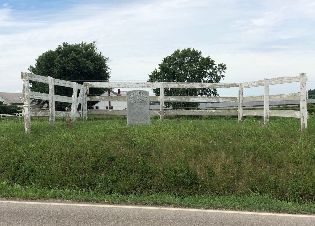
| Description | : | This Amish cemetery is located on the north side of County Highway 207 about 0.3 miles west of its intersection with US 62. The cemetery is located in Berlin Township, Holmes County, Ohio, and is # 5505 (Raymond J. Kline Farm Cemetery #2) in “Ohio Cemeteries 1803-2003”, compiled by the Ohio Genealogical Society. The cemetery is identified as K-18 (Raymond J. Kline Farm) in “Cemetery Directory of the Amish Community in Eastern Holmes and Adjoining Counties in Ohio" by Leroy Beachy, (c) 1975. |
frequently asked questions (FAQ):
-
Where is Raymond J Kline Farm Cemetery #2?
Raymond J Kline Farm Cemetery #2 is located at County Highway 207 Bunker Hill, Holmes County ,Ohio , 44654USA.
-
Raymond J Kline Farm Cemetery #2 cemetery's updated grave count on graveviews.com?
0 memorials
-
Where are the coordinates of the Raymond J Kline Farm Cemetery #2?
Latitude: 40.5865720
Longitude: -81.7723890
Nearby Cemetories:
1. Jacob E Miller Farm Cemetery
Bunker Hill, Holmes County, USA
Coordinate: 40.5901500, -81.7745800
2. Raymond J Kline Farm Cemetery #1
Bunker Hill, Holmes County, USA
Coordinate: 40.5901930, -81.7745870
3. Weaver Family Cemetery
Bunker Hill, Holmes County, USA
Coordinate: 40.5823560, -81.7665830
4. Daniel J Miller Farm Cemetery
Bunker Hill, Holmes County, USA
Coordinate: 40.5905300, -81.7833390
5. Daniel Schlabach Farm Cemetery
Bunker Hill, Holmes County, USA
Coordinate: 40.5751350, -81.7735930
6. Emanuel Miller Farm Cemetery
Millersburg, Holmes County, USA
Coordinate: 40.5942890, -81.7577250
7. Melvin J Hershberger Farm Cemetery
Berlin, Holmes County, USA
Coordinate: 40.5760680, -81.7853330
8. Henry Hersberger Farm Cemetery
Mount Hope, Holmes County, USA
Coordinate: 40.5990270, -81.7869540
9. Paul Burkholder Farm Cemetery
Bunker Hill, Holmes County, USA
Coordinate: 40.5777140, -81.7926060
10. Bunker Hill Cemetery
Berlin, Holmes County, USA
Coordinate: 40.5694060, -81.7793470
11. Melvin Miller Farm Cemetery
Bunker Hill, Holmes County, USA
Coordinate: 40.5800420, -81.7944770
12. Grace Mennonite Church Cemetery
Berlin, Holmes County, USA
Coordinate: 40.5694020, -81.7797610
13. Daniel J Miller Farm Cemetery
Mount Hope, Holmes County, USA
Coordinate: 40.6042620, -81.7658340
14. Daniel J Miller Farm Cemetery #2
Millers Corners, Holmes County, USA
Coordinate: 40.5864760, -81.7976070
15. Monroe A. Miller Farm Cemetery
Bunker Hill, Holmes County, USA
Coordinate: 40.5889960, -81.7470390
16. Emanuel Mullet Farm Cemetery
Trail, Holmes County, USA
Coordinate: 40.5850750, -81.7449220
17. Henry O Yoder Farm Cemetery
Berlin, Holmes County, USA
Coordinate: 40.5654820, -81.7625680
18. David A Miller Farm Cemetery
Bunker Hill, Holmes County, USA
Coordinate: 40.5727370, -81.7481930
19. Jacob Mast Farm Cemetery
Mount Hope, Holmes County, USA
Coordinate: 40.6097900, -81.7786620
20. Drushel Cemetery
Millersburg, Holmes County, USA
Coordinate: 40.6003430, -81.8021060
21. Miller Cemetery
Berlin, Holmes County, USA
Coordinate: 40.5705560, -81.8001390
22. Berlin Community Cemetery
Millersburg, Holmes County, USA
Coordinate: 40.5624190, -81.7870120
23. Ezra Y Miller Farm Cemetery
Millersburg, Holmes County, USA
Coordinate: 40.6101940, -81.7885540
24. Andrew Beachy and Joseph Miller Farms Cemetery
Berlin, Holmes County, USA
Coordinate: 40.5598960, -81.7753990