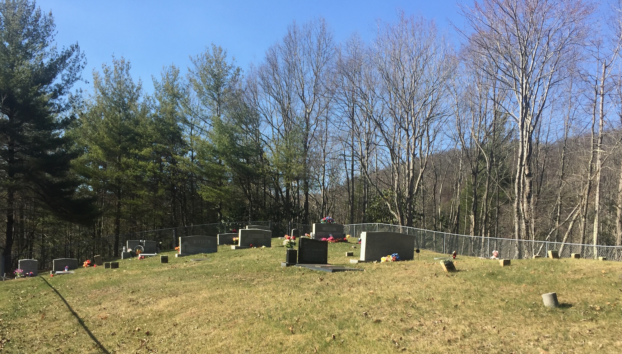
| Memorials | : | 54 |
| Location | : | Grant, Grayson County, USA |
| Coordinate | : | 36.6970499, -81.3873213 |
| Description | : | Location: East of Grant Directions: From the junction of Troutdale Hwy (SR 16) and Flatridge Rd (Rt 658) go east and north about 3/4 mile on Flatridge Rd to Razor Ridge Rd (Rt 677). The entrance to this cemetery is about 2 miles north on Razor Ridge Rd and 0.4 mile east of the Razor Ridge Baptist Church. The cemetery itself is not in view of the road but lies 0.2 mile northwest of the public road at the end of the private road indicated by a sign. Surveyed by: Ginger Ballard, 4 Apr 2003. Comments: This cemetery is fenced and well-maintained. There... Read More |
frequently asked questions (FAQ):
-
Where is Razor Ridge Cemetery?
Razor Ridge Cemetery is located at Grant, Grayson County ,Virginia ,USA.
-
Razor Ridge Cemetery cemetery's updated grave count on graveviews.com?
1 memorials
-
Where are the coordinates of the Razor Ridge Cemetery?
Latitude: 36.6970499
Longitude: -81.3873213
Nearby Cemetories:
1. Parks Cemetery
Grayson County, USA
Coordinate: 36.6927986, -81.3696976
2. Byram Ross Cemetery
Barton Crossroad, Grayson County, USA
Coordinate: 36.6817270, -81.3938530
3. Riley Preston Parks Cemetery
Grant, Grayson County, USA
Coordinate: 36.6960210, -81.3664240
4. Grubb Cemetery
Grayson County, USA
Coordinate: 36.6757770, -81.4072420
5. Troy Ross Cemetery
Flat Ridge, Grayson County, USA
Coordinate: 36.7116750, -81.3580980
6. Burton’s Community Cemetery
Flat Ridge, Grayson County, USA
Coordinate: 36.7228012, -81.3688965
7. Charles Hoffman Cemetery
Flat Ridge, Grayson County, USA
Coordinate: 36.6673760, -81.3832750
8. Rockbridge Baptist Church Cemetery
Grant, Grayson County, USA
Coordinate: 36.6718830, -81.3635510
9. Liberty Hill Baptist Church Cemetery
Grant, Grayson County, USA
Coordinate: 36.6688995, -81.4064026
10. Russell-Testerman Cemetery
Flat Ridge, Grayson County, USA
Coordinate: 36.6950220, -81.3447370
11. Hiram Perkins Cemetery
Flat Ridge, Grayson County, USA
Coordinate: 36.7056482, -81.3446534
12. Wiley Perkins Cemetery
Barton Crossroad, Grayson County, USA
Coordinate: 36.6740960, -81.3523310
13. Perkins Cemetery
Grayson County, USA
Coordinate: 36.6739006, -81.3525009
14. James Cemetery
Grayson County, USA
Coordinate: 36.6822014, -81.3455963
15. Grant Community Cemetery
Grant, Grayson County, USA
Coordinate: 36.6624180, -81.4027100
16. Anderson Family Cemetery
Barton Crossroad, Grayson County, USA
Coordinate: 36.6711710, -81.3452620
17. Anderson Cemetery
Grayson County, USA
Coordinate: 36.6711006, -81.3452988
18. John Ross Cemetery
Grayson County, USA
Coordinate: 36.7235800, -81.3458400
19. Lorenzo Dow Roberts Cemetery
Flat Ridge, Grayson County, USA
Coordinate: 36.6985220, -81.3332590
20. Cole Cemetery
Flat Ridge, Grayson County, USA
Coordinate: 36.6833110, -81.3355710
21. Pugh-Greear Cemetery
Grant, Grayson County, USA
Coordinate: 36.6552800, -81.4055330
22. Ross-Parks Family Cemetery
Grayson County, USA
Coordinate: 36.7249200, -81.3407100
23. James Parks Cemetery
Flat Ridge, Grayson County, USA
Coordinate: 36.7221330, -81.3376830
24. Bartons Crossroads Cemetery
Barton Crossroad, Grayson County, USA
Coordinate: 36.6576080, -81.3528595

