| Memorials | : | 24 |
| Location | : | Grant, Grayson County, USA |
| Coordinate | : | 36.6552800, -81.4055330 |
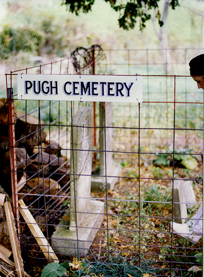
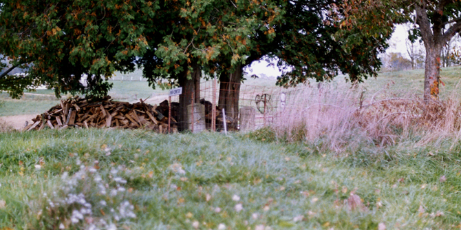
| Description | : | The Pugh-Greear Cemetery is located south of the Grant Community. From the junction of Troutdale Highway (SR 16) and Low Gap Rd (Rt 730) go south approximately 400 feet on Troutdale Highway to the cemetery on the left, east, side of the highway. Just past the cemetery to the south is the home of Joe Pugh, who was living there in 1990, when we first viisted the cemetery and was still there in 2006 on another visit. The cemetery was overgrown for many years, but Joe Pugh cleaned it up and was still doing this in... Read More |
frequently asked questions (FAQ):
-
Where is Pugh-Greear Cemetery?
Pugh-Greear Cemetery is located at Grant, Grayson County ,Virginia ,USA.
-
Pugh-Greear Cemetery cemetery's updated grave count on graveviews.com?
1 memorials
-
Where are the coordinates of the Pugh-Greear Cemetery?
Latitude: 36.6552800
Longitude: -81.4055330
Nearby Cemetories:
1. Grant Community Cemetery
Grant, Grayson County, USA
Coordinate: 36.6624180, -81.4027100
2. Herald Pugh Family Cemetery
Grayson County, USA
Coordinate: 36.6465111, -81.4066467
3. Liberty Hill Baptist Church Cemetery
Grant, Grayson County, USA
Coordinate: 36.6688995, -81.4064026
4. Pugh Cemetery
Grayson County, USA
Coordinate: 36.6445820, -81.4199140
5. Grubb Cemetery
Grayson County, USA
Coordinate: 36.6757770, -81.4072420
6. Charles Hoffman Cemetery
Flat Ridge, Grayson County, USA
Coordinate: 36.6673760, -81.3832750
7. Young Cemetery
Mouth of Wilson, Grayson County, USA
Coordinate: 36.6333997, -81.4127455
8. Fielden Mack Young Cemetery
Mouth of Wilson, Grayson County, USA
Coordinate: 36.6333710, -81.4127510
9. Shelton Family Cemetery
Mouth of Wilson, Grayson County, USA
Coordinate: 36.6489000, -81.4358000
10. Reedy Cemetery
Grayson County, USA
Coordinate: 36.6474991, -81.3752975
11. Byram Ross Cemetery
Barton Crossroad, Grayson County, USA
Coordinate: 36.6817270, -81.3938530
12. Rockbridge Baptist Church Cemetery
Grant, Grayson County, USA
Coordinate: 36.6718830, -81.3635510
13. James C A Perkins Cemetery
Mill Creek, Grayson County, USA
Coordinate: 36.6267730, -81.4382540
14. Thomas Cemetery
Barton Crossroad, Grayson County, USA
Coordinate: 36.6530310, -81.3569760
15. Bartons Crossroads Cemetery
Barton Crossroad, Grayson County, USA
Coordinate: 36.6576080, -81.3528595
16. Osborne-Williams Cemetery
Low Gap, Grayson County, USA
Coordinate: 36.6266230, -81.4456550
17. New Hope Cemetery
Barton Crossroad, Grayson County, USA
Coordinate: 36.6580582, -81.3512268
18. Wright Wingate Family Cemetery #2
Barton Crossroad, Grayson County, USA
Coordinate: 36.6482000, -81.3516000
19. Razor Ridge Cemetery
Grant, Grayson County, USA
Coordinate: 36.6970499, -81.3873213
20. Perkins Cemetery
Grayson County, USA
Coordinate: 36.6739006, -81.3525009
21. Wiley Perkins Cemetery
Barton Crossroad, Grayson County, USA
Coordinate: 36.6740960, -81.3523310
22. Parks Cemetery
Grayson County, USA
Coordinate: 36.6927986, -81.3696976
23. VanHoy Cemetery
Mouth of Wilson, Grayson County, USA
Coordinate: 36.6080075, -81.4178560
24. Anderson Cemetery
Grayson County, USA
Coordinate: 36.6711006, -81.3452988


