
| Memorials | : | 0 |
| Location | : | Reamsville, Smith County, USA |
| Coordinate | : | 39.9299500, -98.8693970 |
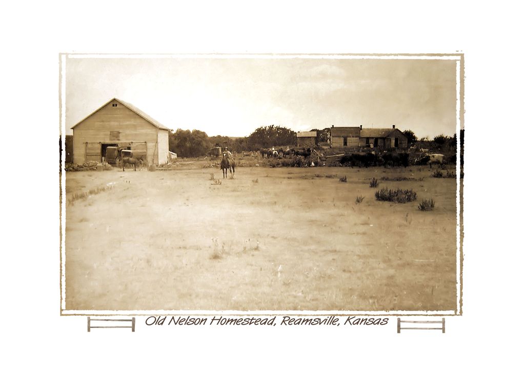
| Description | : | This was the homestead of the Nelson family that settled two miles west of the (now gone) town of Reamsville, Kansas. The (nearby) Methodist Church still is active and the burial grounds were south of the church near the trees. |
frequently asked questions (FAQ):
-
Where is Reamsville Methodist Church Cemetery?
Reamsville Methodist Church Cemetery is located at Reamsville, Smith County ,Kansas ,USA.
-
Reamsville Methodist Church Cemetery cemetery's updated grave count on graveviews.com?
0 memorials
-
Where are the coordinates of the Reamsville Methodist Church Cemetery?
Latitude: 39.9299500
Longitude: -98.8693970
Nearby Cemetories:
1. Reamsville Cemetery
Reamsville, Smith County, USA
Coordinate: 39.9441500, -98.8593500
2. Pleasant Hill Cemetery
Reamsville, Smith County, USA
Coordinate: 39.9510994, -98.9175034
3. William Nelson Gravesite
Athol, Smith County, USA
Coordinate: 39.8866080, -98.8708130
4. Eminence Cemetery
Thornburg, Smith County, USA
Coordinate: 39.9432983, -98.8005981
5. Meade Cemetery
Reamsville, Smith County, USA
Coordinate: 39.8680992, -98.8839035
6. Zion Cemetery
Athol, Smith County, USA
Coordinate: 39.8434100, -98.9171700
7. Spring Vale Cemetery
Washington Township, Smith County, USA
Coordinate: 39.9154700, -98.7424900
8. Womer Cemetery
Womer, Smith County, USA
Coordinate: 39.9736400, -98.7110800
9. Fairview Stone Cemetery
Kensington, Smith County, USA
Coordinate: 39.9304330, -99.0479270
10. Pleasant View Cemetery
Athol, Smith County, USA
Coordinate: 39.7859000, -98.8982000
11. Fairview Cemetery
Smith Center, Smith County, USA
Coordinate: 39.7966995, -98.7881012
12. Fuller Cemetery
Riverton, Franklin County, USA
Coordinate: 40.0764000, -98.7925700
13. Mount Olive Cemetery
Kensington, Smith County, USA
Coordinate: 40.0014000, -99.0658035
14. Germantown Cemetery
Kensington, Smith County, USA
Coordinate: 39.8292300, -99.0450800
15. Cedar Hill Cemetery
Cora, Smith County, USA
Coordinate: 39.8863200, -98.6550000
16. Stevens Cemetery
Riverton, Franklin County, USA
Coordinate: 40.0977000, -98.8201500
17. Greenwood Cemetery
Franklin, Franklin County, USA
Coordinate: 40.1018982, -98.9443970
18. Walnut Creek Cemetery
Inavale, Webster County, USA
Coordinate: 40.0463982, -98.6793976
19. Riverton Cemetery
Riverton, Franklin County, USA
Coordinate: 40.0970993, -98.7530975
20. Haskett Cemetery
Phillips County, USA
Coordinate: 39.9696860, -99.1234470
21. Saint John Lutheran Cemetery
Kensington, Smith County, USA
Coordinate: 39.7744700, -99.0308700
22. Saint John Lutheran Cemetery
Athol, Smith County, USA
Coordinate: 39.7269900, -98.8971600
23. Oak Hill Cemetery
Lebanon, Smith County, USA
Coordinate: 39.8437010, -98.6186200
24. Oriole Cemetery
Lebanon, Smith County, USA
Coordinate: 39.9366400, -98.5938300