
| Memorials | : | 0 |
| Location | : | Riverton, Franklin County, USA |
| Coordinate | : | 40.0977000, -98.8201500 |
frequently asked questions (FAQ):
-
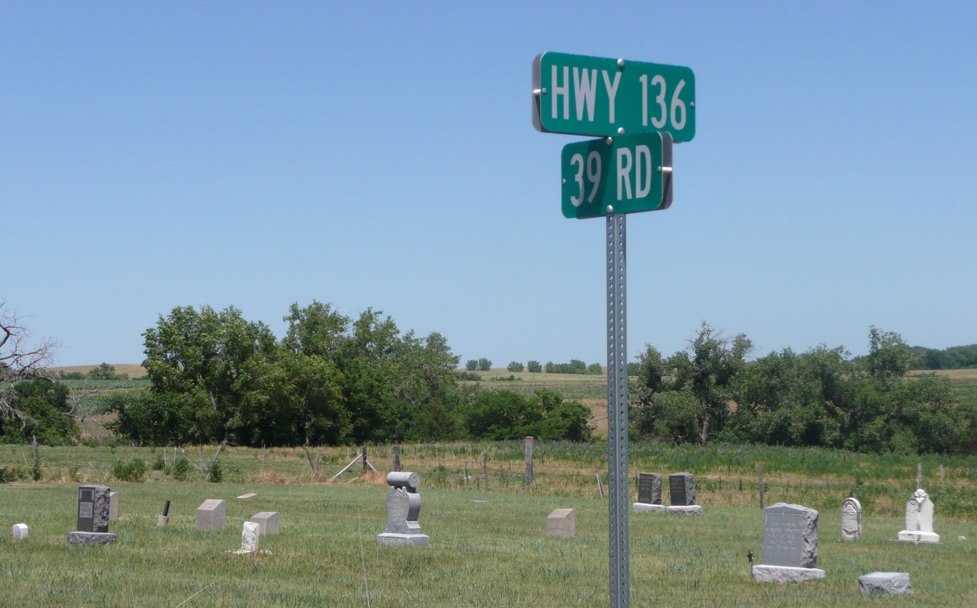
Where is Stevens Cemetery?
Stevens Cemetery is located at Corner of Highway 136 and 39th Road Riverton, Franklin County ,Nebraska ,USA.
-
Stevens Cemetery cemetery's updated grave count on graveviews.com?
0 memorials
-
Where are the coordinates of the Stevens Cemetery?
Latitude: 40.0977000
Longitude: -98.8201500
Nearby Cemetories:
1. Fuller Cemetery
Riverton, Franklin County, USA
Coordinate: 40.0764000, -98.7925700
2. Riverton Cemetery
Riverton, Franklin County, USA
Coordinate: 40.0970993, -98.7530975
3. Greenwood Cemetery
Franklin, Franklin County, USA
Coordinate: 40.1018982, -98.9443970
4. Norwegian Zion Lutheran Cemetery
Inavale, Webster County, USA
Coordinate: 40.1913000, -98.7255000
5. Walnut Creek Cemetery
Inavale, Webster County, USA
Coordinate: 40.0463982, -98.6793976
6. Union Cemetery
Macon, Franklin County, USA
Coordinate: 40.2049000, -98.9439000
7. Pleasant Prairie Cemetery
Inavale, Webster County, USA
Coordinate: 40.1464005, -98.6382980
8. New Virginia Cemetery
Webster County, USA
Coordinate: 40.1906013, -98.6678009
9. Womer Cemetery
Womer, Smith County, USA
Coordinate: 39.9736400, -98.7110800
10. Eminence Cemetery
Thornburg, Smith County, USA
Coordinate: 39.9432983, -98.8005981
11. Reamsville Cemetery
Reamsville, Smith County, USA
Coordinate: 39.9441500, -98.8593500
12. Zion Lutheran Cemetery
Macon, Franklin County, USA
Coordinate: 40.2061500, -98.9718000
13. Pleasant Hill Cemetery
Reamsville, Smith County, USA
Coordinate: 39.9510994, -98.9175034
14. Mount Pleasant Cemetery
Webster County, USA
Coordinate: 40.0491982, -98.6125031
15. Maple Grove Cemetery
Bloomington, Franklin County, USA
Coordinate: 40.1018791, -99.0402832
16. Trinity Lutheran Cemetery
Campbell, Franklin County, USA
Coordinate: 40.2625008, -98.7605972
17. Reamsville Methodist Church Cemetery
Reamsville, Smith County, USA
Coordinate: 39.9299500, -98.8693970
18. Bailey Cemetery
Franklin County, USA
Coordinate: 40.1828003, -99.0342026
19. Miner Ranch Cemetery
Red Cloud, Webster County, USA
Coordinate: 40.0774500, -98.5733500
20. Spring Vale Cemetery
Washington Township, Smith County, USA
Coordinate: 39.9154700, -98.7424900
21. Mount Pleasant Cemetery
Macon, Franklin County, USA
Coordinate: 40.2406616, -98.9908371
22. Dane Lutheran Cemetery
Cowles, Webster County, USA
Coordinate: 40.1903000, -98.5947000
23. Koch-Cook Cemetery
Franklin County, USA
Coordinate: 40.2917700, -98.7474800
24. Catherton Cemetery
Webster County, USA
Coordinate: 40.2421989, -98.6324997