
| Memorials | : | 10 |
| Location | : | Reedtown, Seneca County, USA |
| Coordinate | : | 41.1531800, -82.8792000 |
frequently asked questions (FAQ):
-
Where is Reed Assumption Catholic Church Cemetery?
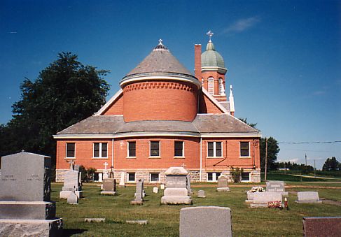
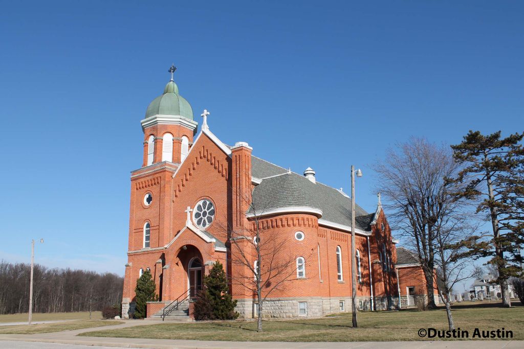
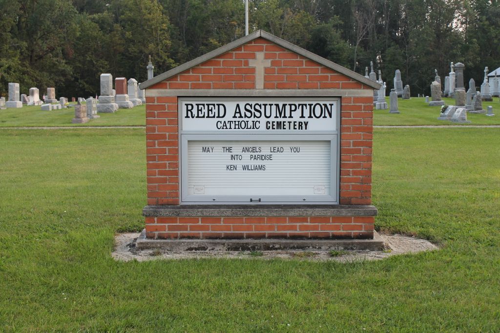
Reed Assumption Catholic Church Cemetery is located at Reedtown, Seneca County ,Ohio ,USA.
-
Reed Assumption Catholic Church Cemetery cemetery's updated grave count on graveviews.com?
10 memorials
-
Where are the coordinates of the Reed Assumption Catholic Church Cemetery?
Latitude: 41.1531800
Longitude: -82.8792000

Nearby Cemetories:
1. Omar Cemetery
Reedtown, Seneca County, USA
Coordinate: 41.1189003, -82.8630981
2. Saint Michaels Cemetery
Frank, Seneca County, USA
Coordinate: 41.1927986, -82.8514023
3. Underhill Cemetery
Seneca County, USA
Coordinate: 41.2098030, -82.8758530
4. Armstrong Cemetery
Seneca County, USA
Coordinate: 41.1246986, -82.9447021
5. Thompson Center Cemetery
Seneca County, USA
Coordinate: 41.2117004, -82.9024963
6. Jones Cemetery
Sherman Township, Huron County, USA
Coordinate: 41.1864400, -82.8063500
7. Saint Sebastian Catholic Cemetery
Bismarck, Huron County, USA
Coordinate: 41.1642600, -82.7915400
8. Bishop Seybert Cemetery
Flat Rock, Seneca County, USA
Coordinate: 41.2257996, -82.8739014
9. Boughton Cemetery
Standardsburg, Huron County, USA
Coordinate: 41.1322900, -82.7851900
10. Banks of Mud Run Cemetery
Norwich Township, Huron County, USA
Coordinate: 41.1328830, -82.7843370
11. Fireside Cemetery
Seneca County, USA
Coordinate: 41.2270000, -82.9072100
12. Block Cemetery
Republic, Seneca County, USA
Coordinate: 41.1753006, -82.9772034
13. Clay-Groscost Cemetery
Seneca County, USA
Coordinate: 41.1455130, -82.9813030
14. Reformed Church Cemetery
West Lodi, Seneca County, USA
Coordinate: 41.1653980, -82.9809600
15. Adams Lutheran Cemetery
Republic, Seneca County, USA
Coordinate: 41.1824646, -82.9758987
16. Wurts Cemetery
Havana, Huron County, USA
Coordinate: 41.1175770, -82.7860160
17. Payne Cemetery
Seneca County, USA
Coordinate: 41.1986690, -82.9750770
18. Attica Venice Township Joint Cemetery
Attica, Seneca County, USA
Coordinate: 41.0674200, -82.8813100
19. Saints Peter and Paul Cemetery
Attica, Seneca County, USA
Coordinate: 41.0670013, -82.8812943
20. Meyer Cemetery
Seneca County, USA
Coordinate: 41.0813980, -82.9428980
21. Saint Pauls German Lutheran Cemetery
Lyme Township, Huron County, USA
Coordinate: 41.2268600, -82.8172600
22. Union Cemetery
Seneca County, USA
Coordinate: 41.2118988, -82.9710999
23. Caroline Reformed Lutheran Cemetery
Caroline, Seneca County, USA
Coordinate: 41.0521240, -82.8903740
24. West Caroline Lutheran Cemetery
Caroline, Seneca County, USA
Coordinate: 41.0524900, -82.8953700