
| Memorials | : | 21 |
| Location | : | Ripon, Harrogate Borough, England |
| Coordinate | : | 54.1418130, -1.5357040 |
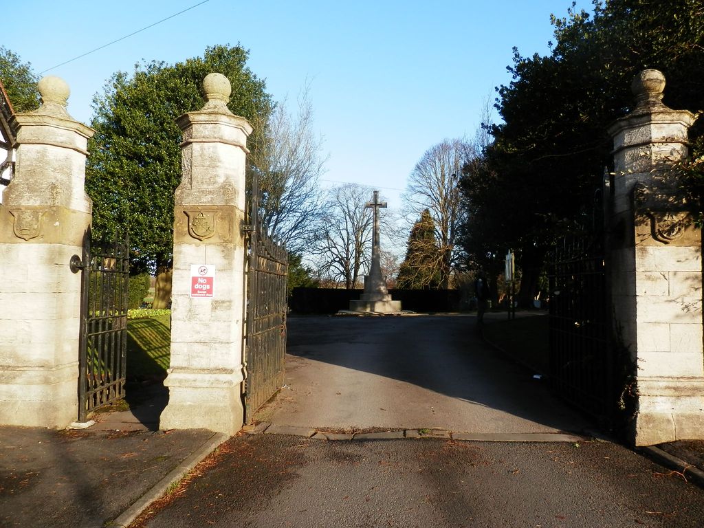
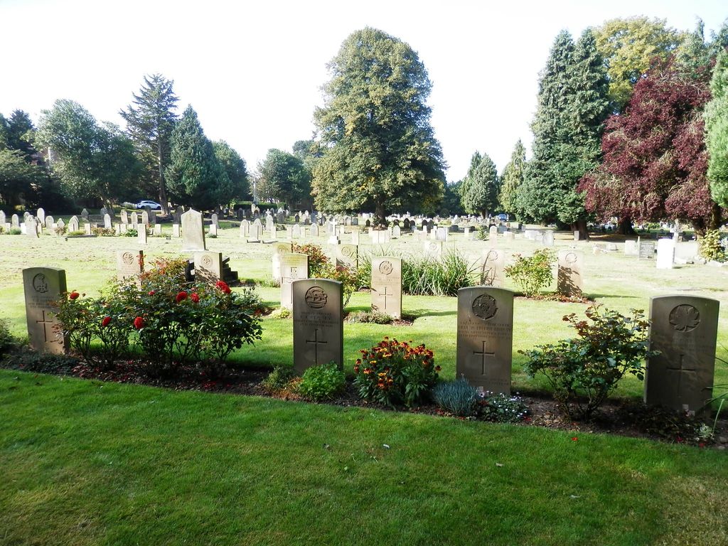
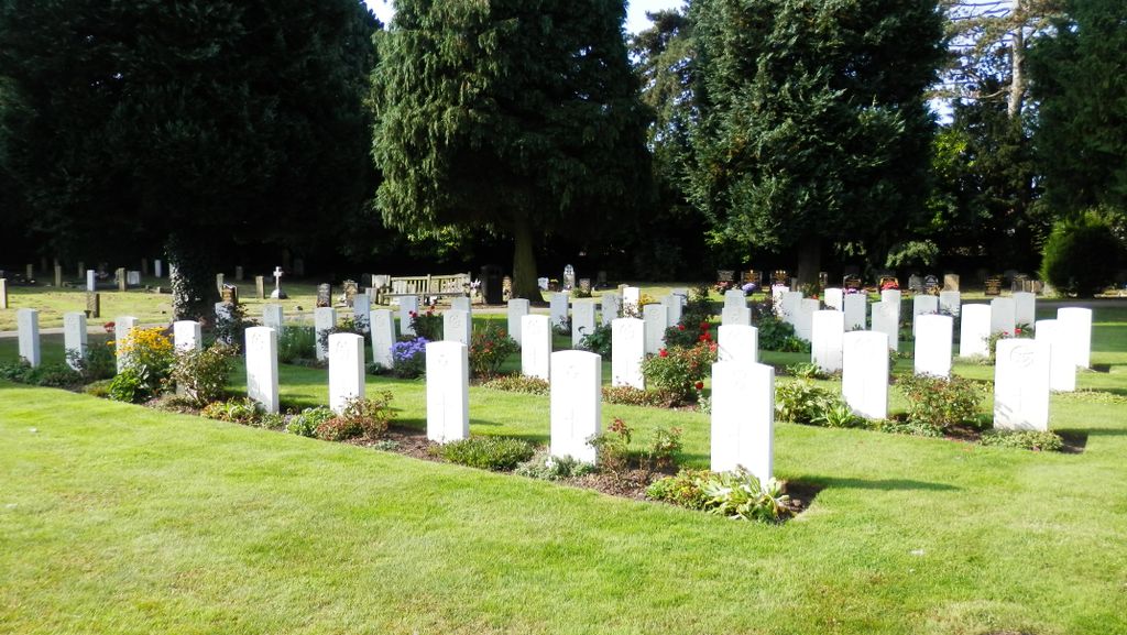
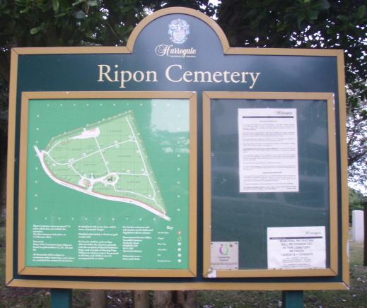
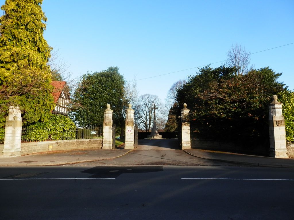
| Description | : | Ripon Cemetery Opened in 1894. Ripon Military Hospital contained 670 beds, and served the military camps at Ripon. Ripon Cemetery contains 122 scattered burials from this period. In 1940 the School of Military Engineering was transferred to Ripon, where it remained for the duration of the war, the Yorkshire dales becoming an important military training centre. However, the majority of the Second World War burials in the cemetery are those of airmen from airfields in the locality, the R.A.F. Station at Dishforth being only a few miles distant. The headquarters of No. 6 (R.C.A.F.) Bomber Group was at Allerton Park near... Read More |
frequently asked questions (FAQ):
-
Where is Ripon Cemetery?
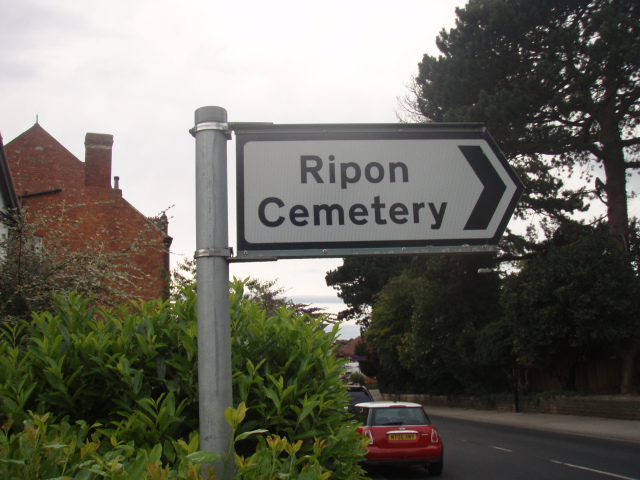
Ripon Cemetery is located at Kirkby Road Ripon, Harrogate Borough ,North Yorkshire ,England.
-
Ripon Cemetery cemetery's updated grave count on graveviews.com?
21 memorials
-
Where are the coordinates of the Ripon Cemetery?
Latitude: 54.1418130
Longitude: -1.5357040
Nearby Cemetories:
1. Lark Hill Cemetery
Ripon, Harrogate Borough, England
Coordinate: 54.1454600, -1.5422800
2. Holy Trinity Churchyard
Ripon, Harrogate Borough, England
Coordinate: 54.1378700, -1.5283900
3. Temple Gardens
Ripon, Harrogate Borough, England
Coordinate: 54.1386070, -1.5229240
4. Ripon Cathedral
Ripon, Harrogate Borough, England
Coordinate: 54.1349487, -1.5255010
5. St John the Evangelist Churchyard
Sharow, Harrogate Borough, England
Coordinate: 54.1436170, -1.5000420
6. St. Mary's Churchyard
Studley Royal, Harrogate Borough, England
Coordinate: 54.1187000, -1.5801000
7. St. Lawrence the Martyr Churchyard
Aldfield, Harrogate Borough, England
Coordinate: 54.1203920, -1.5947810
8. Markenfield Hall
Ripon, Harrogate Borough, England
Coordinate: 54.1016080, -1.5510380
9. Norton Conyers Pet Cemetery
Ripon, Harrogate Borough, England
Coordinate: 54.1814050, -1.5131410
10. Fountains Abbey
Fountains Abbey, Harrogate Borough, England
Coordinate: 54.1097220, -1.5813890
11. St. Cuthbert and St. Oswald Churchyard
Winksley, Harrogate Borough, England
Coordinate: 54.1366080, -1.6150270
12. St Mary the Virgin Churchyard
North Stainley, Harrogate Borough, England
Coordinate: 54.1881600, -1.5627900
13. St. Mary's Churchyard
Wath, Harrogate Borough, England
Coordinate: 54.1889990, -1.5032490
14. St. John the Baptist Churchyard
Bishop Monkton, Harrogate Borough, England
Coordinate: 54.0885430, -1.4988680
15. St Helen Churchyard
Skelton, Harrogate Borough, England
Coordinate: 54.1095070, -1.4489870
16. Christ the Consoler Churchyard
Skelton, Harrogate Borough, England
Coordinate: 54.1059760, -1.4508880
17. St Michael and All Angels Churchyard
Sawley, Harrogate Borough, England
Coordinate: 54.1048910, -1.6202810
18. St. Michael the Archangel Churchyard
Markington, Harrogate Borough, England
Coordinate: 54.0807600, -1.5636610
19. St John the Evangelist Churchyard
Mickley, Harrogate Borough, England
Coordinate: 54.1878300, -1.6117000
20. Kirkby Malzeard Cemetery
Kirkby Malzeard, Harrogate Borough, England
Coordinate: 54.1603370, -1.6420850
21. St. Andrew's Churchyard
Kirkby Malzeard, Harrogate Borough, England
Coordinate: 54.1658250, -1.6410510
22. St. Nicholas' Churchyard
West Tanfield, Hambleton District, England
Coordinate: 54.2036840, -1.5906360
23. St James Churchyard
Baldersby, Harrogate Borough, England
Coordinate: 54.1867500, -1.4405600
24. West Tanfield Methodist Chapelyard
West Tanfield, Hambleton District, England
Coordinate: 54.2065210, -1.5904340