
| Memorials | : | 0 |
| Location | : | Baldersby, Harrogate Borough, England |
| Coordinate | : | 54.1867500, -1.4405600 |
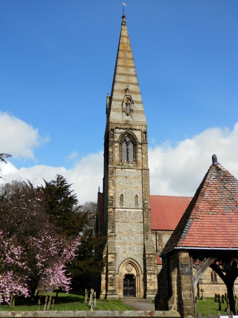
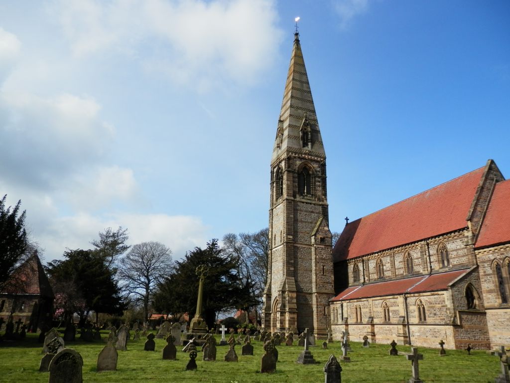
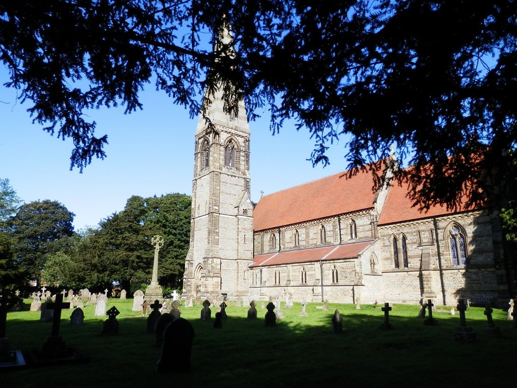
| Description | : | The village of Baldersby St James is 2 miles from the village of Baldersby, roughly halfway between the city of Ripon and the town of Thirsk. Across the road from Baldersby St James Church of England Primary School, the Church was built 1856-58, designed by William Butterfield for Viscount Downe of Baldersby Park. The slender church spire soars to 160 feet and can be seen for miles around. The headstones in the churchyard date from the mid 19th century to the present. Several late vicars of the parish are interred outside the East wall of the church. |
frequently asked questions (FAQ):
-
Where is St James Churchyard?
St James Churchyard is located at Baldersby, Harrogate Borough ,North Yorkshire ,England.
-
St James Churchyard cemetery's updated grave count on graveviews.com?
0 memorials
-
Where are the coordinates of the St James Churchyard?
Latitude: 54.1867500
Longitude: -1.4405600
Nearby Cemetories:
1. St John Churchyard
Skipton-on-Swale, Hambleton District, England
Coordinate: 54.2130000, -1.4379000
2. St Columba Churchyard
Topcliffe, Hambleton District, England
Coordinate: 54.1785070, -1.3892590
3. Topcliffe Cemetery
Topcliffe, Hambleton District, England
Coordinate: 54.1774200, -1.3846100
4. Dishforth Cemetery
Dishforth, Harrogate Borough, England
Coordinate: 54.1561350, -1.4115950
5. St. Mary's Churchyard
Wath, Harrogate Borough, England
Coordinate: 54.1889990, -1.5032490
6. Norton Conyers Pet Cemetery
Ripon, Harrogate Borough, England
Coordinate: 54.1814050, -1.5131410
7. St Lawrence Churchyard
Carlton Miniott, Hambleton District, England
Coordinate: 54.2232500, -1.3958700
8. St Leonard Churchyard
Sandhutton, Hambleton District, England
Coordinate: 54.2326000, -1.4121600
9. St Leonard Church Cemetery
Sandhutton, Hambleton District, England
Coordinate: 54.2325700, -1.4110600
10. St John the Evangelist Churchyard
Sharow, Harrogate Borough, England
Coordinate: 54.1436170, -1.5000420
11. St Michael Churchyard
Kirklington, Hambleton District, England
Coordinate: 54.2242770, -1.5126140
12. St. Mary and All Saints Churchyard
Cundall, Harrogate Borough, England
Coordinate: 54.1518340, -1.3542490
13. St John the Evangelist Churchyard
Dalton, Hambleton District, England
Coordinate: 54.1806400, -1.3341500
14. All Saints Churchyard
Pickhill, Hambleton District, England
Coordinate: 54.2470500, -1.4700700
15. Temple Gardens
Ripon, Harrogate Borough, England
Coordinate: 54.1386070, -1.5229240
16. St Oswald Churchyard
Sowerby, Hambleton District, England
Coordinate: 54.2261950, -1.3404430
17. Holy Trinity Churchyard
Ripon, Harrogate Borough, England
Coordinate: 54.1378700, -1.5283900
18. St Mary the Virgin Churchyard
North Stainley, Harrogate Borough, England
Coordinate: 54.1881600, -1.5627900
19. St John the Baptist Churchyard
Kirby Wiske, Hambleton District, England
Coordinate: 54.2576320, -1.4238510
20. Ripon Cemetery
Ripon, Harrogate Borough, England
Coordinate: 54.1418130, -1.5357040
21. Ripon Cathedral
Ripon, Harrogate Borough, England
Coordinate: 54.1349487, -1.5255010
22. Thirsk Cemetery
Thirsk, Hambleton District, England
Coordinate: 54.2356140, -1.3493790
23. Lark Hill Cemetery
Ripon, Harrogate Borough, England
Coordinate: 54.1454600, -1.5422800
24. Friends Burial Ground
Thirsk, Hambleton District, England
Coordinate: 54.2336160, -1.3444510