
| Memorials | : | 1 |
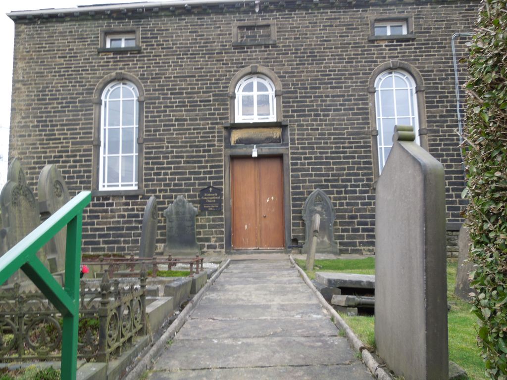
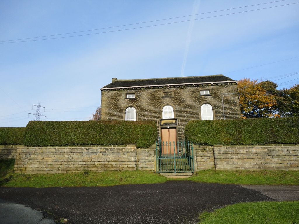
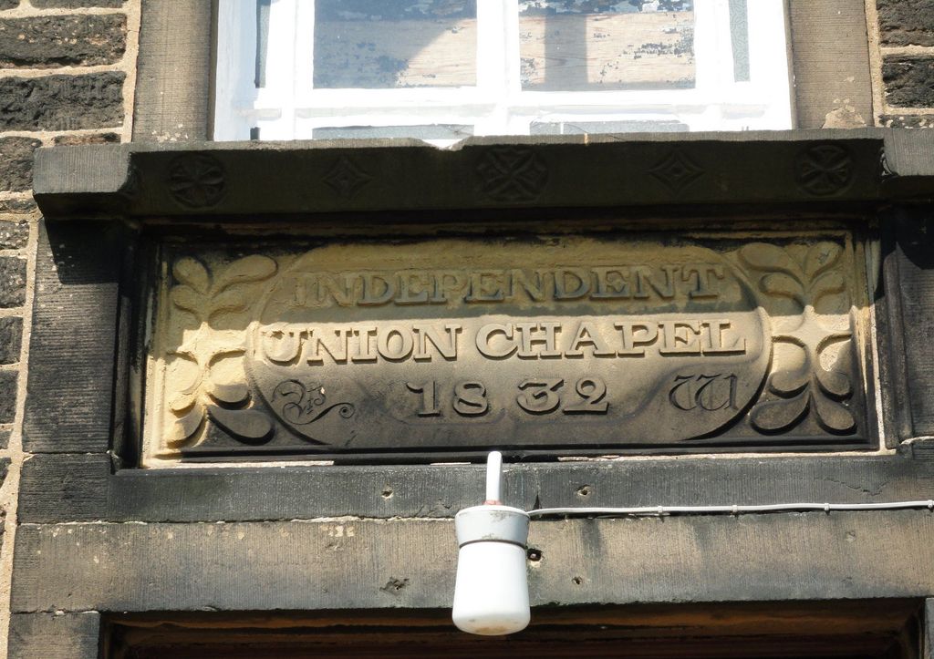
| Location | : | Ripponden, Metropolitan Borough of Calderdale, England |
| Coordinate | : | 53.6602867, -1.9772633 |
frequently asked questions (FAQ):
-
Where is Rishworth Congregational Chapel Parrock Nook?
Rishworth Congregational Chapel Parrock Nook is located at Ripponden, Metropolitan Borough of Calderdale ,West Yorkshire , HX6 4RFEngland.
-
Rishworth Congregational Chapel Parrock Nook cemetery's updated grave count on graveviews.com?
1 memorials
-
Where are the coordinates of the Rishworth Congregational Chapel Parrock Nook?
Latitude: 53.6602867
Longitude: -1.9772633
Nearby Cemetories:
1. Stones Methodist Church
Ripponden, Metropolitan Borough of Calderdale, England
Coordinate: 53.6668240, -1.9559210
2. St. John's Church
Rishworth, Metropolitan Borough of Calderdale, England
Coordinate: 53.6574800, -1.9520000
3. Rishworth Baptist Churchyard
Rishworth, Metropolitan Borough of Calderdale, England
Coordinate: 53.6595480, -1.9494070
4. St. Bartholomew's Churchyard
Ripponden, Metropolitan Borough of Calderdale, England
Coordinate: 53.6744620, -1.9395150
5. Ebenezer Methodist Chapelyard
Soyland Town, Metropolitan Borough of Calderdale, England
Coordinate: 53.6804790, -1.9446120
6. Krumlin Methodist Graveyard
Barkisland, Metropolitan Borough of Calderdale, England
Coordinate: 53.6582489, -1.9250975
7. St. Mary's Churchyard
Sowerby Bridge, Metropolitan Borough of Calderdale, England
Coordinate: 53.6912230, -1.9580330
8. Mill Bank Wesleyan Methodist Graveyard
Sowerby Bridge, Metropolitan Borough of Calderdale, England
Coordinate: 53.6887540, -1.9476840
9. St. Bartholomew's Churchyard
Scammonden, Metropolitan Borough of Kirklees, England
Coordinate: 53.6405370, -1.9311750
10. Christ Churchyard
Barkisland, Metropolitan Borough of Calderdale, England
Coordinate: 53.6753350, -1.9196910
11. St. John the Baptist in the Wilderness Churchyard
Cragg Vale, Metropolitan Borough of Calderdale, England
Coordinate: 53.7052900, -2.0007900
12. Mount Zion Primitive Methodist Chapel Graveyard
Norland, Metropolitan Borough of Calderdale, England
Coordinate: 53.6942630, -1.9215300
13. Sowerby Congregational Church Graveyard
Sowerby Bridge, Metropolitan Borough of Calderdale, England
Coordinate: 53.7059486, -1.9426959
14. Steep Lane Baptist Chapel Cemetery
Sowerby Bridge, Metropolitan Borough of Calderdale, England
Coordinate: 53.7092690, -1.9573450
15. Pole Moor Chapel Graveyard
Pole Moor, Metropolitan Borough of Kirklees, England
Coordinate: 53.6392030, -1.8996510
16. St. Peter's Churchyard
Sowerby Bridge, Metropolitan Borough of Calderdale, England
Coordinate: 53.7052590, -1.9369570
17. Providence Congregational Cemetery
Stainland, Metropolitan Borough of Calderdale, England
Coordinate: 53.6720900, -1.8873800
18. St George Churchyard
Sowerby Bridge, Metropolitan Borough of Calderdale, England
Coordinate: 53.7048800, -1.9184400
19. Sowerby Bridge Cemetery
Sowerby Bridge, Metropolitan Borough of Calderdale, England
Coordinate: 53.7090600, -1.9219900
20. Outlane Methodist Church Graveyard
Outlane, Metropolitan Borough of Kirklees, England
Coordinate: 53.6553950, -1.8778920
21. St Andrew Churchyard
Stainland, Metropolitan Borough of Calderdale, England
Coordinate: 53.6731200, -1.8780500
22. St. Luke Norland Churchyard
Norland, Metropolitan Borough of Calderdale, England
Coordinate: 53.7001000, -1.9008200
23. Luddenden Foot Congregational Churchyard
Luddenden, Metropolitan Borough of Calderdale, England
Coordinate: 53.7166300, -1.9408500
24. Stainland Methodist Chapel Yard
Holywell Green, Metropolitan Borough of Calderdale, England
Coordinate: 53.6725100, -1.8771400