
| Memorials | : | 1 |
| Location | : | Greenback, Loudon County, USA |
| Website | : | www.tngenweb.org/loudon/cemetery/listings/riverbend.html |
| Coordinate | : | 35.6238850, -84.2040080 |
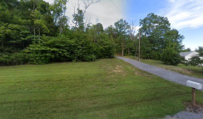
| Description | : | Location: Going south on Hwy. 411, turn right East Coast Tellico Parkway at start of four lane approach to Nile Perry Bridge. Pass "Gap of the Ridge Church". Just pass the church, on the right turn onto dirt road. (There is a gate across the road that has a not trespassing sign attached. Turn left at dead end road. At fork in the road, bear right to the point where the road turns to come back; about 3 miles, then a sharp right turn. Cemetery is through the old gate and on the left of the uppermost knoll, among a... Read More |
frequently asked questions (FAQ):
-
Where is Riverbend Farm Cemetery?
Riverbend Farm Cemetery is located at East Coast Tellico Parkway Greenback, Loudon County ,Tennessee , 37742USA.
-
Riverbend Farm Cemetery cemetery's updated grave count on graveviews.com?
1 memorials
-
Where are the coordinates of the Riverbend Farm Cemetery?
Latitude: 35.6238850
Longitude: -84.2040080
Nearby Cemetories:
1. Rollins Cemetery
Loudon County, USA
Coordinate: 35.6319008, -84.2035980
2. Oakland United Methodist Church Cemetery
Monroe County, USA
Coordinate: 35.6143990, -84.1913986
3. Niles-McGhee Cemetery
Monroe County, USA
Coordinate: 35.6025009, -84.2052994
4. McCollum Family Cemetery
Glendale, Loudon County, USA
Coordinate: 35.6425185, -84.1852114
5. Morganton Cemetery
Loudon County, USA
Coordinate: 35.6425018, -84.2236023
6. Montgomery Cemetery
Blount County, USA
Coordinate: 35.6030998, -84.1735992
7. Tipton Cemetery
Loudon County, USA
Coordinate: 35.6394005, -84.2410965
8. Wear Cemetery
Loudon County, USA
Coordinate: 35.6169014, -84.2461014
9. Smith Cemetery
Loudon County, USA
Coordinate: 35.6516991, -84.2414017
10. Hall Family Cemetery
Vonore, Monroe County, USA
Coordinate: 35.6184516, -84.2556390
11. McGhee Cemetery
Monroe County, USA
Coordinate: 35.5823700, -84.1917600
12. Toqua Graveyard
Vonore, Monroe County, USA
Coordinate: 35.5816667, -84.1941667
13. Toqua Cemetery
Toqua, Monroe County, USA
Coordinate: 35.5788880, -84.2058333
14. Smyrna Baptist Church Cemetery
Blount County, USA
Coordinate: 35.6182750, -84.1444480
15. Upton Cemetery
Vonore, Monroe County, USA
Coordinate: 35.5883145, -84.2450911
16. Vonore Baptist Church Cemetery
Vonore, Monroe County, USA
Coordinate: 35.5902050, -84.2487600
17. Vonore United Methodist Church Cemetery
Vonore, Monroe County, USA
Coordinate: 35.5900002, -84.2489014
18. Pine Grove Presbyterian Church Cemetery
Greenback, Loudon County, USA
Coordinate: 35.6527800, -84.1535600
19. Sinking Creek Cemetery
Greenback, Loudon County, USA
Coordinate: 35.6748167, -84.1912333
20. Blankenship Cemetery
Loudon County, USA
Coordinate: 35.6660995, -84.2418976
21. Liberty Baptist Church Cemetery
Maryville, Blount County, USA
Coordinate: 35.6260986, -84.1335983
22. Bingham Cemetery
Loudon County, USA
Coordinate: 35.6555200, -84.1440500
23. Russell Cemetery
Loudon County, USA
Coordinate: 35.6573830, -84.2642830
24. Clemmer Cemetery
Vonore, Monroe County, USA
Coordinate: 35.6282997, -84.2774963