
| Memorials | : | 0 |
| Location | : | Mouth of Wilson, Grayson County, USA |
| Coordinate | : | 36.5818560, -81.4749340 |
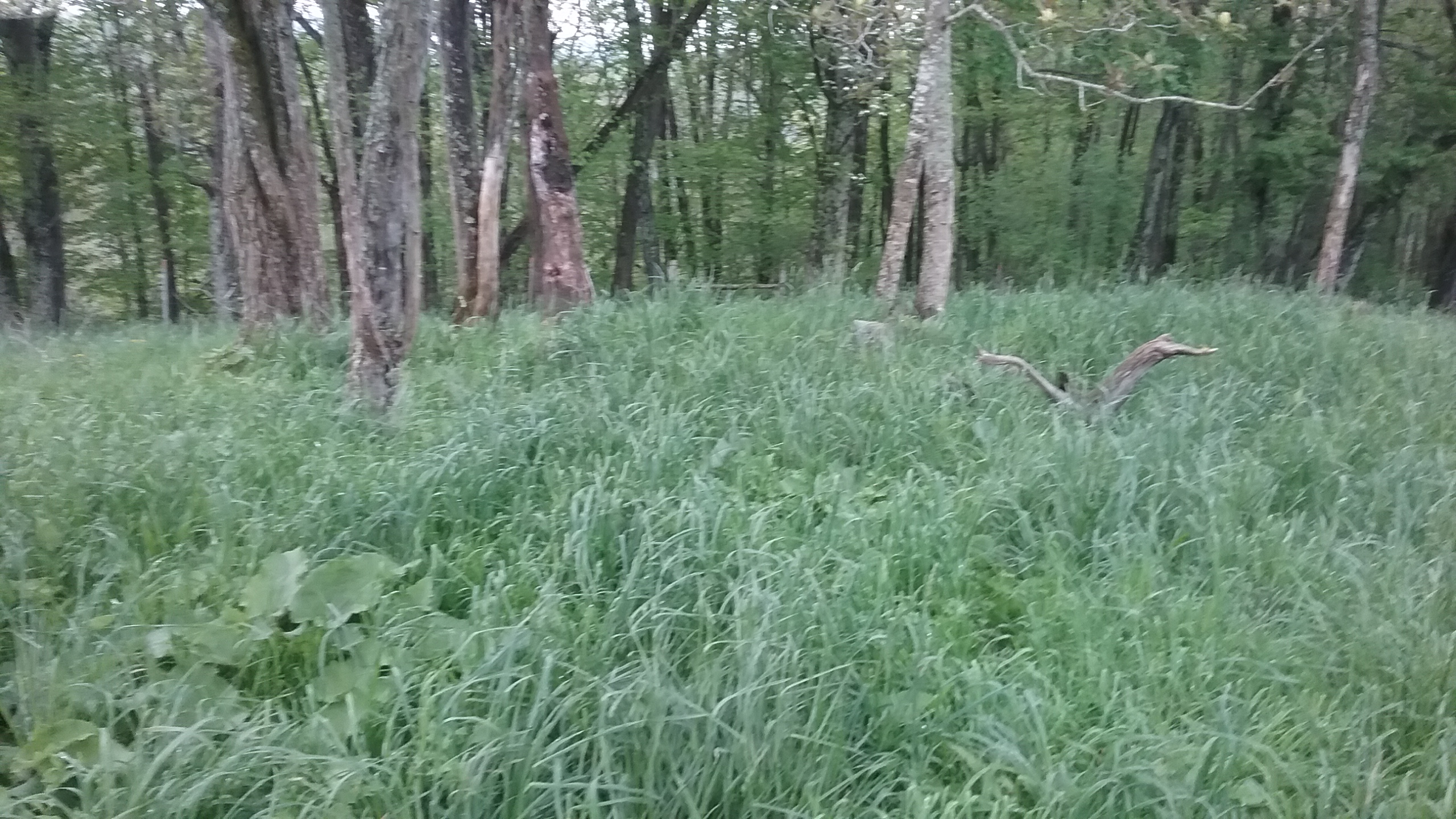
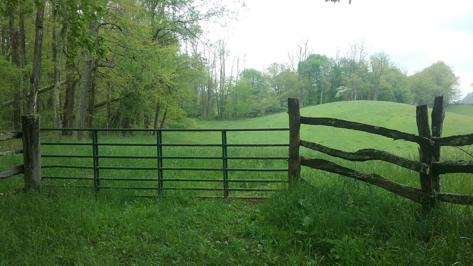
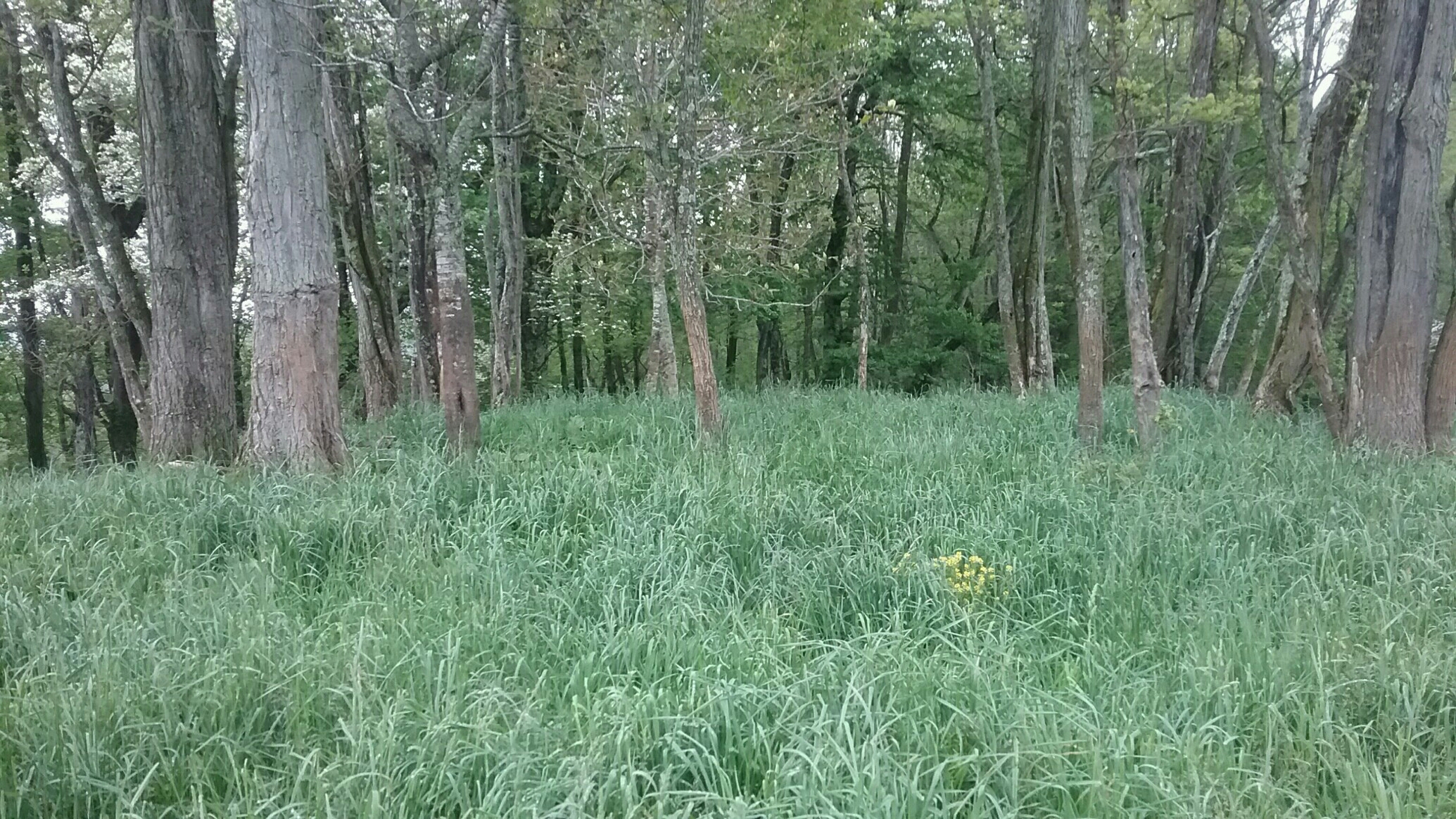
| Description | : | When your on Wade Duvall road(from Joe Thomas Rd) Road Keep going untill you see a gate on the right hand side on the top of the hill,Look out from the gate walk directly across to the highest part of the hill about 200 yards from the gate at the tree line. 3 Headstones All unmarked Just inside the tree line. |
frequently asked questions (FAQ):
-
Where is Roby Testerman Family Cemetery?
Roby Testerman Family Cemetery is located at Laurel Hill Road Mouth of Wilson, Grayson County ,Virginia , 24363USA.
-
Roby Testerman Family Cemetery cemetery's updated grave count on graveviews.com?
0 memorials
-
Where are the coordinates of the Roby Testerman Family Cemetery?
Latitude: 36.5818560
Longitude: -81.4749340
Nearby Cemetories:
1. Phipps Cemetery
Grayson County, USA
Coordinate: 36.5850830, -81.4794240
2. John Weiss Cemetery
Rugby, Grayson County, USA
Coordinate: 36.5809630, -81.4629810
3. Barnes Cemetery
Rugby, Grayson County, USA
Coordinate: 36.5847700, -81.4625570
4. Ambrose Spencer Family Cemetery
Ashe County, USA
Coordinate: 36.5720300, -81.4873300
5. Timothy F Young Cemetery
Rugby, Grayson County, USA
Coordinate: 36.5955220, -81.4797870
6. Duvall Family Cemetery
Grayson County, USA
Coordinate: 36.5942130, -81.4864020
7. Richardson Family Cemetery
Rugby, Grayson County, USA
Coordinate: 36.5975760, -81.4766480
8. Abram Reedy Cemetery
Rugby, Grayson County, USA
Coordinate: 36.5958220, -81.4602810
9. Bill Reedy Cemetery
Rugby, Grayson County, USA
Coordinate: 36.5943000, -81.4571000
10. Ball Family Cemetery
Ashe County, USA
Coordinate: 36.5601400, -81.4733700
11. Kilby Cemetery
Grayson County, USA
Coordinate: 36.5825005, -81.5092010
12. Pleasant Branch Cemetery
Grayson County, USA
Coordinate: 36.5833015, -81.4396973
13. Samuel Tucker Family Cemetery
Mouth of Wilson, Grayson County, USA
Coordinate: 36.6092250, -81.4614260
14. Dr. F. L. Osborne Cemetery
Mouth of Wilson, Grayson County, USA
Coordinate: 36.5811210, -81.4371790
15. Haw Orchard Cemetery
Grayson County, USA
Coordinate: 36.6081009, -81.4950027
16. Fees Ridge Cemetery
Mouth of Wilson, Grayson County, USA
Coordinate: 36.5936130, -81.5113800
17. Quillin Cemetery
Rugby, Grayson County, USA
Coordinate: 36.6006490, -81.4425210
18. Elijah Franklin Sexton Family Cemetery
Mill Creek, Grayson County, USA
Coordinate: 36.6156371, -81.4691845
19. Gideon Weaver Cemetery
Rugby, Grayson County, USA
Coordinate: 36.6156830, -81.4691750
20. Corinth Baptist Church Cemetery
Rugby, Grayson County, USA
Coordinate: 36.6119240, -81.4470280
21. Pickle-Peak Cemetery
Rugby, Grayson County, USA
Coordinate: 36.6120400, -81.4390410
22. Andrew Hurley Family Cemetery
Ashe County, USA
Coordinate: 36.5633011, -81.5246964
23. Spencer Family Cemetery
Mouth of Wilson, Grayson County, USA
Coordinate: 36.5895190, -81.4181710
24. Marshel Jones Cemetery
Rugby, Grayson County, USA
Coordinate: 36.6279230, -81.4816490