| Memorials | : | 0 |
| Location | : | Mouth of Wilson, Grayson County, USA |
| Coordinate | : | 36.6092250, -81.4614260 |
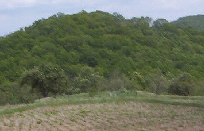
| Description | : | Location: South of Grayson Highlands State Park Directions: To reach this cemetery, turn south on Shippys Branch Road (Rt 742) from Grayson Highlands Pky (U.S. 58) near Grayson Highlands State Park Then turn left onto Pinnacle Lane (Rt 885). This cemetery is about 0.5 mile from 144 Pinnacle Lane. To reach it walk behind the house there, go to a grove of white pines, cross the fence, and then walk to the top of the hill. Look to the right and you will see the cemetery in the distance, and just walk to it. GPS Coordinates: N36.609191 W81.461418 Surveyed by: Jeff Weaver on... Read More |
frequently asked questions (FAQ):
-
Where is Samuel Tucker Family Cemetery?
Samuel Tucker Family Cemetery is located at 144 Pinnacle Lane (Rt. 885) Mouth of Wilson, Grayson County ,Virginia , 24363USA.
-
Samuel Tucker Family Cemetery cemetery's updated grave count on graveviews.com?
0 memorials
-
Where are the coordinates of the Samuel Tucker Family Cemetery?
Latitude: 36.6092250
Longitude: -81.4614260
Nearby Cemetories:
1. Elijah Franklin Sexton Family Cemetery
Mill Creek, Grayson County, USA
Coordinate: 36.6156371, -81.4691845
2. Gideon Weaver Cemetery
Rugby, Grayson County, USA
Coordinate: 36.6156830, -81.4691750
3. Corinth Baptist Church Cemetery
Rugby, Grayson County, USA
Coordinate: 36.6119240, -81.4470280
4. Abram Reedy Cemetery
Rugby, Grayson County, USA
Coordinate: 36.5958220, -81.4602810
5. Bill Reedy Cemetery
Rugby, Grayson County, USA
Coordinate: 36.5943000, -81.4571000
6. Richardson Family Cemetery
Rugby, Grayson County, USA
Coordinate: 36.5975760, -81.4766480
7. Quillin Cemetery
Rugby, Grayson County, USA
Coordinate: 36.6006490, -81.4425210
8. Pickle-Peak Cemetery
Rugby, Grayson County, USA
Coordinate: 36.6120400, -81.4390410
9. Timothy F Young Cemetery
Rugby, Grayson County, USA
Coordinate: 36.5955220, -81.4797870
10. Osborne-Williams Cemetery
Low Gap, Grayson County, USA
Coordinate: 36.6266230, -81.4456550
11. Barnes Cemetery
Rugby, Grayson County, USA
Coordinate: 36.5847700, -81.4625570
12. Marshel Jones Cemetery
Rugby, Grayson County, USA
Coordinate: 36.6279230, -81.4816490
13. Duvall Family Cemetery
Grayson County, USA
Coordinate: 36.5942130, -81.4864020
14. James C A Perkins Cemetery
Mill Creek, Grayson County, USA
Coordinate: 36.6267730, -81.4382540
15. Haw Orchard Cemetery
Grayson County, USA
Coordinate: 36.6081009, -81.4950027
16. Phipps Cemetery
Grayson County, USA
Coordinate: 36.5850830, -81.4794240
17. John Weiss Cemetery
Rugby, Grayson County, USA
Coordinate: 36.5809630, -81.4629810
18. Roby Testerman Family Cemetery
Mouth of Wilson, Grayson County, USA
Coordinate: 36.5818560, -81.4749340
19. Pleasant Branch Cemetery
Grayson County, USA
Coordinate: 36.5833015, -81.4396973
20. Dr. F. L. Osborne Cemetery
Mouth of Wilson, Grayson County, USA
Coordinate: 36.5811210, -81.4371790
21. VanHoy Cemetery
Mouth of Wilson, Grayson County, USA
Coordinate: 36.6080075, -81.4178560
22. Spencer Family Cemetery
Mouth of Wilson, Grayson County, USA
Coordinate: 36.5895190, -81.4181710
23. Ambrose Spencer Family Cemetery
Ashe County, USA
Coordinate: 36.5720300, -81.4873300
24. Fees Ridge Cemetery
Mouth of Wilson, Grayson County, USA
Coordinate: 36.5936130, -81.5113800

