| Memorials | : | 8 |
| Location | : | Rugby, Grayson County, USA |
| Coordinate | : | 36.6279230, -81.4816490 |
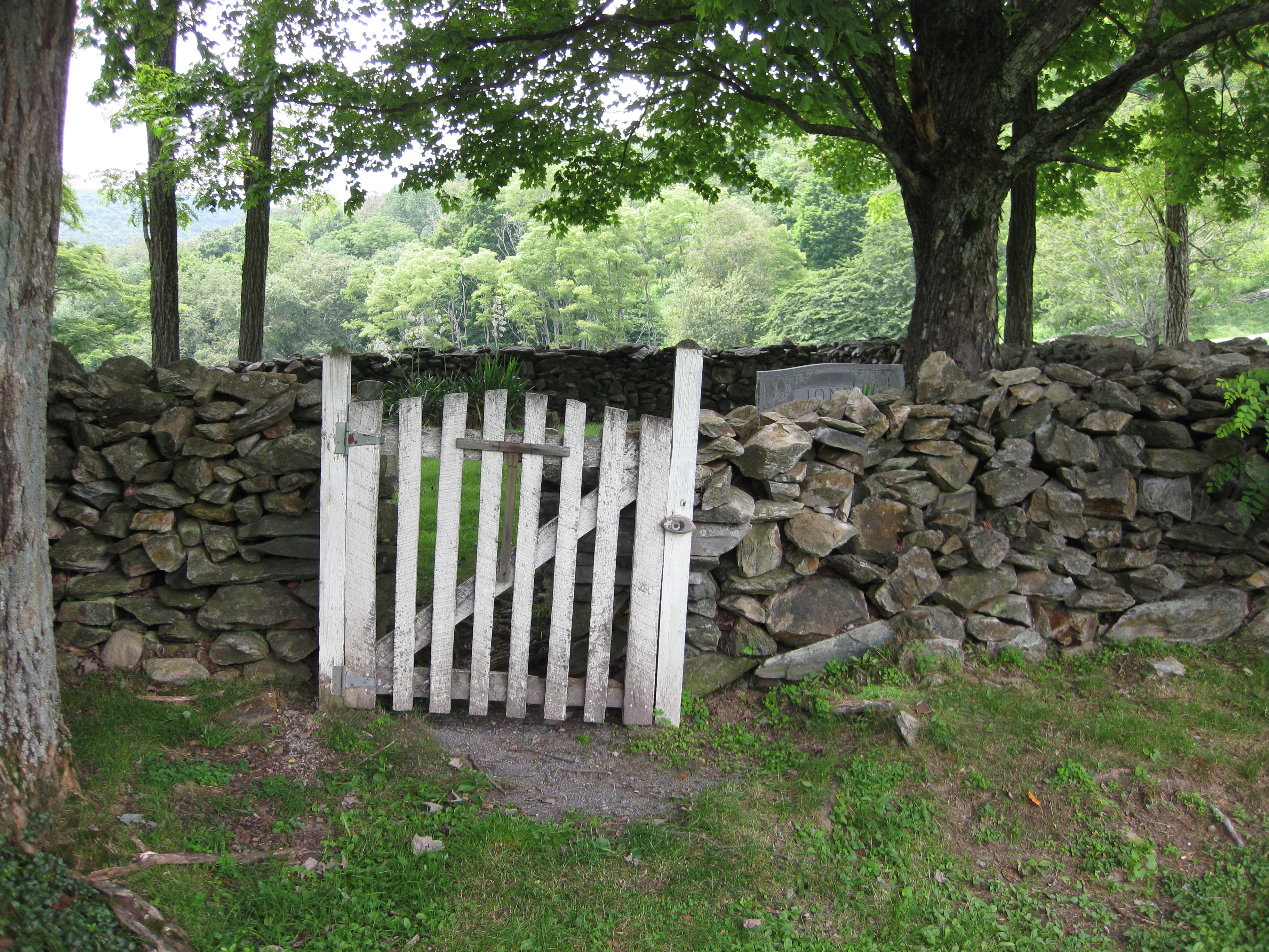
| Description | : | This cemetery is located in Grayson Highlands State Park off US 58 a few miles west of the community of Rugby. Turn off of US 58 onto Grayson Highland Ln (route 362) and continue to the first road going off to the right with a sign denoting the picnic area. The cemetery lies roughly in the middle of the picnic area surrounded by a stone wall. It is gated and is easily accessible. Of the burials, 4 graves are marked only by field stones. A transcription of the cemetery done in June of 2003 provides possible names taken... Read More |
frequently asked questions (FAQ):
-
Where is Marshel Jones Cemetery?
Marshel Jones Cemetery is located at Grayson Highland Lane (Rt. 362) Rugby, Grayson County ,Virginia , 24363USA.
-
Marshel Jones Cemetery cemetery's updated grave count on graveviews.com?
8 memorials
-
Where are the coordinates of the Marshel Jones Cemetery?
Latitude: 36.6279230
Longitude: -81.4816490
Nearby Cemetories:
1. Gideon Weaver Cemetery
Rugby, Grayson County, USA
Coordinate: 36.6156830, -81.4691750
2. Elijah Franklin Sexton Family Cemetery
Mill Creek, Grayson County, USA
Coordinate: 36.6156371, -81.4691845
3. Haw Orchard Cemetery
Grayson County, USA
Coordinate: 36.6081009, -81.4950027
4. Samuel Tucker Family Cemetery
Mouth of Wilson, Grayson County, USA
Coordinate: 36.6092250, -81.4614260
5. Osborne-Williams Cemetery
Low Gap, Grayson County, USA
Coordinate: 36.6266230, -81.4456550
6. Richardson Family Cemetery
Rugby, Grayson County, USA
Coordinate: 36.5975760, -81.4766480
7. Corinth Baptist Church Cemetery
Rugby, Grayson County, USA
Coordinate: 36.6119240, -81.4470280
8. Timothy F Young Cemetery
Rugby, Grayson County, USA
Coordinate: 36.5955220, -81.4797870
9. Duvall Family Cemetery
Grayson County, USA
Coordinate: 36.5942130, -81.4864020
10. James C A Perkins Cemetery
Mill Creek, Grayson County, USA
Coordinate: 36.6267730, -81.4382540
11. Greer Cemetery
Grayson County, USA
Coordinate: 36.6180992, -81.5243988
12. Osborne Cemetery
Grayson County, USA
Coordinate: 36.6119003, -81.5216980
13. Cabin Creek Cemetery
Grayson County, USA
Coordinate: 36.6116000, -81.5218000
14. Abram Reedy Cemetery
Rugby, Grayson County, USA
Coordinate: 36.5958220, -81.4602810
15. Pickle-Peak Cemetery
Rugby, Grayson County, USA
Coordinate: 36.6120400, -81.4390410
16. Bill Reedy Cemetery
Rugby, Grayson County, USA
Coordinate: 36.5943000, -81.4571000
17. Quillin Cemetery
Rugby, Grayson County, USA
Coordinate: 36.6006490, -81.4425210
18. Fees Ridge Cemetery
Mouth of Wilson, Grayson County, USA
Coordinate: 36.5936130, -81.5113800
19. Shelton Family Cemetery
Mouth of Wilson, Grayson County, USA
Coordinate: 36.6489000, -81.4358000
20. Phipps Cemetery
Grayson County, USA
Coordinate: 36.5850830, -81.4794240
21. Barnes Cemetery
Rugby, Grayson County, USA
Coordinate: 36.5847700, -81.4625570
22. Roby Testerman Family Cemetery
Mouth of Wilson, Grayson County, USA
Coordinate: 36.5818560, -81.4749340
23. John Weiss Cemetery
Rugby, Grayson County, USA
Coordinate: 36.5809630, -81.4629810
24. Kilby Cemetery
Grayson County, USA
Coordinate: 36.5825005, -81.5092010

