
| Memorials | : | 0 |
| Location | : | Rock Creek, Newton County, USA |
| Coordinate | : | 32.5629616, -89.0271378 |
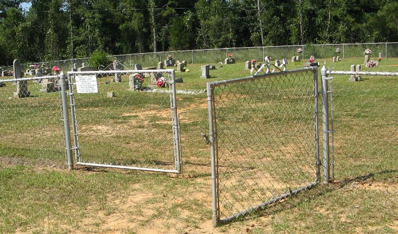
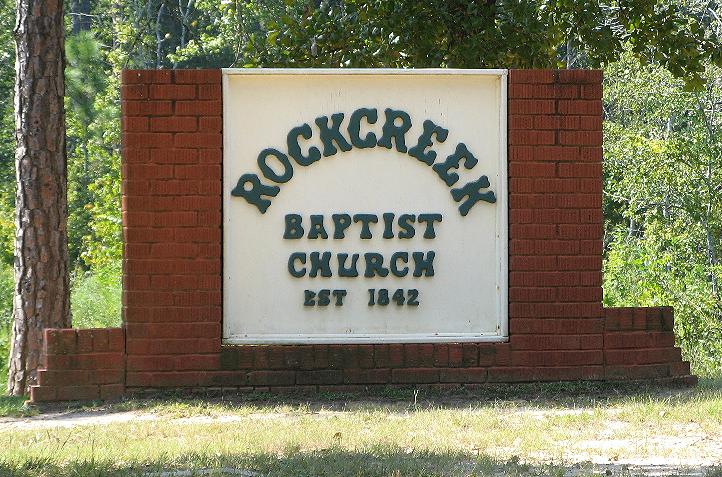
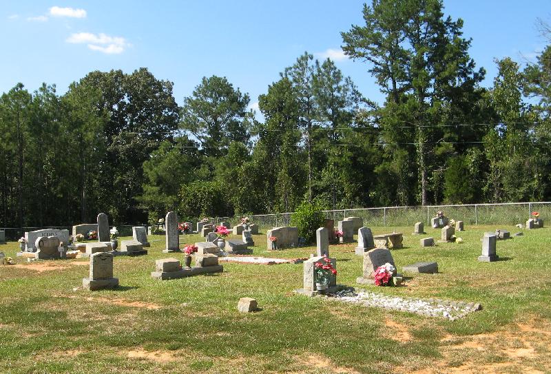
| Description | : | Located in rear of Rock Creek Baptist Church east of Union, MS. From Hwy 15, turn east on Hwy 492, travel 3.15 miles to road 509 (Rock Creek Road) turn south, travel 2.7 miles, church on left side of raod, small cemetery in back of church. |
frequently asked questions (FAQ):
-
Where is Rock Creek Baptist Church Cemetery?
Rock Creek Baptist Church Cemetery is located at Rock Creek, Newton County ,Mississippi ,USA.
-
Rock Creek Baptist Church Cemetery cemetery's updated grave count on graveviews.com?
0 memorials
-
Where are the coordinates of the Rock Creek Baptist Church Cemetery?
Latitude: 32.5629616
Longitude: -89.0271378
Nearby Cemetories:
1. Greenland Baptist Church Cemetery
Newton County, USA
Coordinate: 32.5564680, -89.0561080
2. Little Rock Community Cemetery
Little Rock, Newton County, USA
Coordinate: 32.5285912, -89.0226898
3. Pleasant Grove Missionary Baptist Church Cemetery
Little Rock, Newton County, USA
Coordinate: 32.5539300, -88.9813800
4. Killen Cemetery
Neshoba County, USA
Coordinate: 32.5892330, -89.0635870
5. County Line Cemetery
Neshoba County, USA
Coordinate: 32.5835991, -89.0742035
6. Rock Branch Baptist Church Cemetery
Union, Newton County, USA
Coordinate: 32.5445404, -89.0846786
7. Hebron Missionary Baptist Church Cemetery
Newton County, USA
Coordinate: 32.5119100, -89.0531800
8. Hopewell Baptist Church Cemetery
Duffee, Newton County, USA
Coordinate: 32.5078506, -89.0007324
9. Pine Grove Cemetery
House, Neshoba County, USA
Coordinate: 32.6194000, -89.0044022
10. Cross Roads Baptist Church Cemetery
Neshoba County, USA
Coordinate: 32.6206017, -89.0653000
11. Pentecostals of House
Neshoba County, USA
Coordinate: 32.6130140, -88.9748190
12. Mount Olive Cemetery
House, Neshoba County, USA
Coordinate: 32.6285782, -88.9965668
13. Memorial Park
Union, Newton County, USA
Coordinate: 32.5679512, -89.1113968
14. Howle Cemetery
Neshoba County, USA
Coordinate: 32.6265630, -89.0707970
15. Brand Cemetery
Newton County, USA
Coordinate: 32.4893990, -89.0132980
16. Midway Missionary Baptist Church Cemetery
Little Rock, Newton County, USA
Coordinate: 32.4936295, -89.0622635
17. McDonald Cemetery
Neshoba County, USA
Coordinate: 32.6258011, -88.9713974
18. Antioch Cemetery
Neshoba County, USA
Coordinate: 32.6091995, -88.9441986
19. Greater Rose Hill M.B. Church Cemetery
Union, Newton County, USA
Coordinate: 32.5683316, -89.1265826
20. Beulah Baptist Church Cemetery
Little Rock, Newton County, USA
Coordinate: 32.4784420, -89.0165940
21. Mount Zion Congregational Methodist Cemetery
Newton County, USA
Coordinate: 32.5182300, -89.1142500
22. Golden Grove Cemetery
Neshoba, Neshoba County, USA
Coordinate: 32.6307983, -89.0905991
23. Union Church of God
Neshoba, Neshoba County, USA
Coordinate: 32.5950470, -89.1227390
24. Mount Pleasant Battlefield Baptist Church Cemetery
Lauderdale County, USA
Coordinate: 32.5531830, -88.9242930