
| Memorials | : | 2 |
| Location | : | Neshoba County, USA |
| Coordinate | : | 32.5835991, -89.0742035 |
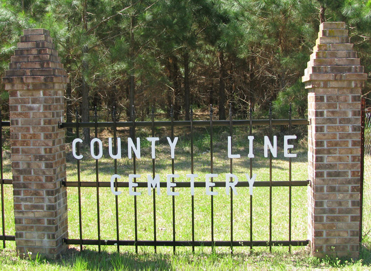
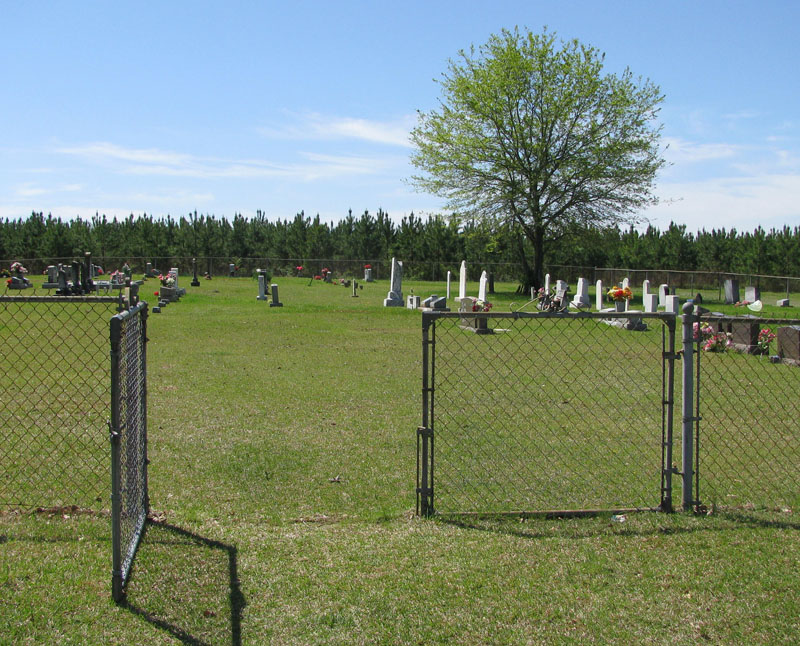
| Description | : | County Line is listed in the Neshoba County Cemetery Records as County Line East. The City of Union is partially in Neshoba County and partially in Newton County, MS. The cemetery is located east of Union, MS on the south side of Highway 492. You must drive down a pathway to reach the entrance to the cemetery. It isn't easy to spot from the highway. |
frequently asked questions (FAQ):
-
Where is County Line Cemetery?
County Line Cemetery is located at Neshoba County ,Mississippi ,USA.
-
County Line Cemetery cemetery's updated grave count on graveviews.com?
2 memorials
-
Where are the coordinates of the County Line Cemetery?
Latitude: 32.5835991
Longitude: -89.0742035

Nearby Cemetories:
1. Killen Cemetery
Neshoba County, USA
Coordinate: 32.5892330, -89.0635870
2. Greenland Baptist Church Cemetery
Newton County, USA
Coordinate: 32.5564680, -89.0561080
3. Memorial Park
Union, Newton County, USA
Coordinate: 32.5679512, -89.1113968
4. Cross Roads Baptist Church Cemetery
Neshoba County, USA
Coordinate: 32.6206017, -89.0653000
5. Rock Branch Baptist Church Cemetery
Union, Newton County, USA
Coordinate: 32.5445404, -89.0846786
6. Union Church of God
Neshoba, Neshoba County, USA
Coordinate: 32.5950470, -89.1227390
7. Howle Cemetery
Neshoba County, USA
Coordinate: 32.6265630, -89.0707970
8. Rock Creek Baptist Church Cemetery
Rock Creek, Newton County, USA
Coordinate: 32.5629616, -89.0271378
9. Greater Rose Hill M.B. Church Cemetery
Union, Newton County, USA
Coordinate: 32.5683316, -89.1265826
10. Golden Grove Cemetery
Neshoba, Neshoba County, USA
Coordinate: 32.6307983, -89.0905991
11. Union Pentecostal Church Cemetery
Union, Neshoba County, USA
Coordinate: 32.6017302, -89.1330688
12. Springhill M.B. Church Cemetery
Union, Newton County, USA
Coordinate: 32.5566800, -89.1464110
13. Neshoba Cemetery
Neshoba County, USA
Coordinate: 32.6236000, -89.1391983
14. Pine Grove Cemetery
House, Neshoba County, USA
Coordinate: 32.6194000, -89.0044022
15. Little Rock Community Cemetery
Little Rock, Newton County, USA
Coordinate: 32.5285912, -89.0226898
16. Mount Zion Congregational Methodist Cemetery
Newton County, USA
Coordinate: 32.5182300, -89.1142500
17. Hebron Missionary Baptist Church Cemetery
Newton County, USA
Coordinate: 32.5119100, -89.0531800
18. Victory Fellowship Church
Neshoba, Neshoba County, USA
Coordinate: 32.6395770, -89.1393970
19. Mount Olive Cemetery
House, Neshoba County, USA
Coordinate: 32.6285782, -88.9965668
20. McCullough Cemetery
Philadelphia, Neshoba County, USA
Coordinate: 32.6615160, -89.1000870
21. Mount Zion United Methodist Church Cemetery
Neshoba County, USA
Coordinate: 32.5929070, -89.1716050
22. Pleasant Grove Missionary Baptist Church Cemetery
Little Rock, Newton County, USA
Coordinate: 32.5539300, -88.9813800
23. Beatline Baptist Cemetery
Neshoba County, USA
Coordinate: 32.6696900, -89.0691020
24. Pinckney Baptist Church Cemetery
Union, Newton County, USA
Coordinate: 32.5317612, -89.1583862