
| Memorials | : | 9 |
| Location | : | Newton County, USA |
| Coordinate | : | 32.5182300, -89.1142500 |
frequently asked questions (FAQ):
-
Where is Mount Zion Congregational Methodist Cemetery?
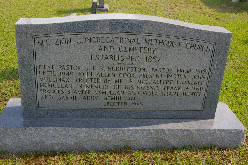
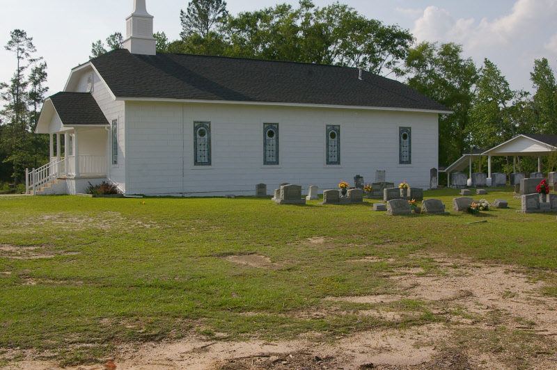
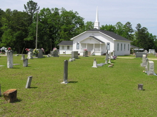
Mount Zion Congregational Methodist Cemetery is located at Newton County ,Mississippi ,USA.
-
Mount Zion Congregational Methodist Cemetery cemetery's updated grave count on graveviews.com?
9 memorials
-
Where are the coordinates of the Mount Zion Congregational Methodist Cemetery?
Latitude: 32.5182300
Longitude: -89.1142500


Nearby Cemetories:
1. Rock Branch Baptist Church Cemetery
Union, Newton County, USA
Coordinate: 32.5445404, -89.0846786
2. Pinckney Baptist Church Cemetery
Union, Newton County, USA
Coordinate: 32.5317612, -89.1583862
3. Springhill M.B. Church Cemetery
Union, Newton County, USA
Coordinate: 32.5566800, -89.1464110
4. Fellowship-New Hope Cemetery
Stratton, Newton County, USA
Coordinate: 32.4945100, -89.1648000
5. Memorial Park
Union, Newton County, USA
Coordinate: 32.5679512, -89.1113968
6. Midway Missionary Baptist Church Cemetery
Little Rock, Newton County, USA
Coordinate: 32.4936295, -89.0622635
7. Greater Rose Hill M.B. Church Cemetery
Union, Newton County, USA
Coordinate: 32.5683316, -89.1265826
8. Hebron Missionary Baptist Church Cemetery
Newton County, USA
Coordinate: 32.5119100, -89.0531800
9. Indian Cemetery
Newton County, USA
Coordinate: 32.4914017, -89.1757965
10. Greenland Baptist Church Cemetery
Newton County, USA
Coordinate: 32.5564680, -89.0561080
11. New Ireland Baptist Church Cemetery
New Ireland, Newton County, USA
Coordinate: 32.5635490, -89.1785278
12. Erin Cumberland Presbyterian Church Cemetery
Union, Newton County, USA
Coordinate: 32.5200615, -89.2011490
13. County Line Cemetery
Neshoba County, USA
Coordinate: 32.5835991, -89.0742035
14. Fryery Cemetery
Edinburg, Leake County, USA
Coordinate: 32.4977900, -89.1996000
15. Abney Cemetery
Union, Newton County, USA
Coordinate: 32.5611000, -89.1889038
16. Union Church of God
Neshoba, Neshoba County, USA
Coordinate: 32.5950470, -89.1227390
17. Little Rock Community Cemetery
Little Rock, Newton County, USA
Coordinate: 32.5285912, -89.0226898
18. Hudson Chapel Church of God Cemetery
Union, Newton County, USA
Coordinate: 32.5343310, -89.2098860
19. Killen Cemetery
Neshoba County, USA
Coordinate: 32.5892330, -89.0635870
20. Crossroads Baptist Church Cemetery
Decatur, Newton County, USA
Coordinate: 32.4552040, -89.1800050
21. Union Pentecostal Church Cemetery
Union, Neshoba County, USA
Coordinate: 32.6017302, -89.1330688
22. Rock Creek Baptist Church Cemetery
Rock Creek, Newton County, USA
Coordinate: 32.5629616, -89.0271378
23. Mount Zion United Methodist Church Cemetery
Neshoba County, USA
Coordinate: 32.5929070, -89.1716050
24. Brand Cemetery
Newton County, USA
Coordinate: 32.4893990, -89.0132980