| Memorials | : | 69 |
| Location | : | Rock Springs, Sweetwater County, USA |
| Phone | : | 307-352-1462 |
| Website | : | burialsearch.com/ecims#/s/454/Rock_Springs_Municipal_Cemetery |
| Coordinate | : | 41.5778008, -109.2118988 |
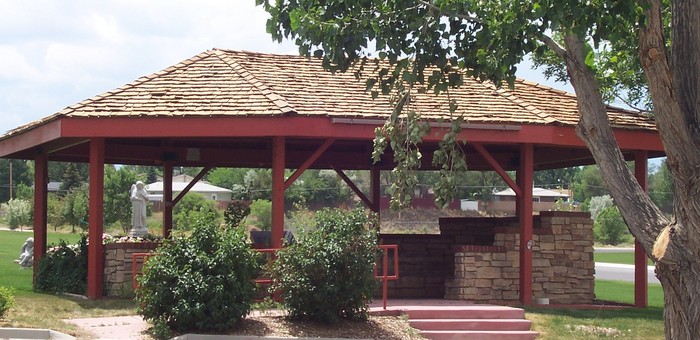
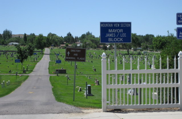
| Description | : | There are three sections in Rock Springs Cemetery: Saint Joseph's, Mountain View and Paul J. Wataha Perpetual Care. There is a map and directory in the meditation area south of the main parking lot. The directory is not complete. 10/12: Rock Springs Cemetery often gets incorrectly identified as Mountain View or St. Joseph's by people who don't live here. What now is the Rock Springs cemetery was originally two cemeteries, on the east side of a road, Mountain View and on the west side, St. Joseph's. The road is gone, the cemeteries have been merged as one into the RS cemetery... Read More |
frequently asked questions (FAQ):
-
Where is Rock Springs Cemetery?
Rock Springs Cemetery is located at 800 Thompson Street Rock Springs, Sweetwater County ,Wyoming , 82901USA.
-
Rock Springs Cemetery cemetery's updated grave count on graveviews.com?
56 memorials
-
Where are the coordinates of the Rock Springs Cemetery?
Latitude: 41.5778008
Longitude: -109.2118988
Nearby Cemetories:
1. Rest Haven Memorial Gardens
Rock Springs, Sweetwater County, USA
Coordinate: 41.6504000, -109.2586000
2. Riverview Cemetery
Green River, Sweetwater County, USA
Coordinate: 41.5335999, -109.4571991
3. Mountain View Cemetery
Superior, Sweetwater County, USA
Coordinate: 41.7562670, -108.9614150
4. Bryan Cemetery
Bryan, Sweetwater County, USA
Coordinate: 41.5748500, -109.6866670
5. Daniel Lantz Gravesite
Granger, Sweetwater County, USA
Coordinate: 41.6285840, -109.9054120
6. Charles Hatch Gravesite
Farson, Sweetwater County, USA
Coordinate: 42.0847800, -109.4713900
7. Eden Valley Cemetery
Eden, Sweetwater County, USA
Coordinate: 42.1035995, -109.4467010
8. Granger Municipal Cemetery
Granger, Sweetwater County, USA
Coordinate: 41.5917200, -109.9676100
9. William's Family Cemetery
Sweetwater County, USA
Coordinate: 41.0027400, -109.4267300
10. Dutch John Memorial Park
Dutch John, Daggett County, USA
Coordinate: 40.9379000, -109.3887120
11. Dick Son Ranch Cemetery
Sweetwater County, USA
Coordinate: 41.0236110, -109.6933300
12. John Jarvie Ranch Historic Site Cemetery
Dutch John, Daggett County, USA
Coordinate: 40.8997890, -109.1785400
13. Dart Gravesite
Maybell, Moffat County, USA
Coordinate: 40.9229000, -108.9436000
14. Manila Cemetery
Manila, Daggett County, USA
Coordinate: 40.9968987, -109.7144012
15. Charlotte Dansie Memorial Gravesite
Fremont County, USA
Coordinate: 42.3011500, -108.9879200
16. Browns Park Livestock Ranch Cemetery
Daggett County, USA
Coordinate: 40.8412420, -109.0770950
17. McKinnon Cemetery
Sweetwater County, USA
Coordinate: 41.0200000, -109.8892000
18. McKinnon Cemetery
McKinnon, Sweetwater County, USA
Coordinate: 41.0197400, -109.8899500
19. Cleophas J. Dowd Gravesite
Manila, Daggett County, USA
Coordinate: 40.9399986, -109.7585983
20. Whitman Cemetery
Lincoln County, USA
Coordinate: 42.0183000, -110.0525000
21. Burntfork Cemetery
Burntfork, Sweetwater County, USA
Coordinate: 41.0381012, -109.9897003
22. Widdop Cemetery
Sweetwater County, USA
Coordinate: 41.0182991, -110.0111008
23. Lodore Cemetery
Greystone, Moffat County, USA
Coordinate: 40.7801000, -108.8920000
24. Bassett Cemetery
Maybell, Moffat County, USA
Coordinate: 40.7914009, -108.8458023


