
| Memorials | : | 0 |
| Location | : | Roosendaal, Roosendaal Municipality, Netherlands |
| Coordinate | : | 51.5382800, 4.4794100 |
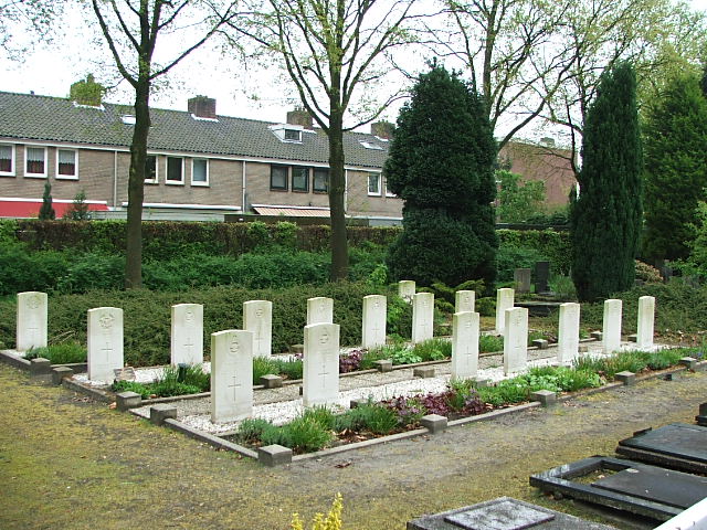
| Description | : | The town of Roosendaal lies about 1 kilometre north of the motorway from Breda to Bergen-op-Zoom. It is 24 kilometres south-west of Breda and 12 kilometres north-east of Bergen-op-Zoom. From the motorway A58 turn off at junction 23 and onto Van Beethovenlaan. At the first crossroads turn right into Strausslaan and then first right again into Bredaseweg. Take the first turning right into Bachlaan and the cemetery is along here. |
frequently asked questions (FAQ):
-
Where is Roosendaal-en-Nispen General Cemetery?
Roosendaal-en-Nispen General Cemetery is located at Roosendaal, Roosendaal Municipality ,Noord-Brabant ,Netherlands.
-
Roosendaal-en-Nispen General Cemetery cemetery's updated grave count on graveviews.com?
0 memorials
-
Where are the coordinates of the Roosendaal-en-Nispen General Cemetery?
Latitude: 51.5382800
Longitude: 4.4794100
Nearby Cemetories:
1. Roosendaal-en-Nispen Roman Catholic Cemetery
Roosendaal, Roosendaal Municipality, Netherlands
Coordinate: 51.5381600, 4.4718800
2. Begraafplaats Zegestede
Roosendaal, Roosendaal Municipality, Netherlands
Coordinate: 51.5338500, 4.5113600
3. Kerkhof Zegge
Zegge, Rucphen Municipality, Netherlands
Coordinate: 51.5562542, 4.5147188
4. Protestantse Begraafplaats
Oud Gastel, Halderberge Municipality, Netherlands
Coordinate: 51.5841651, 4.4683994
5. Begraafplaats Rucphen
Rucphen, Rucphen Municipality, Netherlands
Coordinate: 51.5279365, 4.5526156
6. R.K.Begraafplaats Laurentius
Oud Gastel, Halderberge Municipality, Netherlands
Coordinate: 51.5869694, 4.4628189
7. Protestantse Begraafplaats Kruisland
Kruisland, Steenbergen Municipality, Netherlands
Coordinate: 51.5687517, 4.4081460
8. Steenbergen-En-Kruisland Churchyard
Kruisland, Steenbergen Municipality, Netherlands
Coordinate: 51.5702921, 4.4061697
9. Rooms Katholieke Begraafplaats
Nispen, Roosendaal Municipality, Netherlands
Coordinate: 51.4826245, 4.4629658
10. Oudenbosch Rooms-Katholieke Begraafplaats
Oudenbosch, Halderberge Municipality, Netherlands
Coordinate: 51.5891200, 4.5310900
11. R.K. Begraafplaats O L Vrouw in het Woud
Wouw, Roosendaal Municipality, Netherlands
Coordinate: 51.5223800, 4.3834559
12. Begraafplaats Schijf
Schijf, Rucphen Municipality, Netherlands
Coordinate: 51.4978952, 4.5591589
13. Algemene Begraafplaats Oudenbosch
Oudenbosch, Halderberge Municipality, Netherlands
Coordinate: 51.5967744, 4.5244521
14. Kerkhof St. Willebrord
Sint Willebrord, Rucphen Municipality, Netherlands
Coordinate: 51.5517370, 4.5889150
15. Essen Centrum Cemetery
Essen, Arrondissement Antwerpen, Belgium
Coordinate: 51.4681100, 4.4699800
16. Essen Horendonk Communal Cemetery
Essen, Arrondissement Antwerpen, Belgium
Coordinate: 51.4694900, 4.5039100
17. Begraafplaats Nederlands Hervormde Kerk v.m.
Standdaarbuiten, Moerdijk Municipality, Netherlands
Coordinate: 51.6089430, 4.5166929
18. Begraafplaats Sprundel
Sprundel, Rucphen Municipality, Netherlands
Coordinate: 51.5360801, 4.6035448
19. R.K.Parochiebegraafplaats Wouwse Plantage
Wouwse Plantage, Roosendaal Municipality, Netherlands
Coordinate: 51.4819133, 4.3909965
20. Stampersgat Roman Catholic Cemetery
Stampersgat, Halderberge Municipality, Netherlands
Coordinate: 51.6141200, 4.4450400
21. Standdaarbuiten Catholic Cemetery
Standdaarbuiten, Moerdijk Municipality, Netherlands
Coordinate: 51.6140900, 4.5149400
22. Kerkhof Hoeven
Hoeven, Halderberge Municipality, Netherlands
Coordinate: 51.5829553, 4.5858363
23. Begraafplaats Moerstraten
Moerstraten, Roosendaal Municipality, Netherlands
Coordinate: 51.5412321, 4.3411845
24. Bergen-op-Zoom War Cemetery
Bergen op Zoom, Bergen op Zoom Municipality, Netherlands
Coordinate: 51.5021200, 4.3337500