
| Memorials | : | 0 |
| Location | : | Springfield, Greene County, USA |
| Coordinate | : | 37.1913532, -93.3367156 |
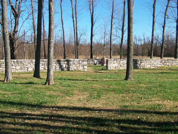
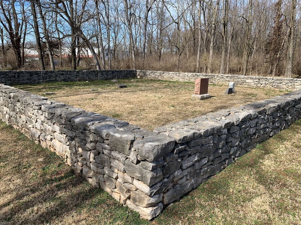
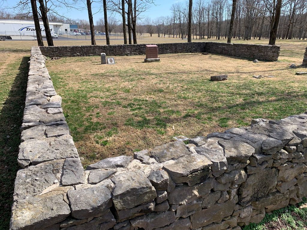
| Description | : | Originated on homestead of Joseph Rountree, Nancy his daughter planted seeds of a coffee tree, from locust tree family Ground Radar done March 23, 1991 revealed 31 grave sites. Located on Bennett Street about 1/2 miles west of South Scenic Street. Campbell Township. Located inside of the Rountree Historic Park. |
frequently asked questions (FAQ):
-
Where is Rountree Cemetery?
Rountree Cemetery is located at 2975 W. Bennett St Springfield, Greene County ,Missouri , 65807USA.
-
Rountree Cemetery cemetery's updated grave count on graveviews.com?
0 memorials
-
Where are the coordinates of the Rountree Cemetery?
Latitude: 37.1913532
Longitude: -93.3367156
Nearby Cemetories:
1. Rose Cemetery
Springfield, Greene County, USA
Coordinate: 37.1851470, -93.3462860
2. Saint Marys Cemetery
Springfield, Greene County, USA
Coordinate: 37.2038994, -93.3249969
3. Gray-Campbell Cemetery
Springfield, Greene County, USA
Coordinate: 37.1729400, -93.3255300
4. Russell and Ringenberg Cemetery
Springfield, Greene County, USA
Coordinate: 37.1695200, -93.3651580
5. Maple Park Cemetery
Springfield, Greene County, USA
Coordinate: 37.1944008, -93.2921982
6. Redeemer Lutheran Church Columbarium
Springfield, Greene County, USA
Coordinate: 37.1625700, -93.3012600
7. Keet Burial
Springfield, Greene County, USA
Coordinate: 37.2069190, -93.2883940
8. Payne Cemetery
Springfield, Greene County, USA
Coordinate: 37.1516113, -93.3547516
9. Payne Family Cemeteru
Springfield, Greene County, USA
Coordinate: 37.1515046, -93.3550087
10. Christ Episcopal Church Columbarium
Springfield, Greene County, USA
Coordinate: 37.2071800, -93.2862800
11. Hampton Cemetery
Springfield, Greene County, USA
Coordinate: 37.1568298, -93.3744202
12. Resurrection Cemetery
Springfield, Greene County, USA
Coordinate: 37.2276200, -93.3747550
13. Friends of the Family Pet Memorial Gardens
Springfield, Greene County, USA
Coordinate: 37.2323600, -93.3673400
14. Alms House Cemetery
Springfield, Greene County, USA
Coordinate: 37.2319720, -93.3712130
15. White Chapel Memorial Gardens
Springfield, Greene County, USA
Coordinate: 37.2252998, -93.3906021
16. Norman Cemetery
Battlefield, Greene County, USA
Coordinate: 37.1394420, -93.3649380
17. McElhaney Cemetery
Republic, Greene County, USA
Coordinate: 37.1425896, -93.3742294
18. Temple Israel Cemetery
Springfield, Greene County, USA
Coordinate: 37.1730995, -93.2664032
19. Antioch Cemetery
Springfield, Greene County, USA
Coordinate: 37.2505989, -93.3538971
20. Hazelwood Cemetery
Springfield, Greene County, USA
Coordinate: 37.1707993, -93.2647018
21. Springfield National Cemetery
Springfield, Greene County, USA
Coordinate: 37.1730995, -93.2636032
22. Yarbrough Cemetery
Greene County, USA
Coordinate: 37.1314011, -93.3106003
23. Gorman and Scharpf Mortuary Columbarium
Springfield, Greene County, USA
Coordinate: 37.1746900, -93.2593800
24. Carmelite Monastery Cemetery
Springfield, Greene County, USA
Coordinate: 37.1396103, -93.2893677