| Memorials | : | 0 |
| Location | : | Salt River Township, Adair County, USA |
| Coordinate | : | 40.1857440, -92.4032830 |
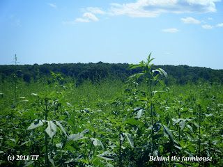
| Description | : | The Rueben Long Family Cemetery is not easily accessible as it is on PRIVATE PROPERTY from ALL SIDES. ❈ ❈ ❈ ❈ ❈ ❈ ❈ ❈ ❈ ❈ ❈ ❈ ❈ ❈ It can't be seen on satellite imaging but the approximate area can be narrowed down. It would be quite a hike in the Missouri humidity and heat to get there IF one can get permission. As far as I know as of 2011, Missouri law allows access to pioneer family cemeteries on private land as long as one can prove the relationship. They still greatly encourage one to have the... Read More |
frequently asked questions (FAQ):
-
Where is Rueben Long Family Cemetery?
Rueben Long Family Cemetery is located at On PRIVATE PROPERTY / Horseshoe Lake Way, 1/8 mile off RD. J, then half a mile west Salt River Township, Adair County ,Missouri ,USA.
-
Rueben Long Family Cemetery cemetery's updated grave count on graveviews.com?
0 memorials
-
Where are the coordinates of the Rueben Long Family Cemetery?
Latitude: 40.1857440
Longitude: -92.4032830
Nearby Cemetories:
1. Sabbath Home Church Cemetery
Brashear, Adair County, USA
Coordinate: 40.1998500, -92.4168600
2. Pitt Family Burying Ground
Salt River Township, Adair County, USA
Coordinate: 40.1827120, -92.4297730
3. Moots Cemetery
Adair County, USA
Coordinate: 40.2236230, -92.4238560
4. Paultown Cemetery
Brashear, Adair County, USA
Coordinate: 40.1608009, -92.3557968
5. Greenwood Farm Cemetery
Brashear, Adair County, USA
Coordinate: 40.1431500, -92.4210900
6. Brashear Cemetery
Brashear, Adair County, USA
Coordinate: 40.1439018, -92.3739014
7. Bullion Cemetery
Kirksville, Adair County, USA
Coordinate: 40.1733900, -92.4878500
8. Saint Marys Cemetery
Adair, Adair County, USA
Coordinate: 40.2522200, -92.3741600
9. Prairie Bird Cemetery
Gibbs, Adair County, USA
Coordinate: 40.1098000, -92.4496000
10. East Center Cemetery
Kirksville, Adair County, USA
Coordinate: 40.2395800, -92.4880400
11. Richardson Cemetery
Adair County, USA
Coordinate: 40.2588997, -92.4597015
12. Gibbs Union Cemetery
Gibbs, Adair County, USA
Coordinate: 40.1030998, -92.4310989
13. Fairview School Cemetery
Knox County, USA
Coordinate: 40.1172500, -92.3361700
14. Gibbs South Methodist Cemetery
Adair County, USA
Coordinate: 40.0995300, -92.4209100
15. IOOF Cemetery
Hurdland, Knox County, USA
Coordinate: 40.1449190, -92.2882730
16. Sparks Family Cemetery
Clay Township, Adair County, USA
Coordinate: 40.2803497, -92.4324736
17. Bethel Cemetery
Kirksville, Adair County, USA
Coordinate: 40.2804100, -92.4614500
18. Cater Cemetery
Adair County, USA
Coordinate: 40.1467018, -92.5318985
19. Waddill Cemetery
Kirksville, Adair County, USA
Coordinate: 40.2214012, -92.5397034
20. County Farm Cemetery
Kirksville, Adair County, USA
Coordinate: 40.1896840, -92.5557370
21. Highland Park Cemetery
Kirksville, Adair County, USA
Coordinate: 40.1907997, -92.5569000
22. Mount Tabor Primitive Baptist Church Cemetery
Knox County, USA
Coordinate: 40.0837300, -92.3261500
23. Mary Immaculate Catholic Cemetery
Kirksville, Adair County, USA
Coordinate: 40.1913500, -92.5574800
24. Oak Grove Cemetery
Adair County, USA
Coordinate: 40.2524986, -92.5307999

