
| Memorials | : | 0 |
| Location | : | Pawnee County, USA |
| Coordinate | : | 36.1878310, -96.4017170 |
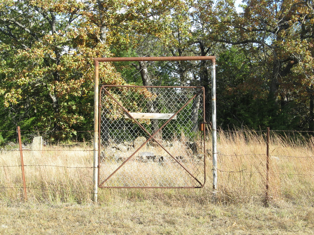
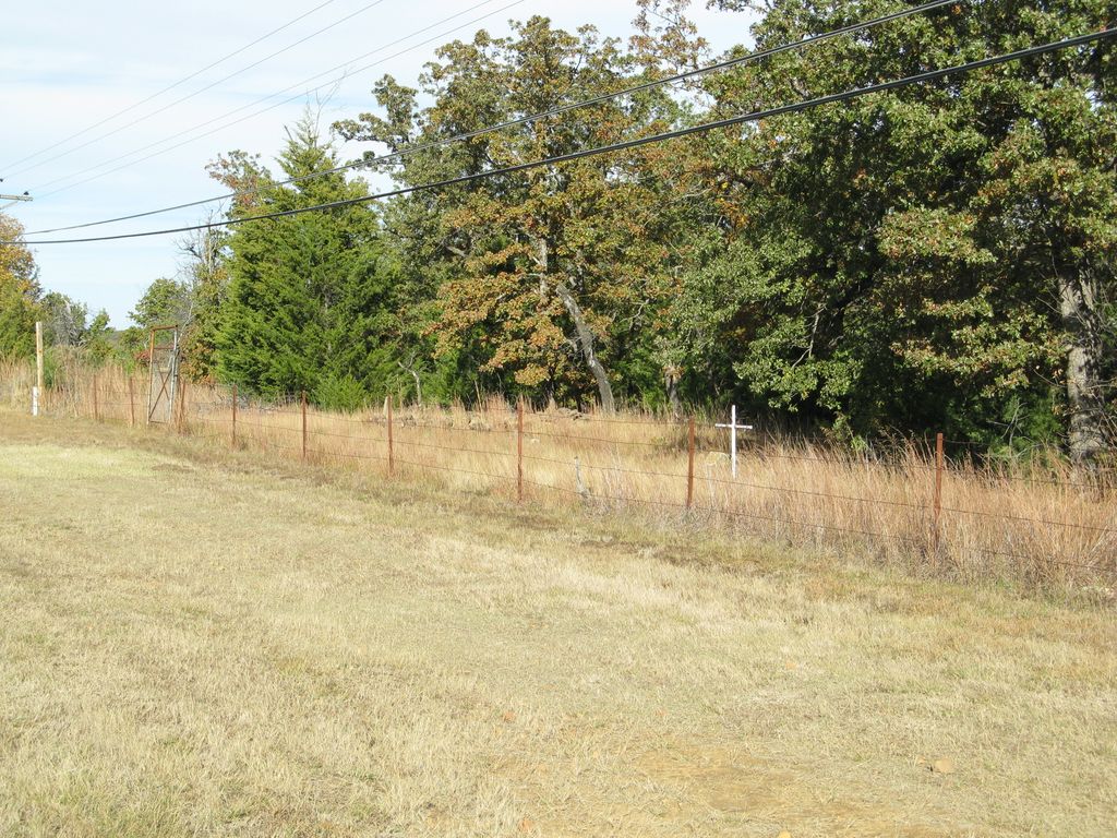
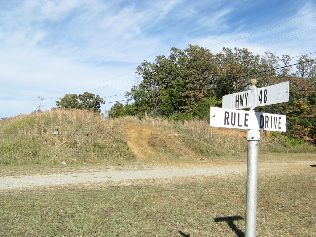
| Description | : | The Russell Family Cemetery is an old small private cemetery. It is the final resting place of the family of James Joseph Russell, who owned the property when he was buried there in 1898. The cemetery contains 14 graves. The last person was buried there in 1918. The cemetery is now owned and maintained by the Mannford Historical Society in Creek County. The cemetery is located in Pawnee County, Cimarron Twp, Section 25, T 20-N, R-8-E. It is off of Hwy 48, 2 miles south of the 64-48 junction. To reach the cemetery, park at the abandoned car wash near the... Read More |
frequently asked questions (FAQ):
-
Where is Russell Family Cemetery?
Russell Family Cemetery is located at Pawnee County ,Oklahoma ,USA.
-
Russell Family Cemetery cemetery's updated grave count on graveviews.com?
0 memorials
-
Where are the coordinates of the Russell Family Cemetery?
Latitude: 36.1878310
Longitude: -96.4017170
Nearby Cemetories:
1. Oak Hill Cemetery
Mannford, Creek County, USA
Coordinate: 36.1420364, -96.3981552
2. Dixie Cemetery
Westport, Pawnee County, USA
Coordinate: 36.2383003, -96.3728027
3. East Basin Cemetery
Pawnee County, USA
Coordinate: 36.1657982, -96.3364029
4. Terlton Cemetery
Terlton, Pawnee County, USA
Coordinate: 36.2022018, -96.4717026
5. Sinnett Memorial Cemetery
Oak Grove, Pawnee County, USA
Coordinate: 36.2085991, -96.3052979
6. Osage Cemetery
Osage, Osage County, USA
Coordinate: 36.2999992, -96.4085999
7. Dixie and Bear Creek Cemeteries
Cleveland, Pawnee County, USA
Coordinate: 36.2930984, -96.4527969
8. New Friendship Cemetery
Silver City, Creek County, USA
Coordinate: 36.0905991, -96.4764023
9. Leroy Cemetery
Pawnee County, USA
Coordinate: 36.2083015, -96.2596970
10. Prairie View Cemetery
New Prue, Osage County, USA
Coordinate: 36.2453003, -96.2703018
11. Bethany Cemetery
Hallett, Pawnee County, USA
Coordinate: 36.2317009, -96.5522003
12. Brooks Cemetery
Silver City, Creek County, USA
Coordinate: 36.0971985, -96.5299988
13. Woodland Cemetery
Cleveland, Pawnee County, USA
Coordinate: 36.3196983, -96.4732971
14. Jennings Cemetery
Jennings, Pawnee County, USA
Coordinate: 36.1878014, -96.5905991
15. Gooden Indian Cemetery
Sand Springs, Tulsa County, USA
Coordinate: 36.1517900, -96.2122500
16. Boston Pool Cemetery
Osage County, USA
Coordinate: 36.3083000, -96.5322037
17. Hinson Cemetery
Sand Springs, Osage County, USA
Coordinate: 36.1838186, -96.1961881
18. Rock Creek Cemetery
Sand Springs, Tulsa County, USA
Coordinate: 36.0965500, -96.2263300
19. Sub-Station Cemetery
Freedom Hill, Creek County, USA
Coordinate: 36.0063400, -96.4064026
20. Pope Field Cemetery
Hominy, Osage County, USA
Coordinate: 36.3737300, -96.3839000
21. Highland Cemetery
Oilton, Creek County, USA
Coordinate: 36.0844002, -96.5952988
22. Sunrise Cemetery
Pawnee County, USA
Coordinate: 36.2030000, -96.6336000
23. Diamond G Cemetery
Jennings, Pawnee County, USA
Coordinate: 36.1752566, -96.6405065
24. Tiger Bone Cemetery
Sand Springs, Tulsa County, USA
Coordinate: 36.0756650, -96.1833940