| Memorials | : | 0 |
| Location | : | Ryda, Vara kommun, Sweden |
| Phone | : | +46(512)797200 |
| Website | : | www.svenskakyrkan.se/vara/ryda-kyrka-och-kyrkogard |
| Coordinate | : | 58.2868140, 12.8839170 |
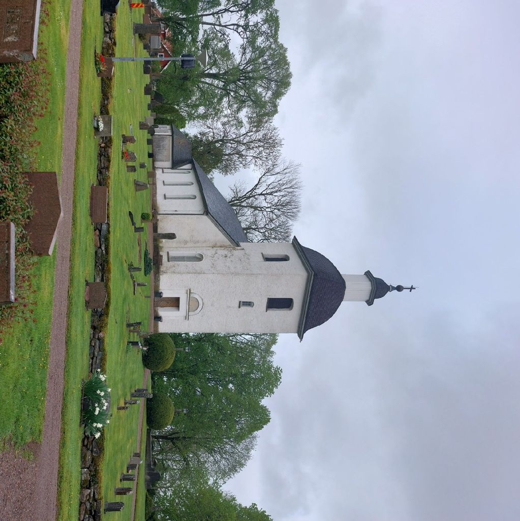
| Description | : | The older part of the church is traditionally built by Algot Gripson around the year 1270. The church was expanded in the following centuries, but in 1799 it was demolished and the current church was built on the expanded foundation. The baptismal font and pulpit were reused. The oldest part of the cemetery is from the Middle Ages and is closest to today's church. In 1937, a runestone was taken out of the tower wall and erected outside. On the other side of the tower is a sundial from 1685. The cemetery's tree wreath consists of ashes, lindens, elms and maples. The new... Read More |
frequently asked questions (FAQ):
-
Where is Ryda kyrkogård?
Ryda kyrkogård is located at Ryda Prästbolet 1 Ryda, Vara kommun ,Västra Götalands län , 534 96Sweden.
-
Ryda kyrkogård cemetery's updated grave count on graveviews.com?
0 memorials
-
Where are the coordinates of the Ryda kyrkogård?
Latitude: 58.2868140
Longitude: 12.8839170
Nearby Cemetories:
1. Long Kyrkogård
Long, Vara kommun, Sweden
Coordinate: 58.2984400, 12.9601700
2. Södra Kedum Kyrkogård
Vara, Vara kommun, Sweden
Coordinate: 58.2396225, 12.8730965
3. Naum Kyrkogård
Naum, Vara kommun, Sweden
Coordinate: 58.2394046, 12.9210738
4. Sparlösa Kyrkogård
Sparlosa, Vara kommun, Sweden
Coordinate: 58.3358930, 12.8316680
5. Hyringa ödekyrkogård
Hyringa, Grästorps kommun, Sweden
Coordinate: 58.2926790, 12.7683480
6. Önum Kyrkogård
Vara, Vara kommun, Sweden
Coordinate: 58.2626400, 13.0053700
7. Skarstad kyrkogård
Skarstad, Vara kommun, Sweden
Coordinate: 58.2956950, 13.0351750
8. Slädene Cemetery
Sparlosa, Vara kommun, Sweden
Coordinate: 58.3731650, 12.8834091
9. Järpås Cemetery
Jarpas, Lidköpings kommun, Sweden
Coordinate: 58.3765354, 12.9779452
10. Fyrunga Cemetery
Fyrunga, Vara kommun, Sweden
Coordinate: 58.2844180, 13.0938448
11. Tråvads Kyrkogård
Vara kommun, Sweden
Coordinate: 58.2457260, 13.0870450
12. Tengene kyrkogård
Grästorps kommun, Sweden
Coordinate: 58.3077900, 12.6661620
13. Tengene kyrkogård
Grästorps kommun, Sweden
Coordinate: 58.3077900, 12.6661620
14. Essunga
Essunga kommun, Sweden
Coordinate: 58.1822346, 12.7838108
15. Bäreberg Cemetery
Essunga kommun, Sweden
Coordinate: 58.2067226, 12.7205270
16. Södra Lundby Nya Kyrkogården
Sodra Lundby, Vara kommun, Sweden
Coordinate: 58.1958870, 13.0388570
17. Laske-Vedums kyrkogård
Vedum, Vara kommun, Sweden
Coordinate: 58.1717990, 12.9901200
18. Jung kyrkogård
Jung, Vara kommun, Sweden
Coordinate: 58.3280660, 13.1174700
19. Södra Lundby gamla kyrkogård
Sodra Lundby, Vara kommun, Sweden
Coordinate: 58.1887920, 13.0456000
20. Längjum Cemetery
Vara kommun, Sweden
Coordinate: 58.2149503, 13.1016114
21. Lekåsa Cemetery
Lekåsa, Essunga kommun, Sweden
Coordinate: 58.1393980, 12.8820870
22. Barne-Åsaka
Essunga kommun, Sweden
Coordinate: 58.1418128, 12.8318773
23. Larvs kyrkogård
Larv, Vara kommun, Sweden
Coordinate: 58.1897710, 13.1156840
24. Fåglums Nya Kyrkogård
Essunga kommun, Sweden
Coordinate: 58.1258998, 12.7792135

