
| Memorials | : | 19 |
| Location | : | Shubert, Richardson County, USA |
| Coordinate | : | 40.2042500, -95.6549500 |
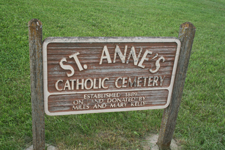
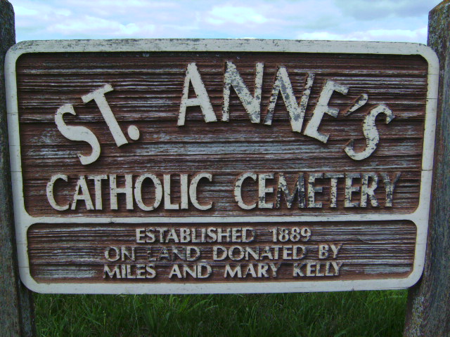
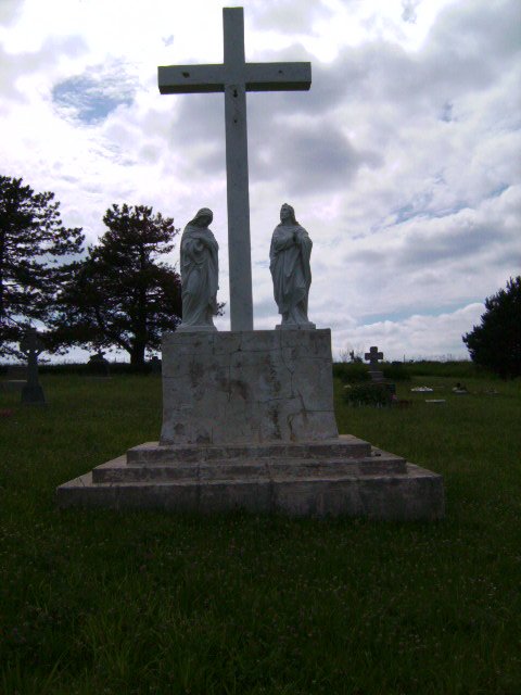
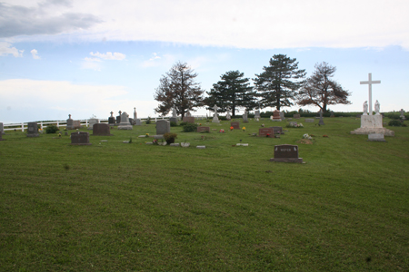
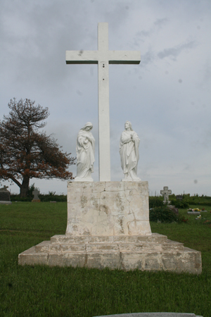
| Description | : | By 1867 there were many French, German and Irish Catholics scattered throughout northeastern Richardson County who felt a need for a church. In that year August and Joanna Buchholz agreed to sell two acres of land for Saint Anns Catholic Church. The east half became the cemetery. In 1940 a fire destroyed both the church ans rectory. Intead of rebuilding there, the church was relocted to Shubert. Only the cemetery, loccated in Barada Township, Section 19, remains, with the parishioners of the present church providing the upkeep. |
frequently asked questions (FAQ):
-
Where is Saint Annes Catholic Cemetery?
Saint Annes Catholic Cemetery is located at 649 Ave/716 Road Shubert, Richardson County ,Nebraska ,USA.
-
Saint Annes Catholic Cemetery cemetery's updated grave count on graveviews.com?
18 memorials
-
Where are the coordinates of the Saint Annes Catholic Cemetery?
Latitude: 40.2042500
Longitude: -95.6549500
Nearby Cemetories:
1. Huff Cemetery
Barada, Richardson County, USA
Coordinate: 40.2039000, -95.6248500
2. Berg Cemetery
Barada, Richardson County, USA
Coordinate: 40.2257996, -95.6168976
3. Brick Church Cemetery
Barada, Richardson County, USA
Coordinate: 40.2328000, -95.6155000
4. Cupola Cemetery
Verdon, Richardson County, USA
Coordinate: 40.1892014, -95.7086029
5. Prairie Union Cemetery
Shubert, Richardson County, USA
Coordinate: 40.2475800, -95.7150200
6. Harris Cemetery
Barada, Richardson County, USA
Coordinate: 40.2182999, -95.5730972
7. Verdon Cemetery
Verdon, Richardson County, USA
Coordinate: 40.1450005, -95.6893997
8. Penniwell Cemetery
Shubert, Richardson County, USA
Coordinate: 40.2619000, -95.6994500
9. Saint Pauls Evangelical Lutheran Cemetery
Falls City, Richardson County, USA
Coordinate: 40.1443800, -95.6150400
10. Saint Johns Catholic Cemetery
Barada, Richardson County, USA
Coordinate: 40.2189000, -95.5683000
11. Maple Grove Cemetery
Verdon, Richardson County, USA
Coordinate: 40.1307983, -95.6410980
12. Liberty-Cornell Cemetery
Verdon, Richardson County, USA
Coordinate: 40.1603000, -95.7375000
13. Saint Deroin Cemetery
Barada, Richardson County, USA
Coordinate: 40.2543983, -95.5682983
14. Saint Peters Evangelical Lutheran Church Cemetery
Richardson County, USA
Coordinate: 40.1752014, -95.5491257
15. Stella Cemetery
Stella, Richardson County, USA
Coordinate: 40.2268982, -95.7671967
16. Saint Marks Lutheran Cemetery
Verdon, Richardson County, USA
Coordinate: 40.1160100, -95.6864900
17. Hillsdale Cemetery
Nemaha County, USA
Coordinate: 40.2882996, -95.6010971
18. Half-Breed Cemetery
Nemaha County, USA
Coordinate: 40.2664900, -95.5604900
19. Liberty Township Cemetery
Verdon, Richardson County, USA
Coordinate: 40.1597200, -95.7664100
20. Silver Creek Cemetery
Richardson County, USA
Coordinate: 40.1157990, -95.5969009
21. Fricke Cemetery
Richardson County, USA
Coordinate: 40.1516991, -95.5391998
22. Saint Johns Cemetery
Richardson County, USA
Coordinate: 40.1375008, -95.5188980
23. Archer Cemetery
Falls City, Richardson County, USA
Coordinate: 40.0950200, -95.5736900
24. Herbster Cemetery
Falls City, Richardson County, USA
Coordinate: 40.0808700, -95.6184700