
| Memorials | : | 26 |
| Location | : | Hoyes, Garrett County, USA |
| Coordinate | : | 39.5868300, -79.3698600 |
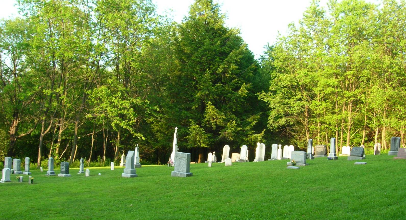
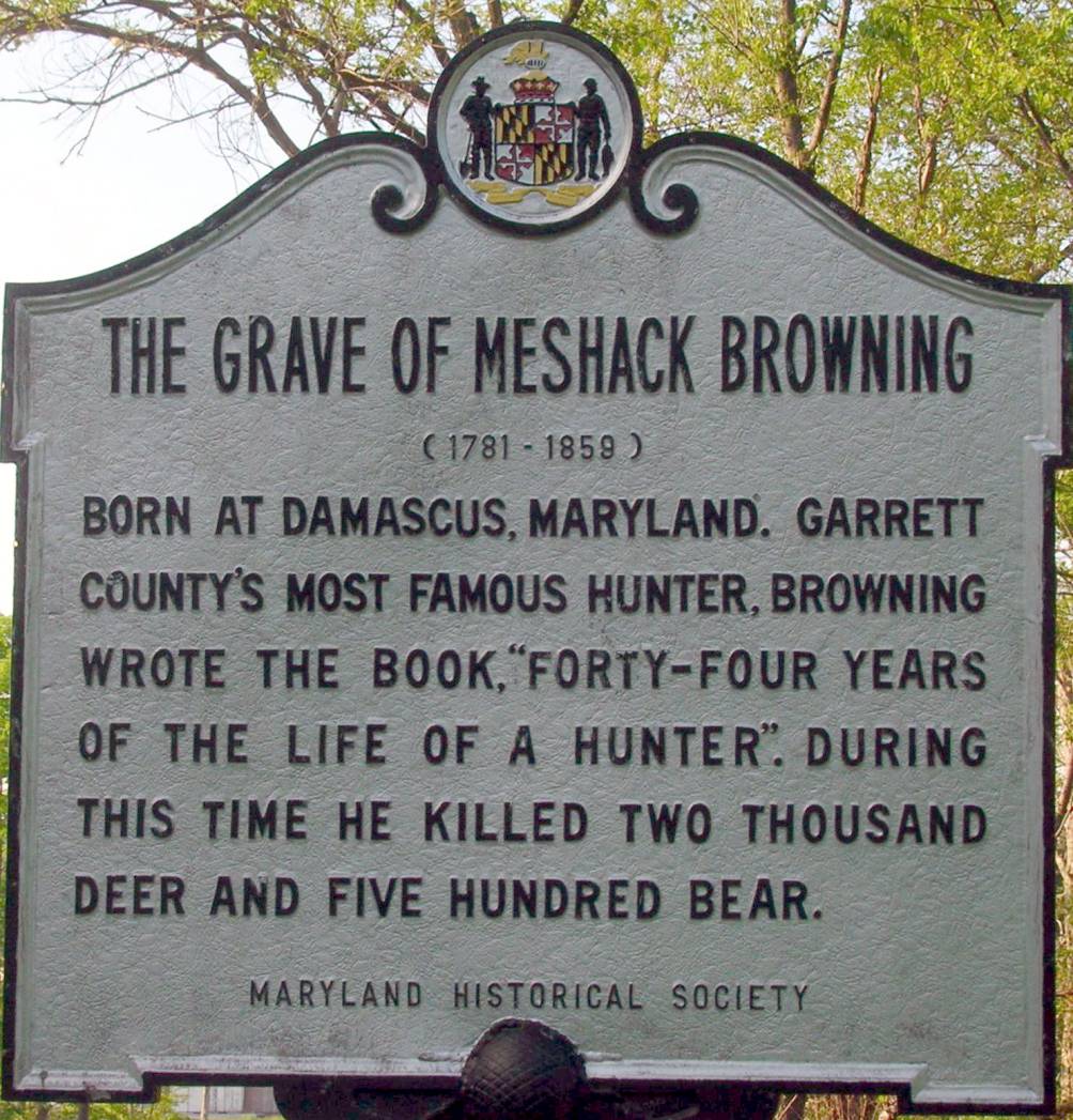
| Description | : | This cemetery was built in large measure by my wife's ancestor, Dominick Mattingly, who along with Meshack Browning and William Browning were selected to collect donations to build this church in what was called Johnstown, MD, about 1850. St. James Church was dedicated in 1853 under the passtorate of Rev. Wm. Lambert. In 1890, the "present" church was built under the pastorate of Romanus Mattingly. The name was changed from St. James to St. Dominic, the patron saint of Dominick Mattingly, who was a zealous Catholic. The cemetery contains the graves of Meshack Browning, D. J.... Read More |
frequently asked questions (FAQ):
-
Where is Saint Dominic Catholic Cemetery?
Saint Dominic Catholic Cemetery is located at Friendship Road Hoyes, Garrett County ,Maryland ,USA.
-
Saint Dominic Catholic Cemetery cemetery's updated grave count on graveviews.com?
26 memorials
-
Where are the coordinates of the Saint Dominic Catholic Cemetery?
Latitude: 39.5868300
Longitude: -79.3698600
Nearby Cemetories:
1. Hoyes Cemetery
Garrett County, USA
Coordinate: 39.5905991, -79.3683014
2. Flatwood Cemetery
Accident, Garrett County, USA
Coordinate: 39.5923500, -79.3515400
3. Oak Grove Church of the Brethren Cemetery
McHenry, Garrett County, USA
Coordinate: 39.5694400, -79.3834300
4. Skiles Cemetery
Accident, Garrett County, USA
Coordinate: 39.5971570, -79.3439160
5. Hoye Family Cemetery - Crab Tree Bottom
McHenry, Garrett County, USA
Coordinate: 39.5642220, -79.3855000
6. Bumblebee Ridge Cemetery
McHenry, Garrett County, USA
Coordinate: 39.5774400, -79.3296800
7. Upper Sang Run Cemetery
McHenry, Garrett County, USA
Coordinate: 39.5717810, -79.4242430
8. Bear Creek Church of the Brethren Cemetery
Accident, Garrett County, USA
Coordinate: 39.6213000, -79.3099800
9. Saint Paul's Old Cemetery
Accident, Garrett County, USA
Coordinate: 39.6287100, -79.3182100
10. Zion Lutheran Cemetery
Accident, Garrett County, USA
Coordinate: 39.6300510, -79.3129020
11. Glotfelty Farm Cemetery
McHenry, Garrett County, USA
Coordinate: 39.5708800, -79.2905500
12. Hoyes Run Cemetery
Garrett County, USA
Coordinate: 39.5313100, -79.4110900
13. Ruckle Family Cemetery
Bittinger, Garrett County, USA
Coordinate: 39.5802600, -79.2821900
14. Cherry Glade Cemetery
Accident, Garrett County, USA
Coordinate: 39.5827200, -79.2799500
15. Glade Mennonite Cemetery
Bittinger, Garrett County, USA
Coordinate: 39.5826300, -79.2796700
16. Steele Cemetery
Friendsville, Garrett County, USA
Coordinate: 39.6650009, -79.4005966
17. Friend Family Graveyard
Friendsville, Garrett County, USA
Coordinate: 39.6622000, -79.4124200
18. Andrew Friend Cemetery
Friendsville, Garrett County, USA
Coordinate: 39.6631700, -79.4197000
19. Meadow Mountain Mennonite Cemetery
Bittinger, Garrett County, USA
Coordinate: 39.6043890, -79.2603900
20. Old Cherry Glade Cemetery
Bittinger, Garrett County, USA
Coordinate: 39.6105000, -79.2617000
21. Tice Cemetery
Bittinger, Garrett County, USA
Coordinate: 39.6104140, -79.2616130
22. Bray Cemetery
Oakland, Garrett County, USA
Coordinate: 39.5006900, -79.3858100
23. Blooming Rose Church Cemetery
Friendsville, Garrett County, USA
Coordinate: 39.6558900, -79.4399500
24. Emberson Cemetery
Friendsville, Garrett County, USA
Coordinate: 39.6716995, -79.4150009