
| Memorials | : | 220 |
| Location | : | McHenry, Garrett County, USA |
| Coordinate | : | 39.5717810, -79.4242430 |
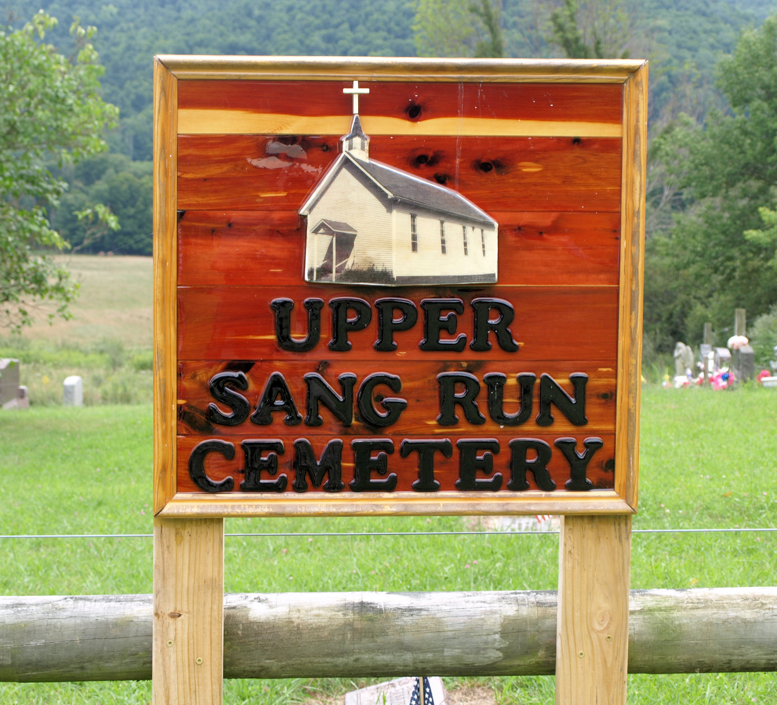
| Description | : | This cemetery is located on the "Friend's Delight," tract, land originally settled by John Friend about 1796. In 1808 John Friend, Sr, deeded this land to his son John Friend, Jr. (Allegany Co, MD, Deed E:331), and in 1899, John's son D.A. Friend deed the land "distinguished as a graveyard for public general use." |
frequently asked questions (FAQ):
-
Where is Upper Sang Run Cemetery?
Upper Sang Run Cemetery is located at McHenry, Garrett County ,Maryland , 21541USA.
-
Upper Sang Run Cemetery cemetery's updated grave count on graveviews.com?
220 memorials
-
Where are the coordinates of the Upper Sang Run Cemetery?
Latitude: 39.5717810
Longitude: -79.4242430
Nearby Cemetories:
1. Hoye Family Cemetery - Crab Tree Bottom
McHenry, Garrett County, USA
Coordinate: 39.5642220, -79.3855000
2. Oak Grove Church of the Brethren Cemetery
McHenry, Garrett County, USA
Coordinate: 39.5694400, -79.3834300
3. Hoyes Run Cemetery
Garrett County, USA
Coordinate: 39.5313100, -79.4110900
4. Saint Dominic Catholic Cemetery
Hoyes, Garrett County, USA
Coordinate: 39.5868300, -79.3698600
5. Hoyes Cemetery
Garrett County, USA
Coordinate: 39.5905991, -79.3683014
6. Cranesville Cemetery
Cranesville, Preston County, USA
Coordinate: 39.5543920, -79.4929870
7. Flatwood Cemetery
Accident, Garrett County, USA
Coordinate: 39.5923500, -79.3515400
8. Lake Ford Cemetery
Garrett County, USA
Coordinate: 39.5278015, -79.4792023
9. Sisler Cemetery
Mountain Dale, Preston County, USA
Coordinate: 39.6081009, -79.4938965
10. Skiles Cemetery
Accident, Garrett County, USA
Coordinate: 39.5971570, -79.3439160
11. Keeler Glade Cemetery
Garrett County, USA
Coordinate: 39.6308000, -79.4768000
12. Bumblebee Ridge Cemetery
McHenry, Garrett County, USA
Coordinate: 39.5774400, -79.3296800
13. Bray Cemetery
Oakland, Garrett County, USA
Coordinate: 39.5006900, -79.3858100
14. Miller Cemetery
Preston County, USA
Coordinate: 39.5250015, -79.5081024
15. Taylor-Sines Cemetery
Oakland, Garrett County, USA
Coordinate: 39.4894470, -79.4165480
16. Savage Cemetery
Hazelton, Preston County, USA
Coordinate: 39.6323470, -79.5003360
17. Blooming Rose Church Cemetery
Friendsville, Garrett County, USA
Coordinate: 39.6558900, -79.4399500
18. Kelly Cemetery
Afton, Preston County, USA
Coordinate: 39.5492200, -79.5333720
19. Friend Cemetery
Oakland, Garrett County, USA
Coordinate: 39.4913500, -79.3778000
20. Friend Family Graveyard
Friendsville, Garrett County, USA
Coordinate: 39.6622000, -79.4124200
21. Andrew Friend Cemetery
Friendsville, Garrett County, USA
Coordinate: 39.6631700, -79.4197000
22. Cuppett-Falkner Cemetery
Hazelton, Preston County, USA
Coordinate: 39.6493900, -79.4879280
23. Steele Cemetery
Friendsville, Garrett County, USA
Coordinate: 39.6650009, -79.4005966
24. Danks Cemetery
Bruceton Mills, Preston County, USA
Coordinate: 39.6256110, -79.5290560