
| Memorials | : | 8 |
| Location | : | Savanna, Carroll County, USA |
| Coordinate | : | 42.0793991, -90.1280975 |
frequently asked questions (FAQ):
-
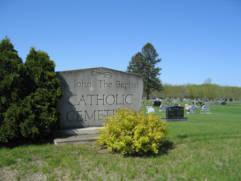
Where is Saint John the Baptist Catholic Cemetery?
Saint John the Baptist Catholic Cemetery is located at Vaiduct Road/84 Savanna, Carroll County ,Illinois ,USA.
-
Saint John the Baptist Catholic Cemetery cemetery's updated grave count on graveviews.com?
6 memorials
-
Where are the coordinates of the Saint John the Baptist Catholic Cemetery?
Latitude: 42.0793991
Longitude: -90.1280975
Nearby Cemetories:
1. Savanna Township Cemetery
Savanna, Carroll County, USA
Coordinate: 42.0791702, -90.1297226
2. Spring Lake Cemetery
Savanna, Carroll County, USA
Coordinate: 42.0503235, -90.1111069
3. Free Family Cemetery
Mount Carroll Township, Carroll County, USA
Coordinate: 42.0907590, -90.0767000
4. Evergreen Cemetery
Sabula, Jackson County, USA
Coordinate: 42.0966682, -90.1913910
5. Saint Peters Cemetery
Sabula, Jackson County, USA
Coordinate: 42.0844002, -90.1988983
6. Center Hill Cemetery
Center Hill, Carroll County, USA
Coordinate: 42.0813904, -90.0425034
7. Hickory Grove Cemetery
Mount Carroll, Carroll County, USA
Coordinate: 42.0578651, -90.0461960
8. Canada Hollow Cemetery
Miles, Jackson County, USA
Coordinate: 42.0553017, -90.2193985
9. Sipe Cemetery
Mount Carroll, Carroll County, USA
Coordinate: 42.0450900, -90.0226600
10. Dickinson Cemetery
Jackson County, USA
Coordinate: 42.1077995, -90.2369003
11. Sterling Cemetery
Sterling, Jackson County, USA
Coordinate: 42.0766983, -90.2528000
12. Saint Peters Lutheran Cemetery
Savanna, Carroll County, USA
Coordinate: 42.1758900, -90.1486210
13. Hauntown Cemetery
Elk River Junction, Clinton County, USA
Coordinate: 41.9889153, -90.1973505
14. Carroll County Farm Cemetery
Mount Carroll, Carroll County, USA
Coordinate: 42.0722050, -89.9848680
15. Oak Hill Cemetery
Mount Carroll, Carroll County, USA
Coordinate: 42.1033287, -89.9861069
16. Zion Cemetery
Mount Carroll, Carroll County, USA
Coordinate: 42.1841698, -90.0847168
17. Argo Cemetery
Argo Fay, Carroll County, USA
Coordinate: 42.0042480, -90.0170160
18. Woodland Brethren Cemetery
Mount Carroll, Carroll County, USA
Coordinate: 42.1277809, -89.9877777
19. Smith Cemetery
Clinton County, USA
Coordinate: 41.9742012, -90.1949997
20. Fairview Cemetery
Sterling, Jackson County, USA
Coordinate: 42.0992012, -90.2863998
21. Teeds Grove Cemetery
Clinton County, USA
Coordinate: 42.0031013, -90.2621994
22. Trinity Lutheran Church Cemetery
Mount Carroll, Carroll County, USA
Coordinate: 42.0505600, -89.9588928
23. Miller-Wilson Cemetery
Almont, Clinton County, USA
Coordinate: 41.9641991, -90.2118988
24. Lower York Cemetery
Thomson, Carroll County, USA
Coordinate: 41.9588890, -90.0555573