
| Memorials | : | 0 |
| Location | : | Cooperstown, Manitowoc County, USA |
| Coordinate | : | 44.2914990, -87.8685450 |
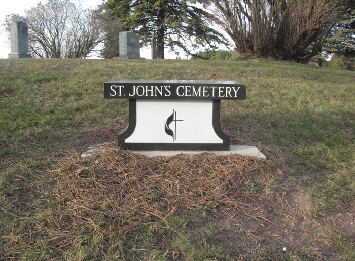
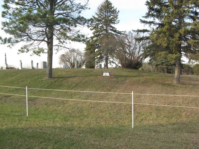
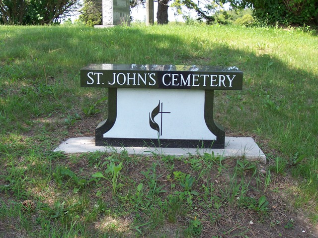
| Description | : | This cemetery has also been called the Westside Cooperstown cemetery and Lark Emmanuel Cemetery. Currently referred to as St. John's Cemetery and is affiliated with the United Methodists (that is their symbol on the cemetery sign/monument). The last church this cemetery was connected with was the now defunct United Methodist Church in Lark, WI. |
frequently asked questions (FAQ):
-
Where is Saint Johns United Methodist Cemetery?
Saint Johns United Methodist Cemetery is located at Frelich Road Cooperstown, Manitowoc County ,Wisconsin , 54227USA.
-
Saint Johns United Methodist Cemetery cemetery's updated grave count on graveviews.com?
0 memorials
-
Where are the coordinates of the Saint Johns United Methodist Cemetery?
Latitude: 44.2914990
Longitude: -87.8685450
Nearby Cemetories:
1. Saint Mary Cemetery
Morrison, Brown County, USA
Coordinate: 44.3022700, -87.8884700
2. Rovnost National Cemetery
Denmark, Brown County, USA
Coordinate: 44.3276100, -87.8518500
3. Holy Trinity Catholic Church Cemetery
Denmark, Brown County, USA
Coordinate: 44.3330900, -87.8874100
4. Saint Johns Evangelical Lutheran Cemetery
Maribel, Manitowoc County, USA
Coordinate: 44.2702800, -87.8063900
5. Eastside Cemetery
Cooperstown, Manitowoc County, USA
Coordinate: 44.3269000, -87.8075000
6. Emanuels Cemetery
Morrison, Brown County, USA
Coordinate: 44.2991982, -87.9503021
7. Saint Wenceslaus Cemetery
Cooperstown, Manitowoc County, USA
Coordinate: 44.2514000, -87.8073500
8. All Saints Catholic Church Cemetery
Denmark, Brown County, USA
Coordinate: 44.3492000, -87.8356500
9. Saint James Cemetery
Cooperstown, Manitowoc County, USA
Coordinate: 44.3177500, -87.7783400
10. Zion Cemetery
Wayside, Brown County, USA
Coordinate: 44.2497300, -87.9505500
11. Old Morrison Zion Evangelical Lutheran Cemetery
Wayside, Brown County, USA
Coordinate: 44.2702904, -87.9649353
12. West Danish Cemetery
Denmark, Brown County, USA
Coordinate: 44.3535995, -87.8058014
13. Morrison Zion Evangelical Lutheran Cemetery
Morrison, Brown County, USA
Coordinate: 44.2890625, -87.9796677
14. Saint Joseph Cemetery
Kellnersville, Manitowoc County, USA
Coordinate: 44.2231330, -87.8019000
15. Immanuel Evangelical Lutheran Church Cemetery
Shirley, Brown County, USA
Coordinate: 44.3575070, -87.9526220
16. Eastside Cemetery
Denmark, Brown County, USA
Coordinate: 44.3591995, -87.7866974
17. Zion Lutheran Cemetery
Glenmore, Brown County, USA
Coordinate: 44.3618140, -87.9599760
18. Melnik Presbyterian Cemetery
Melnik, Manitowoc County, USA
Coordinate: 44.2470300, -87.7461910
19. Saint Marys Cemetery
Glenmore, Brown County, USA
Coordinate: 44.3725000, -87.9475700
20. Kossuth National Cemetery
Francis Creek, Manitowoc County, USA
Coordinate: 44.2108002, -87.7767029
21. Saint Johns Catholic Cemetery
Morrison, Brown County, USA
Coordinate: 44.2985992, -88.0139008
22. Saint Patrick Catholic Cemetery
Maple Grove, Manitowoc County, USA
Coordinate: 44.1876333, -87.9227500
23. Larrabee Church Cemetery
Larrabee, Manitowoc County, USA
Coordinate: 44.2697258, -87.7164764
24. Saint Johns Evangelical Lutheran Cemetery
Zander, Manitowoc County, USA
Coordinate: 44.3024100, -87.7059100