
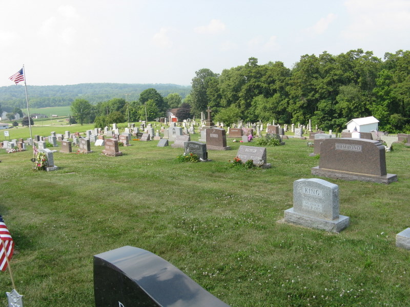
| Memorials | : | 36 |
| Location | : | Danville, Knox County, USA |
| Coordinate | : | 40.4468994, -82.2786026 |
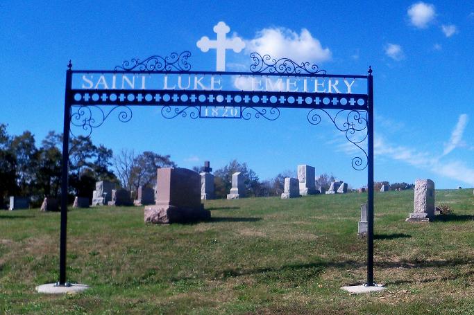
| Description | : | This Roman Catholic cemetery is located on the north side of Danville-Howard Road (County Road 9) just east of its junction with Carey Lane (Township Road 238). The cemetery was established in 1812. The cemetery is located in Union Township, Knox County, Ohio, and is # 6288 (Saint Lukes Cemetery) in “Ohio Cemeteries 1803-2003”, compiled by the Ohio Genealogical Society. The cemetery is registered with the Ohio Division of Real Estate and Professional Licensing (ODRE) as Saint Luke Cemetery with registration license number CGR.0000981925. The U.S. Geological Survey (USGS) Geographic Names Information System (GNIS) feature ID for the... Read More |
frequently asked questions (FAQ):
-
Where is Saint Luke Cemetery?
Saint Luke Cemetery is located at Danville-Howard Road (County Road 9) Danville, Knox County ,Ohio , 43014USA.
-
Saint Luke Cemetery cemetery's updated grave count on graveviews.com?
36 memorials
-
Where are the coordinates of the Saint Luke Cemetery?
Latitude: 40.4468994
Longitude: -82.2786026
Nearby Cemetories:
1. Workman Cemetery
Danville, Knox County, USA
Coordinate: 40.4361000, -82.2636032
2. McKee Cemetery
Danville, Knox County, USA
Coordinate: 40.4306204, -82.2443237
3. Banbury Cemetery
Danville, Knox County, USA
Coordinate: 40.4774490, -82.2717850
4. Mast Cemetery
Danville, Knox County, USA
Coordinate: 40.4642420, -82.2381500
5. Millwood Cemetery
Millwood, Knox County, USA
Coordinate: 40.4028015, -82.2746964
6. Wright Cemetery
Howard, Knox County, USA
Coordinate: 40.4116040, -82.3264590
7. Old Jelloway Cemetery
Howard, Knox County, USA
Coordinate: 40.4240740, -82.3451150
8. Wesley Chapel Cemetery
Knox, Knox County, USA
Coordinate: 40.5022900, -82.2601600
9. North Bend Church of the Brethren Cemetery
Jelloway, Knox County, USA
Coordinate: 40.5047600, -82.3052700
10. Branstool-Critchfield-Shrimplin Cemetery
Howard, Knox County, USA
Coordinate: 40.4021940, -82.3393400
11. Brinkhaven Cemetery
Brinkhaven, Knox County, USA
Coordinate: 40.4686012, -82.1988983
12. Hollister Cemetery
Knox County, USA
Coordinate: 40.3830986, -82.2485962
13. Hardinger Cemetery
Knox County, USA
Coordinate: 40.5078011, -82.2260971
14. Amity Cemetery
Knox County, USA
Coordinate: 40.4716988, -82.3743973
15. Shadley Valley Cemetery
Knox County, USA
Coordinate: 40.5253403, -82.2854390
16. Greer Family Cemetery
Greer, Knox County, USA
Coordinate: 40.5117140, -82.2135900
17. Tiverton Baptist Church Cemetery
Tiverton Center, Coshocton County, USA
Coordinate: 40.4371400, -82.1717900
18. Zion Lutheran Cemetery
Jelloway, Knox County, USA
Coordinate: 40.5233955, -82.3196062
19. Pleasant Valley Cemetery
Howard, Knox County, USA
Coordinate: 40.4021988, -82.3705978
20. Patterson Cemetery
Mount Vernon, Knox County, USA
Coordinate: 40.4262300, -82.3857190
21. Staats Cemetery
Millwood, Knox County, USA
Coordinate: 40.3711090, -82.2150680
22. Riley Chapel Cemetery
Knox County, USA
Coordinate: 40.3782360, -82.2009740
23. Mount Zion Cemetery
Gambier, Knox County, USA
Coordinate: 40.3750000, -82.3518982
24. Bigelow Cemetery
Knox County, USA
Coordinate: 40.5127500, -82.3617800