
| Memorials | : | 11 |
| Location | : | West Boylston, Worcester County, USA |
| Coordinate | : | 42.3833008, -71.7568970 |
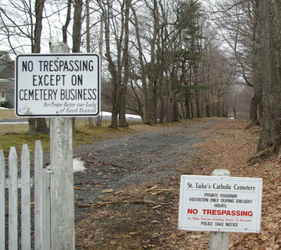
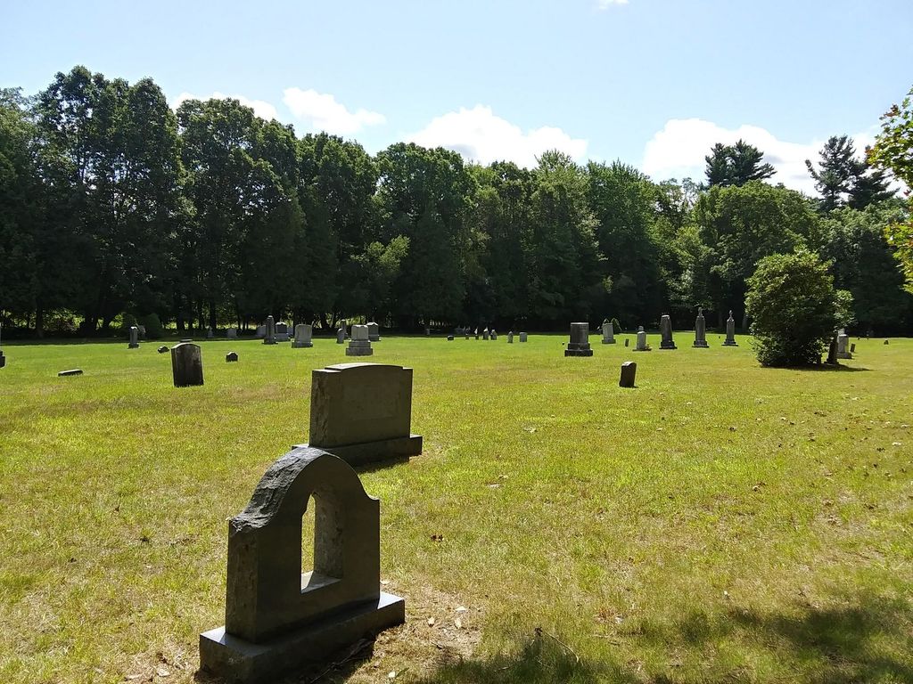
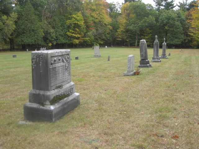
| Description | : | St. Luke's cemetery is the burial site of parishioners of St. Anthony's Catholic Church that burnt down in 1890 along with the wooden Baptist Church located in the same area. Since the rectory was next to the church, it is assumed that all records were lost. A new Baptist church, built of stone, was erected two years later. It survived until abandoned during the building of the Wachusett Reservoir and is known as the "Old Stone Church". St. Anthony's was not rebuilt in that location. More recently, the stones were removed from the cemetery, the cemetery graded level, and the stones then returned.... Read More |
frequently asked questions (FAQ):
-
Where is Saint Lukes Cemetery?
Saint Lukes Cemetery is located at Highway 110 West Boylston, Worcester County ,Massachusetts ,USA.
-
Saint Lukes Cemetery cemetery's updated grave count on graveviews.com?
11 memorials
-
Where are the coordinates of the Saint Lukes Cemetery?
Latitude: 42.3833008
Longitude: -71.7568970
Nearby Cemetories:
1. Beaman Cemetery
West Boylston, Worcester County, USA
Coordinate: 42.3649590, -71.7803600
2. Mount Vernon Cemetery
West Boylston, Worcester County, USA
Coordinate: 42.3634650, -71.7804030
3. Pine Grove Cemetery
Boylston, Worcester County, USA
Coordinate: 42.3582993, -71.7431030
4. Cookshire Cemetery
Sterling, Worcester County, USA
Coordinate: 42.4108500, -71.7734800
5. High Plains Cemetery
West Boylston, Worcester County, USA
Coordinate: 42.3889008, -71.7972031
6. Old Burial Ground
Boylston, Worcester County, USA
Coordinate: 42.3515700, -71.7355300
7. Fairbank Burial Ground
Sterling, Worcester County, USA
Coordinate: 42.4152600, -71.7320000
8. Legg Cemetery
Sterling, Worcester County, USA
Coordinate: 42.4070020, -71.7986150
9. Reservoir Pines Cemetery
Clinton, Worcester County, USA
Coordinate: 42.4084900, -71.7109700
10. Chocksett Burial Ground
Sterling, Worcester County, USA
Coordinate: 42.4377000, -71.7555400
11. Hillside Cemetery
Sterling, Worcester County, USA
Coordinate: 42.4410000, -71.7492570
12. Oak Hill Cemetery
Sterling, Worcester County, USA
Coordinate: 42.4417000, -71.7493973
13. Woodlawn Cemetery
Clinton, Worcester County, USA
Coordinate: 42.4185982, -71.6889038
14. Saint John's Cemetery
Lancaster, Worcester County, USA
Coordinate: 42.4328003, -71.6977997
15. West Cemetery
Sterling, Worcester County, USA
Coordinate: 42.4514100, -71.7651400
16. Saint Francis Episcopal Church Memorial Garden
Holden, Worcester County, USA
Coordinate: 42.3522800, -71.8588700
17. Old Burying Ground
Holden, Worcester County, USA
Coordinate: 42.3505800, -71.8626000
18. Thayer Cemetery
Lancaster, Worcester County, USA
Coordinate: 42.4578500, -71.7024400
19. Parker II Cemetery
Princeton, Worcester County, USA
Coordinate: 42.4451900, -71.8370600
20. Park Avenue Cemetery
Holden, Worcester County, USA
Coordinate: 42.3514200, -71.8656900
21. Grove Cemetery
Holden, Worcester County, USA
Coordinate: 42.3520400, -71.8672700
22. Saint Mary Cemetery
Holden, Worcester County, USA
Coordinate: 42.3522400, -71.8684200
23. Old Burying Ground
Berlin, Worcester County, USA
Coordinate: 42.3811646, -71.6375351
24. Mountain View Cemetery
Shrewsbury, Worcester County, USA
Coordinate: 42.2999306, -71.7147598